- Del Mar Mesa, San Diego
-
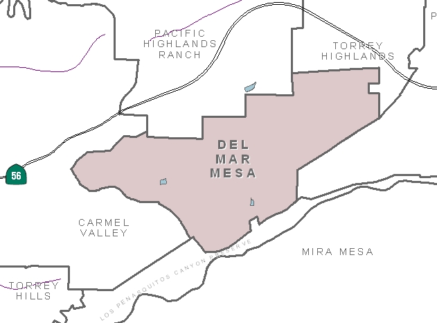
Del Mar Mesa — Community of San Diego — Del Mar Mesa boundaries and surrounding communities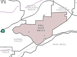 Location within Northwestern San Diego
 Del Mar MesaLocation within Northeastern San Diego
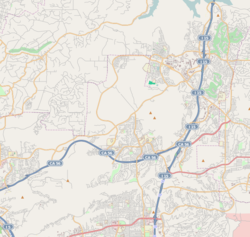 Del Mar Mesa
Coordinates: 32°56′12″N 117°11′02″W / 32.936667°N 117.183889°W Country United States State California County County of San Diego City City of San Diego Del Mar Mesa is a primarily residential community of 2,042 acres (8.26 km2) located in northern San Diego, California. The majority of the community has been developed in the 2000s.
A number of artifacts, including pottery, possibly dating back 9,000 to 10,000 years ago, were found in this community and are being studied by the San Diego Archaeological Center.[1]
Contents
Geography
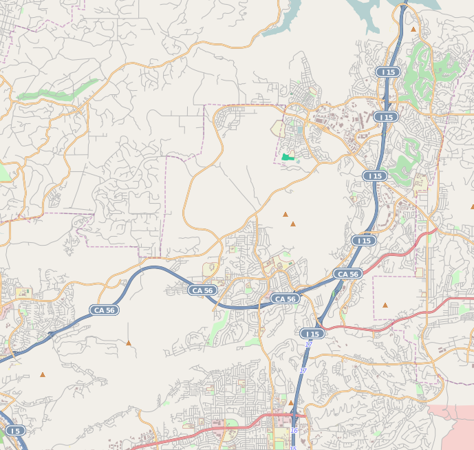
Del Mar Mesa is bordered: to the north by Rancho Santa Fe; to the south by Los Peñasquitos Canyon; to the east by Rancho Peñasquitos and Pacific Highlands Ranch; and to the west by Carmel Valley and Torrey Hills. State Route 56 (Ted Williams Freeway) is slightly north of this community.
In the eastern part of the community, a large portion of land is conserved for open space under the City's Multiple Species Conservation Program.[2] Eucalyptus groves in the community were planted around farmsteads in the 1800s.[2]
Demographics
According to January 2006 estimates by the San Diego Association of Governments,[3] there were 525 people and 227 households residing in the neighborhood, which increased 1246.2% from 39 people in 2000. The estimated racial makeup was 68.7% White, 15.2% Asian & Pacific Islander, 12.0% Hispanic, 4.0% from other races, 0.8% American Indian, and 0.2% African American. The median age is 37.8 with 29.1% under the age of 18 and 9.3% over the age of 65. The estimated median household income was $139,630 ($109,375 adjusted for inflation in 1999 dollars); 18.9% of the community made more than $150,000; 47.6% made between $60,000 and $149,999; and 18.9% made less than $60,000.
External links
- The City of San Diego: Del Mar Mesa Community Profile
- SANDAG: Del Mar Mesa 2006 demographs
- SANDAG: Del Mar Mesa 2030 forecast demographs
- Boy Scout Troop 667
References
- ^ "The Stone Age on Del Mar Mesa" (PDF). San Diego Archaeological Center. Archived from the original on 2007-01-03. http://web.archive.org/web/20070103224233/http://sandiegoarchaeology.org/Del+Mar+Mesa.pdf. Retrieved 2007-03-23.
- ^ a b "Del Mar Mesa Community Profile". San Diego Government. http://www.sandiego.gov/planning/community/profiles/delmarmesa/index.shtml. Retrieved 2007-03-22.
- ^ "Population and Housing Estimates: Del Mar Mesa Community Planning Area" (PDF). SANDAG (San Diego Association of Governments). http://profilewarehouse.sandag.org/profiles/est/sdcpa1461est.pdf. Retrieved 2007-03-22.
Neighborhoods of San Diego Northern Bay Ho · Bay Park · Carmel Valley · Clairemont · Del Mar Heights · Del Mar Mesa · La Jolla · La Jolla Village · Mission Beach · North City · Pacific Beach · Pacific Highlands Ranch · Torrey Hills · Torrey Pines · University City · Village of La JollaNortheastern Black Mountain Ranch · Carmel Mountain Ranch · Mira Mesa · Miramar · Rancho Bernardo · Rancho Encantada · Rancho Peñasquitos · Sabre Springs · San Pasqual Valley · Scripps Ranch · Sorrento Valley · Sorrento Mesa · Torrey HighlandsEastern Birdland · Kearny Mesa · Mission Valley East · Navajo (Allied Gardens · Del Cerro · Grantville · San Carlos) · Serra Mesa · TierrasantaWestern Burlingame · Hillcrest · Linda Vista · Midtown · Mission Hills · Mission Valley West · Morena · North Park · Ocean Beach · Old Town · Point Loma (La Playa · Liberty Station · Loma Portal · Midway · Point Loma Heights · Roseville-Fleetridge · Sunset Cliffs · Wooded Area) · University HeightsCentral Downtown (Columbia · Core · Cortez Hill · East Village · Gaslamp Quarter · Harborview · Little Italy · Marina) · Balboa Park · Bankers Hill · Barrio Logan · Golden Hill · Grant Hill · Logan Heights · Middletown · Sherman Heights · South Park · StocktonMid-City Adams North · Azalea/Hollywood Park · Castle · Cherokee Point · Chollas Creek · City Heights · Colina del Sol · College Area · Corridor · Darnall · El Cerrito · Fairmont Park · Fox Canyon · Gateway · Islenair · Kensington · Normal Heights · Oak Park · Ridgeview · Redwood Village · Rolando · Swan Canyon · Talmadge · Teralta · WebsterSoutheastern Alta Vista · Bay Terraces · Broadway Heights · Chollas View · Emerald Hills · Encanto · Jamacha-Lomita · Lincoln Park · Mountain View · Mount Hope · Paradise Hills · Shelltown · Skyline · Southcrest · Valencia ParkSouthern Border · Egger Highlands · Nestor · Ocean View Hills · Otay Mesa · Otay Mesa West · Palm City · San Ysidro · Tijuana River ValleyCoordinates: 32°56′12″N 117°11′2″W / 32.93667°N 117.18389°W
Categories:- Neighborhoods in San Diego, California
Wikimedia Foundation. 2010.