- Old Town, San Diego
-
Coordinates: 32°45′27.45″N 117°11′44.11″W / 32.757625°N 117.1955861°W
This article is about the Old Town neighborhood of San Diego. For the California state historic park, see Old Town San Diego State Historic Park. For the Old Town transit center, see Old Town Transit Center (MTS Transit Center).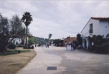 Old Town State Historic Park
Old Town is a neighborhood of San Diego, California. It contains 230 acres (93 ha) and is bounded by Interstate 8 on the north, Interstate 5 on the west, Mission Hills on the east and Bankers Hill on the south.[1] It is the oldest settled area in San Diego and is the site of the first European settlement in present-day California.[2] It contains Old Town San Diego State Historic Park and Presidio Park, both of which are listed on the National Register of Historic Places.
Contents
History
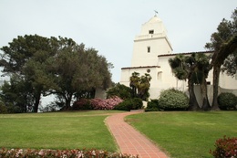
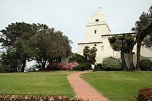 The Serra Museum in Presidio Park marks the original site of the Presidio and Mission
The San Diego Presidio and Mission San Diego de Alcala were founded in 1769 by Gaspar de Portola and Junipero Serra on a bluff at the western end of the San Diego River valley. The Presidio and Mission constituted the first Spanish settlement in Alta California, the present day state of California. After five years the Mission moved to a location several miles upriver, while the Presidio on its hill remained the primary settlement. In the 1820s the town of San Diego grew up at the base of the bluff, at the site commemorated by Old Town San Diego State Historic Park, while the Presidio fell into disrepair.[3]
In 1834 the Mexican government granted San Diego the status of a pueblo, or chartered town. However, the population of the town declined so much that in 1838 its pueblo status was revoked. One problem was the town's location far from navigable water. All imports and exports had to be brought ashore in Point Loma and carried several miles over the La Playa Trail to the town.[4]
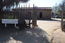 The Casa de Machado y Stewart, an 1830s adobe house in Old Town San Diego State Historic Park.
When California was admitted to the United States in 1850, San Diego (still largely limited to the Old Town area) was made the county seat of San Diego County, even though the town's population was only 650.[5]
The Old Town area remained the heart of the city of San Diego until the 1860s, when a newcomer to San Diego named Alonzo Horton began to promote development at the site of present-day Downtown San Diego. Residents and businesses quickly abandoned "Old Town" for Horton's "New Town" because of New Town's proximity to shipping. In 1871, government records were moved from Old Town to a new county courthouse in New Town, and Downtown permanently eclipsed Old Town as the focal point of San Diego.[6]
 Class 1 Streetcar homes in the Old Town neighborhood of San Diego, CA.
In the 1910s, Old Town became one of the many San Diego neighborhoods connected by the Class 1 streetcars and an extensive San Diego public transit system that was spurred by the Panama-California Exposition of 1915 and built by John D. Spreckels. These streetcars became a fixture of this neighborhood until their retirement in 1939.[7][unreliable source?]
Economy
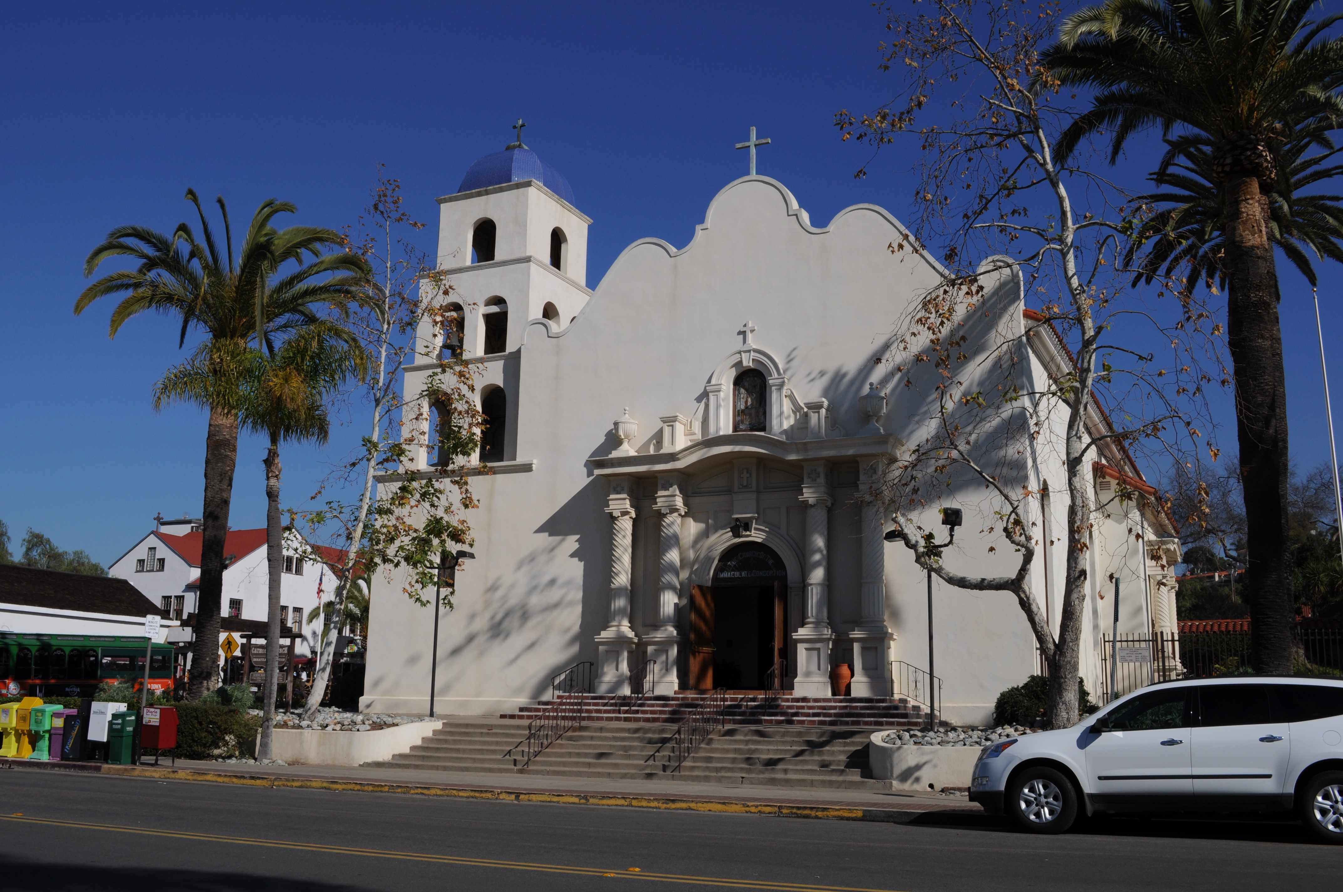
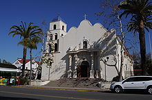 Church of the Immaculate Conception (built 1917).
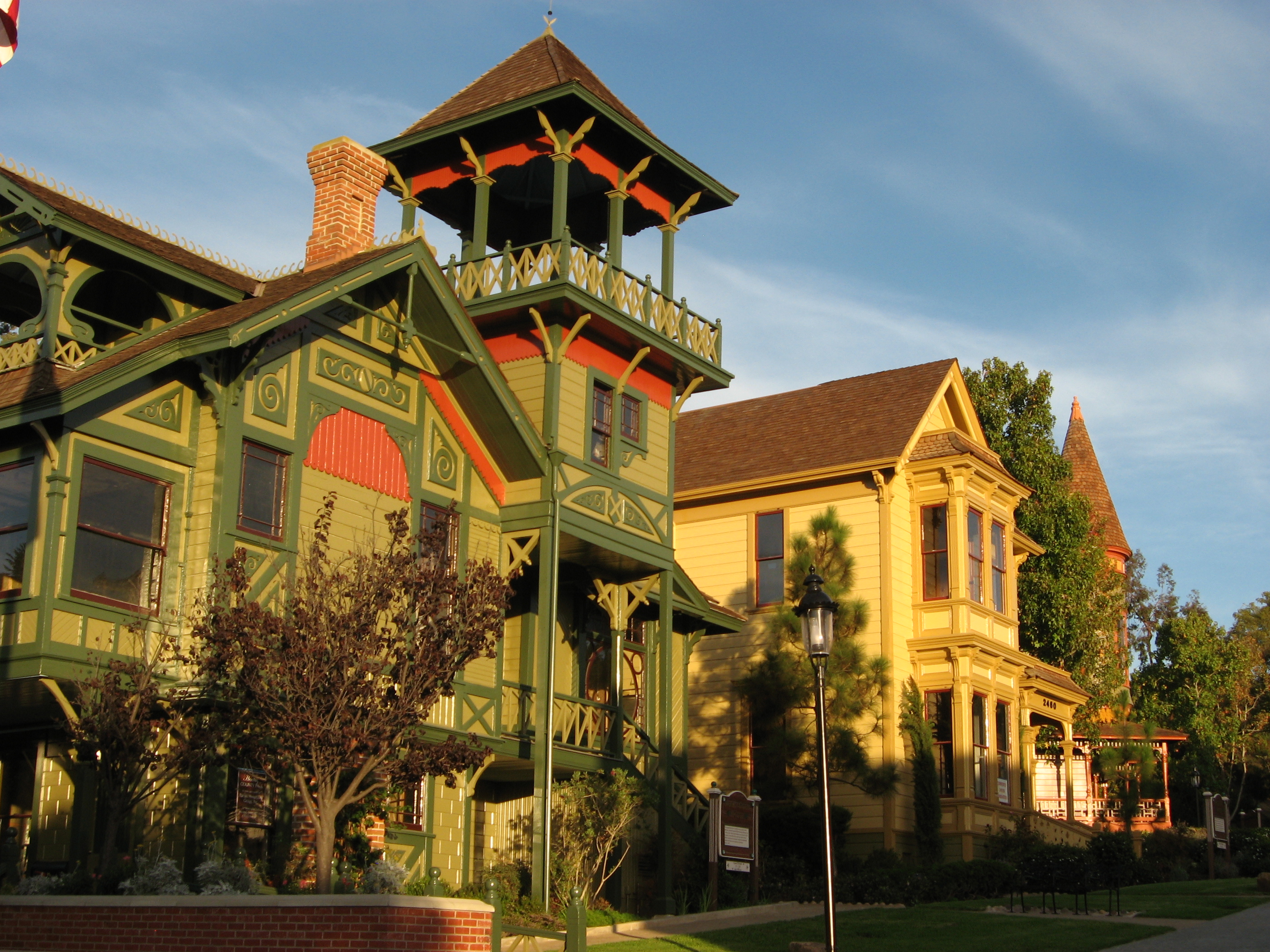
The Old Town neighborhood has nine hotels, 32 restaurants and more than 100 specialty shops.[8] There are 12 art galleries and 27 historic buildings and sites, including Old Town San Diego State Historic Park, Presidio Park, Heritage Park (a collection of Victorian homes), and the Mormon Battalion Visitor Center. A major government building is the District 11 headquarters of Caltrans, the California Department of Transportation.[9]
Annual events
San Diego's Cinco de Mayo celebration is held in Old Town every year.[10]
The Old Town Art Festival takes place in October of each year.[11]
Fiesta Navidad is a two-day Christmas festival in December, highlighted by the Mexican tradition of Las Posadas, which re-enacts the story of Mary and Joseph's journey to Bethlehem for the first Christmas.[12]
Community organizations
The Old Town Community Planning Committee advises the city on land use and other issues. The Old Town San Diego Chamber of Commerce promotes business interests and tourism.[13] Local service organizations include a Kiwanis club.
Infrastructure
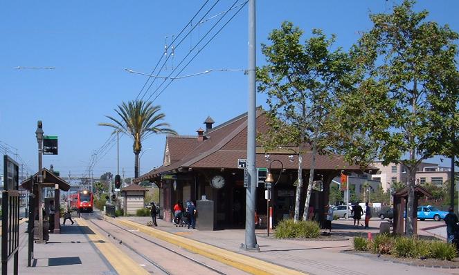
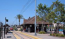 Old Town Transit Center
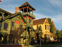 Houses in Old Town
The Old Town Transit Center is a major intermodal transportation station where travelers can transfer between city buses, the San Diego Trolley, and the San Diego Coaster, the regional rail system of Amtrak.[14]
References
- ^ Old Town community profile, City of San Diego
- ^ Journal of San Diego History, Summer 1999
- ^ Journal of San Diego History, October 1968
- ^ La Playa Trail Association
- ^ San Diego population table, San Diego Historical Society
- ^ Engstrand, Iris Wilson, California’s Cornerstone, Sunbelt Publications, Inc., 2005, p. 80
- ^ The Home of the San Diego Historic Class 1Streetcars
- ^ Old Town Chamber of Commerce: Businesses
- ^ Caltrans District 11
- ^ fiestacincodemayo.com
- ^ oldtownartfestival.com
- ^ Old Town San Diego Guide
- ^ Chamber of Commerce webpage
- ^ San Diego Metropolitan Transit System
See also
- History of San Diego
- Two Years Before the Mast by Richard Henry Dana
- Ramona by Helen Hunt Jackson
Neighborhoods of San Diego Northern Bay Ho · Bay Park · Carmel Valley · Clairemont · Del Mar Heights · Del Mar Mesa · La Jolla · La Jolla Village · Mission Beach · North City · Pacific Beach · Pacific Highlands Ranch · Torrey Hills · Torrey Pines · University City · Village of La JollaNortheastern Black Mountain Ranch · Carmel Mountain Ranch · Mira Mesa · Miramar · Rancho Bernardo · Rancho Encantada · Rancho Peñasquitos · Sabre Springs · San Pasqual Valley · Scripps Ranch · Sorrento Valley · Sorrento Mesa · Torrey HighlandsEastern Birdland · Kearny Mesa · Mission Valley East · Navajo (Allied Gardens · Del Cerro · Grantville · San Carlos) · Serra Mesa · TierrasantaWestern Burlingame · Hillcrest · Linda Vista · Midtown · Mission Hills · Mission Valley West · Morena · North Park · Ocean Beach · Old Town · Point Loma (La Playa · Liberty Station · Loma Portal · Midway · Point Loma Heights · Roseville-Fleetridge · Sunset Cliffs · Wooded Area) · University HeightsCentral Downtown (Columbia · Core · Cortez Hill · East Village · Gaslamp Quarter · Harborview · Little Italy · Marina) · Balboa Park · Bankers Hill · Barrio Logan · Golden Hill · Grant Hill · Logan Heights · Middletown · Sherman Heights · South Park · StocktonMid-City Adams North · Azalea/Hollywood Park · Castle · Cherokee Point · Chollas Creek · City Heights · Colina del Sol · College Area · Corridor · Darnall · El Cerrito · Fairmont Park · Fox Canyon · Gateway · Islenair · Kensington · Normal Heights · Oak Park · Ridgeview · Redwood Village · Rolando · Swan Canyon · Talmadge · Teralta · WebsterSoutheastern Alta Vista · Bay Terraces · Broadway Heights · Chollas View · Emerald Hills · Encanto · Jamacha-Lomita · Lincoln Park · Mountain View · Mount Hope · Paradise Hills · Shelltown · Skyline · Southcrest · Valencia ParkSouthern Border · Egger Highlands · Nestor · Ocean View Hills · Otay Mesa · Otay Mesa West · Palm City · San Ysidro · Tijuana River ValleyCategories:- Neighborhoods in San Diego, California
- History of San Diego, California


Wikimedia Foundation. 2010.