- Tierrasanta, San Diego
-
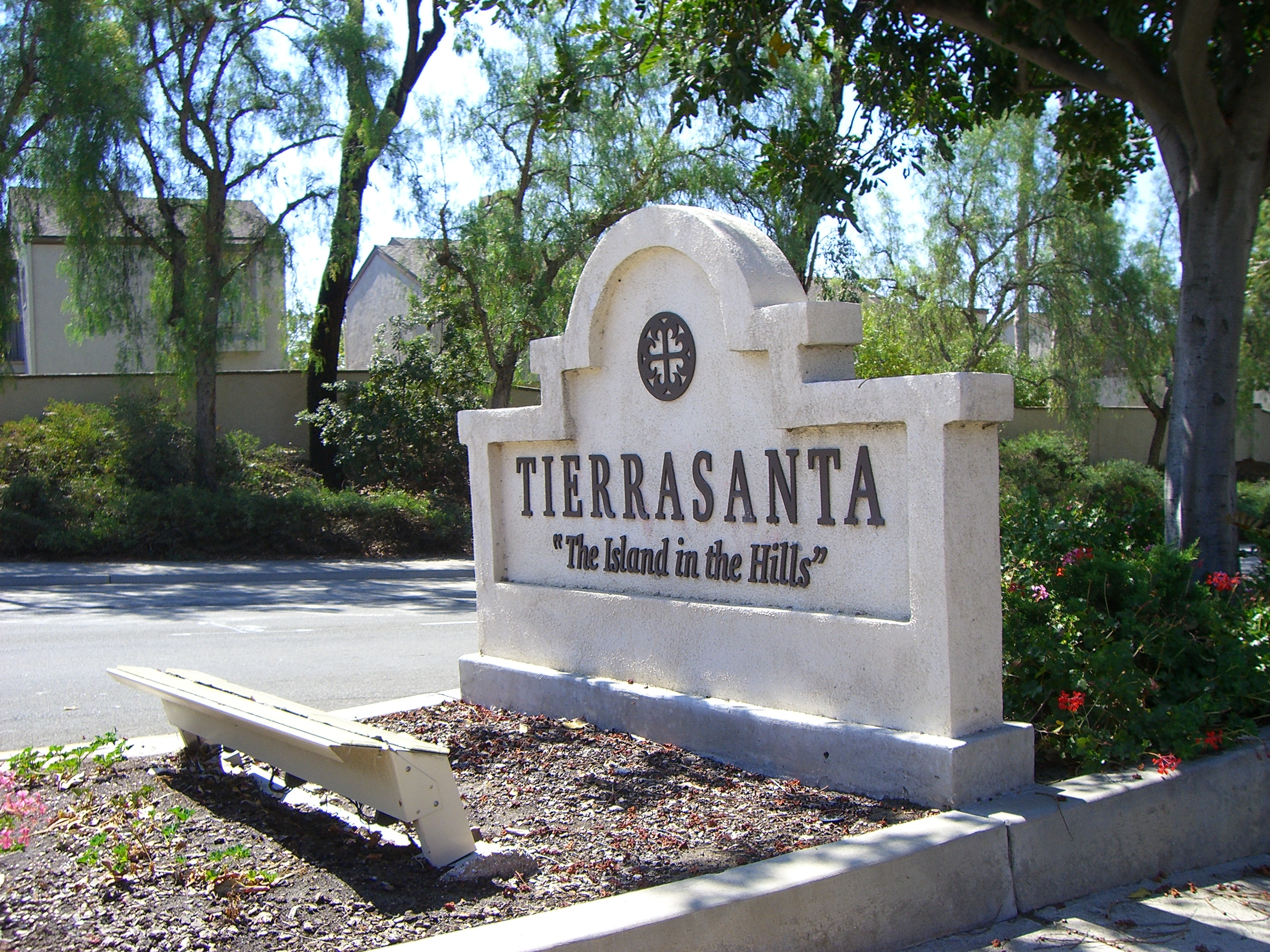
Tierrasanta — Community of San Diego — The Tierrasanta sign located on Santo Road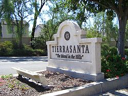 Location within San Diego
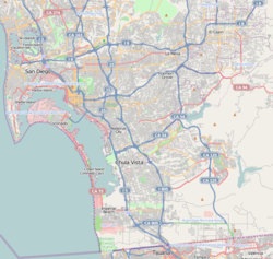
 Tierrasanta
Coordinates: 32°49′15″N 117°05′47″W / 32.820833°N 117.096389°W Country United States State California County County of San Diego City City of San Diego Area code(s) 858 Tierrasanta, Spanish for "holy land," is a community within the city of San Diego, California. The symbol of Tierrasanta is an encircled Conquistador cross, similar to the Montserrat Cross of Barcelona, Spain, though it holds no religious meaning. The community is referred to as "The Island in the Hills" by locals and on welcome signs.
Contents
History
Tierrasanta was originally part of the Mission San Diego de Alcalá ranch, which was active during the late 18th and 19th centuries. The U.S. military purchased the land in 1941 as Camp Elliott, a Marine Corps training facility. The Marines moved out in 1944 and the land was transferred to the Navy. It was deactivated in 1946. In 1961, the U.S. Government sold the area that is now Tierrasanta and a portion of neighboring Mission Trails Regional Park to the City of San Diego. In the following year, the Elliott Community Plan was issued to serve as a roadmap for development going forward, and in 1971 Tierrasanta was founded. The current Tierrasanta community plan was issued in 1982,[1] and included both the currently developed area and much of what is now Mission Trails Regional Park. By 1982 approximately one-half of the private residential area had been developed, with the area called Tierrasanta Norte, in the northeastern part of town, being one of the locations still to be developed. Tierrasanta has been fully built out since the early 1990s, and in 2010 had a population of 30,443 (ZIP code 92124).[2] It was one of the first master planned communities in San Diego.
Because of the area's history as a military training base, some military debris including unexploded ordnance remained in the area when it was developed, in spite of multiple cleanup efforts by different branches of the services. In 1983 two 8-year-old Tierrasanta boys were killed after discovering unexploded ordnance in a canyon near their home.[3] The Navy performed surface clearance operations in 1984 and 1985. Between 1990 and 1995 the U.S. Army Corps of Engineers removed several tons of ordnance and debris under its FUDS (Formerly Used Defense Sites) program. The Corps continues to monitor the area.
In October 2003, Tierrasanta, among other communities in San Diego, was affected by what was known as "Firestorm 2003." This was a conglomeration of the Cedar Fire and numerous other wildfires that converged on Southern California. The residents of Tierrasanta were forced to evacuate. Nearly a dozen homes were lost to the blaze. Shortly after, in 2004, the Tierrasanta Community Emergency Response Team (T-CERT) was created for rapid local response to natural disasters. A similar scare swept through Tierrasanta in the fall of 2007, though residents were not required to evacuate.
Geography
Tierrasanta is situated like an island, not directly bordered by any community. It is bounded on the north by the Mount Soledad (52) Freeway and the sprawling southern fields of MCAS Miramar; on the east by the 5,800-acre (23 km2) Mission Trails Regional Park, which has numerous hiking and mountain biking trails; on the west by bluffs bordering the Interstate 15 corridor, and on the south by steep canyons overlooking the San Diego River and Mission Valley. Community activities focus on the Tierrasanta Recreation Center, which includes lighted sports fields, a large swimming pool, tennis courts, a gymnasium, and meeting rooms.[4] Numerous green belts with walking paths run through the canyons of Tierrasanta. The community has tree-lined streets and a secluded "small town" atmosphere, though it is centrally located with a 20 minute drive to downtown San Diego.
Tierrasanta is a community of single family homes, condominiums, apartments, three shopping centers, a branch of the San Diego Public Library, and a research park. Also located in the community are several top-ranked elementary and middle schools, part of the San Diego Unified School District, including Serra High School.
Government and culture
The elected Tierrasanta Community Council (TCC) has responsibility for community planning and for advising the City of San Diego and other government agencies on local issues. The TCC supports numerous events in the community such as the Concert in the park series, annual parade, Oktoberfest and other events. The TCC represents the citizens as their voice to the city government on land use and planning issues. The TCC also acts as the communities Town Council and takes positions on things that affect the Tierrasanta Community and the City of San Diego.
Dedicated open space areas and landscaped medians are maintained by the Tierrasanta Maintenance Assessment District, which was established in 1972 and most recently approved by voters in 1997. The 818 acres of Tierrasanta Open Space qualifies this urban park as one of the 150 largest in the United States.
The Tierrasanta Community Council has an agreement with the owners of the Tierra Towne Center for the free use of a large storefront in the shopping center by community groups.
San Diego City Councilwoman Marti Emerald, representing District 7, is a resident of Tierrasanta.
Cultural amenities
The community has jogging/biking trails and several baseball and soccer teams. Music falling under the categories of jazz and instrumental concert band is quite prominent in addition to the numerous amounts of physical sports teams.
Notable residents
- Tony Hawk grew-up in Tierrasanta and attended Farb Middle School. Presently, the Tony Hawk Foundation is raising funds for a million-dollar skatepark in Tierrasanta[5]
References
External links
- Planning Dept. Community Profile
- Tierrasanta Community Council
- Tierrasanta Kiwanis
- Yahoo Group for Tierrasanta Norte Neighbors
Schools
- Vista Grande Elementary
- Tierrasanta Elementary
- Kumeyaay Elementary
- Miller Elementary
- Gaspar de Portola Middle School
- Jean Farb Middle School
- Junipero Serra High School
- Hancock Elementary School
Coordinates: 32°49′15″N 117°5′47″W / 32.82083°N 117.09639°W
Neighborhoods of San Diego Northern Bay Ho · Bay Park · Carmel Valley · Clairemont · Del Mar Heights · Del Mar Mesa · La Jolla · La Jolla Village · Mission Beach · North City · Pacific Beach · Pacific Highlands Ranch · Torrey Hills · Torrey Pines · University City · Village of La JollaNortheastern Black Mountain Ranch · Carmel Mountain Ranch · Mira Mesa · Miramar · Rancho Bernardo · Rancho Encantada · Rancho Peñasquitos · Sabre Springs · San Pasqual Valley · Scripps Ranch · Sorrento Valley · Sorrento Mesa · Torrey HighlandsEastern Birdland · Kearny Mesa · Mission Valley East · Navajo (Allied Gardens · Del Cerro · Grantville · San Carlos) · Serra Mesa · TierrasantaWestern Burlingame · Hillcrest · Linda Vista · Midtown · Mission Hills · Mission Valley West · Morena · North Park · Ocean Beach · Old Town · Point Loma (La Playa · Liberty Station · Loma Portal · Midway · Point Loma Heights · Roseville-Fleetridge · Sunset Cliffs · Wooded Area) · University HeightsCentral Downtown (Columbia · Core · Cortez Hill · East Village · Gaslamp Quarter · Harborview · Little Italy · Marina) · Balboa Park · Bankers Hill · Barrio Logan · Golden Hill · Grant Hill · Logan Heights · Middletown · Sherman Heights · South Park · StocktonMid-City Adams North · Azalea/Hollywood Park · Castle · Cherokee Point · Chollas Creek · City Heights · Colina del Sol · College Area · Corridor · Darnall · El Cerrito · Fairmont Park · Fox Canyon · Gateway · Islenair · Kensington · Normal Heights · Oak Park · Ridgeview · Redwood Village · Rolando · Swan Canyon · Talmadge · Teralta · WebsterSoutheastern Alta Vista · Bay Terraces · Broadway Heights · Chollas View · Emerald Hills · Encanto · Jamacha-Lomita · Lincoln Park · Mountain View · Mount Hope · Paradise Hills · Shelltown · Skyline · Southcrest · Valencia ParkSouthern Border · Egger Highlands · Nestor · Ocean View Hills · Otay Mesa · Otay Mesa West · Palm City · San Ysidro · Tijuana River ValleyCategories:- Neighborhoods in San Diego, California

Wikimedia Foundation. 2010.