- Mission Trails Regional Park
-
Coordinates: 32°49′40″N 117°03′04″W / 32.827817°N 117.051086°W
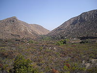 View of the park and gorge from the visitors center
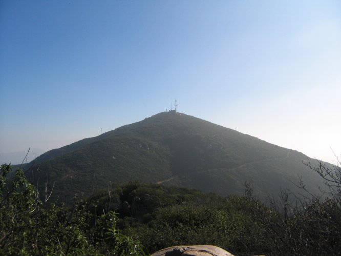
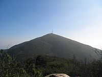 A photograph of Cowles Mountain, facing East, taken on the trail to Pyles Peak.
Mission Trails Regional Park is a 5,800 acre (23 km²) open space preserve within the city of San Diego, California, established in 1974. It is the sixth largest municipally-owned park in the United States, and the largest in California.[citation needed]
Contents
Description
The park consists mostly of rugged canyons and hills, with both natural and developed recreation areas. It is the seventh largest open space urban park in the United States consisting of 6,150 acres (24.9 km2). The highest point is 1,592 foot (485 m) high Cowles Mountain, which is also the highest point in the city of San Diego. The San Diego River flows through the park. A one-way access road goes through the park, allowing hikers, bikers and pedestrians on one side and cars on the other. The park is open every day of the year.
The park has over forty miles of hiking, mountain bike and equestrian trails, a rock climbing area, a campground adjacent to a small lake. There is also the modern 14,000-square-foot (1,300 m2) Mission Tails Regional Park Visitor and Interpretive Center. It includes a number of exhibits, a library, a 93 seat theater that includes a Blu-ray projection system with a large screen. The Visitor Center also includes an art gallery where award winning artists display up to 55 photos and paintings. New artists display their talent every month. The most popular trail of the park is the Cowles Mountain trail, which takes hundreds of people per day to the summit for a breathtaking 360 degree panorama of San Diego County. Another popular stop is the Old Mission Dam, which was built to supply irrigation water to the Mission San Diego de Alcala, the first of the chain of missions established by Junípero Serra in California. Another popular destination within the park is Lake Murray, a reservoir supplying water to San Diego neighborhoods. It is also home to the Kumeyaay Campground which consists of 46 rustic campsites, and the Equestrian Staging Area(Multi-use) Staging Area.
Special annual events at Mission Trails include the Amateur Photo Contest which begins in February and entries are due by the middle of April. Each year the park celebrates Explore Mission Trails Day (EMTD)on the third Saturday of May. All the activities for EMTD are free and take place at the Visitor and Interpretive Center and at the Equestrian Staging Area.
Natural history
The park is in the California chaparral and woodlands Ecoregion. It has coastal sage and chaparral and riparian habitats and plant communities of California native plants.
2003 Cedar Fire
A significant portion of the park was burned by the Cedar Fire in 2003. As is typical of a chaparral ecology, within a year the park had recovered and exhibited little evidence of recent fire damage.[1]
References
"San Diego's Mission Trails Regional Park : Official Guidebook", by Pamela Crooks, 2003, ISBN 0970621914
External links
- Mission Trails Regional Park - City of San Diego web site.
Categories:- Municipal parks in California
- Urban public parks
- Parks in San Diego, California
- Regional parks in California
- Nature reserves in California
- Visitor attractions in San Diego, California

Wikimedia Foundation. 2010.