- Midway, San Diego
-
The Midway area, also called the North Bay area, is a neighborhood of San Diego, California. It is located at the northern (mainland) end of the Point Loma peninsula, northwest of Downtown San Diego and just west of Old Town. It is often considered to be part of Point Loma, although the city treats it as a separate Planning Area.
The boundaries of the Midway community plan are the San Diego River and Interstate 8 to the north, Interstate 5 to the east, Laurel Street to the south, and Lytton Street and the bluffs above Kenyon Street to the west.[1] The area encompasses approximately 800 acres (320 ha) of mostly flatland.
The area is primarily commercial and industrial, and contains only a few small pockets of multi-family residential development.
Contents
History
Historically the area was part of the San Diego River delta, comprising the flat land between the hill of the San Diego Presidio and the hills of Point Loma. The San Diego river switched back and forth between emptying into Mission Bay (called False Bay by the early settlers) and emptying through the Midway area into the San Diego Bay. Because of fears that San Diego Bay might silt up, the river was confined to its present course north of Point Loma by a levee built by the city in 1877.[2] This exposed the flat, marshy areas of Midway for development.
Rosecrans Street, a main thoroughfare through Midway, follows the route of the historic La Playa Trail, the oldest European trail in the Western United States. It connected the settlements in Old Town and Mission San Diego with La Playa, the beach in Point Loma where ships loaded and unloaded cargo.[3]
In 1850, approximately 687 acres (278 ha) of land in the area was conveyed to a group of ten would-be developers, who subdivided the land in hopes of developing it. The names of some of the original ten investors are remembered in the existing street name system along Pacific Highway, including Emory, Sutherland, Noell, Estudillo, Wright, Banini, Couts, and Witherby.[1] However, the area was still marshy, and little development occurred until the 1930s, when commercial, industrial, and residential development could be found in some areas.[4]
By the early 1900s central Midway was known as Dutch Flats and still included a lot of standing water. Dutch Flats was also the name of a small dirt airstrip in the area used by the Ryan Aeronautical Company, located near what are now Midway and Barnett streets. Dutch Flats became famous when Ryan built a specially designed aircraft for Charles A. Lindbergh, who tested it at Dutch Flats and then used it to fly solo across the Atlantic in 1927. A post office now located on the site contains several historic plaques commemorating Dutch Flats and Lindbergh.[5]
The city of San Diego opened San Diego Municipal Airport/Lindbergh Field in 1928 on land located between the Midway area and San Diego Bay.[6] As a result, aircraft-related industries and businesses continued to be important for the Midway area up until the present day.
In 1921 the Marine Advanced Expeditionary Base (now Marine Corps Recruit Depot San Diego) was built in the Midway area on Barnett Avenue, lending a boost to the area’s economy and setting the stage for future military development.
During the 1940s the Midway area experienced a boom, with numerous war-related industrial sites and a large (approximately 4000 units) housing complex for defense workers known as the Frontier Housing.[7] Areas along Pacific Highway became wartime factories, and later provided the hub of the city’s aerospace industry.[1]
During the 1950s the neighborhood became a mecca for then-popular establishments such as a drive-in restaurant (Oscar's, owned by Robert Oscar Peterson who later founded the Jack in the Box chain[8]), two drive-in theaters (the Midway and the Frontier[9]), and a bowling alley (Frontier Lanes). The only remaining structure from that era is the Loma Theater on Rosecrans St., which opened in 1944 as a 1188-seat movie palace in the Arte Moderne style; it is now a bookstore with some of the Arte Moderne architectural features retained, including the neon sign.[10]
From the 1960s to the present the area became less industrial and more commercial. It is now mainly known for large region-serving retail establishments and multi-lane traffic arteries.
During the 1990s the city proposed to build a “bay to bay” water link between San Diego Bay and Mission Bay, which would have run right through the Midway area.[11] However, the plan received little community support and was abandoned after a consultant’s report deemed it not economically feasible.[12]
The area contains two sites that are listed on the National Register of Historic Places: Mission Brewery, a three-story brick building on Hancock Street dating from the turn of the century, originally a brewery but now used for offices and retail; and the Marine Corps Recruit Depot Historic District.
Geography
The area is entirely flat. It consists mostly of “fill” land built up over formerly marshy areas and river sediment deposits. Nothing remains of the former wetlands except Famosa Slough (a city-owned nature preserve which is technically located in Point Loma but is considered part of Midway by many people) and the San Diego River bed itself.
Most of the area is commercial or industrial in nature, but there are some residential areas, including the seniors-only Orchard Apartments (built on land owned by the city of San Diego), a Navy family housing complex between Rosecrans and Barnett, and some private apartment and condominium developments in the Pacific Highway corridor near the San Diego Trolley.
Economy
The area now consists primarily of medium-to-large strip malls with region-serving stores such as groceries, drugstores, and general and discount stores. Many of those establishments closed during 2008-2009 leaving a lot of empty commercial space in the area. There are a few remaining small industrial businesses such as boat repair yards and trucking firms.
A major employer in the area is Space and Naval Warfare Systems Center San Diego, known as “SPAWAR,” together with related contractors and businesses. There are also many airport-related businesses such as long-term parking lots and car rental companies.
Midway is also known for a concentration of adult establishments such as strip clubs, partly because city laws regulating such establishments make the area favorable for them, and partly because of the proximilty of large military bases (MCRD and formerly the Naval Training Center San Diego) full of young recruits.
Homeless people are very visible in the area, partly because of illegal but tolerated encampments along the San Diego River, and partly because of the presence of numerous establishments such as Goodwill, the Salvation Army, and the San Diego Veterans Village.
Midway is included in the North Bay Redevelopment Project area.[13]
Culture
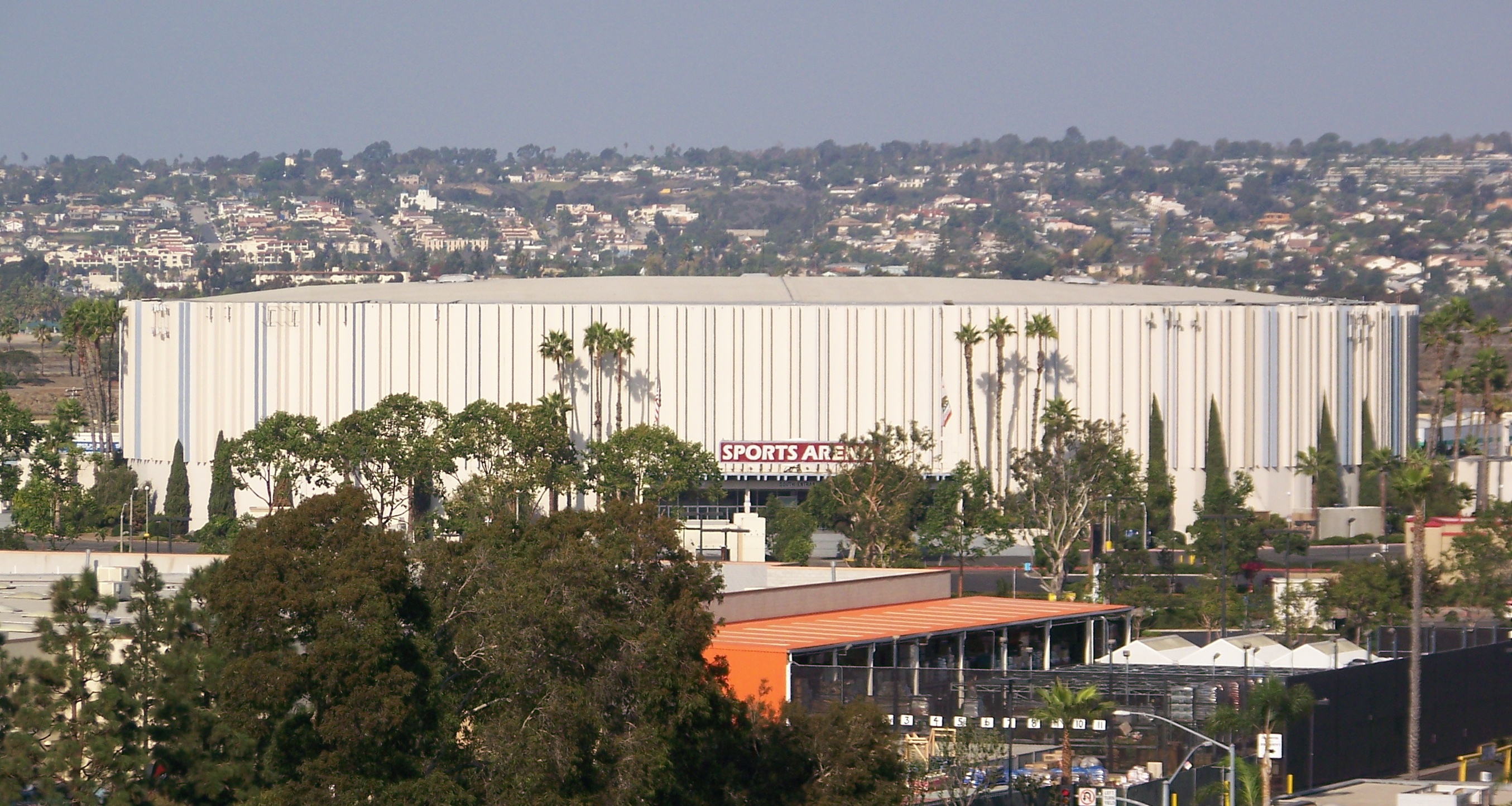
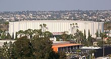 Valley View Casino Center in November 2007
The Valley View Casino Center, owned by the city and managed by a private company, is located in the area. It primarily hosts concerts and touring shows such as ice shows and circuses. One of the largest swap meets on the West Coast takes place in the parking lot each week.[14] The SOMA concert venue is also located in Midway.
Education
There is one public elementary school in the area, Dewey Elementary, under the jurisdiction of the San Diego City Schools, as well as a Catholic elementary-middle school, St. Charles Boromeo Academy. There is also an adult-education campus of the San Diego Community College District on Fordham St.
Infrastructure
The community is located next to the interesection of Interstate 5 and Interstate 8. It is dominated by multi-lane roads which serve as the main ingress and egress for the entire Point Loma peninsula. Rosecrans Street, Midway Drive, Sports Arena Boulevard (formerly known as Frontier Drive), West Point Loma Boulevard and Pacific Highway are the main streets. Traffic is extremely heavy and congestion is common. Two intersections in the Midway area (Midway/Rosecrans and Sports Arena/Rosecrans) are among the worst intersections in the city for accidents, according to the city of San Diego.[15]
Government
The area is part of the Second Council District in the City of San Diego, currently represented by Kevin Faulconer. The North Bay Community Advisory Group advises the city on planning, land use and other issues.
References
- ^ a b c City of San Diego Community Profile
- ^ Smythe, William E., “History of San Diego, 1542-1908”, Part Seven, Chapter II
- ^ Historic La Playa Trail Association website
- ^ Journal of San Diego History, Vol. 23, No. 4, Fall 1977
- ^ Free Internet Archive
- ^ CharlesLindbergh.com
- ^ Journal of San Diego History, Vol. 29, Nos. 1-2, Spring 1993
- ^ NNDB.com
- ^ San Diego Reader, Aug. 1, 2008
- ^ cinematreasures.org
- ^ City of San Diego
- ^ San Diego Metro, Feb. 2002
- ^ North Bay Redevelopment Agency
- ^ Kobey’s Swap Meet
- ^ Los Angeles Times
Neighborhoods of San Diego Northern Bay Ho · Bay Park · Carmel Valley · Clairemont · Del Mar Heights · Del Mar Mesa · La Jolla · La Jolla Village · Mission Beach · North City · Pacific Beach · Pacific Highlands Ranch · Torrey Hills · Torrey Pines · University City · Village of La JollaNortheastern Black Mountain Ranch · Carmel Mountain Ranch · Mira Mesa · Miramar · Rancho Bernardo · Rancho Encantada · Rancho Peñasquitos · Sabre Springs · San Pasqual Valley · Scripps Ranch · Sorrento Valley · Sorrento Mesa · Torrey HighlandsEastern Birdland · Kearny Mesa · Mission Valley East · Navajo (Allied Gardens · Del Cerro · Grantville · San Carlos) · Serra Mesa · TierrasantaWestern Burlingame · Hillcrest · Linda Vista · Midtown · Mission Hills · Mission Valley West · Morena · North Park · Ocean Beach · Old Town · Point Loma (La Playa · Liberty Station · Loma Portal · Midway · Point Loma Heights · Roseville-Fleetridge · Sunset Cliffs · Wooded Area) · University HeightsCentral Downtown (Columbia · Core · Cortez Hill · East Village · Gaslamp Quarter · Harborview · Little Italy · Marina) · Balboa Park · Bankers Hill · Barrio Logan · Golden Hill · Grant Hill · Logan Heights · Middletown · Sherman Heights · South Park · StocktonMid-City Adams North · Azalea/Hollywood Park · Castle · Cherokee Point · Chollas Creek · City Heights · Colina del Sol · College Area · Corridor · Darnall · El Cerrito · Fairmont Park · Fox Canyon · Gateway · Islenair · Kensington · Normal Heights · Oak Park · Ridgeview · Redwood Village · Rolando · Swan Canyon · Talmadge · Teralta · WebsterSoutheastern Alta Vista · Bay Terraces · Broadway Heights · Chollas View · Emerald Hills · Encanto · Jamacha-Lomita · Lincoln Park · Mountain View · Mount Hope · Paradise Hills · Shelltown · Skyline · Southcrest · Valencia ParkSouthern Border · Egger Highlands · Nestor · Ocean View Hills · Otay Mesa · Otay Mesa West · Palm City · San Ysidro · Tijuana River ValleyCategories:- Neighborhoods in San Diego, California
- History of San Diego, California

Wikimedia Foundation. 2010.