- Westville Village Historic District
-
Westville Village Historic District
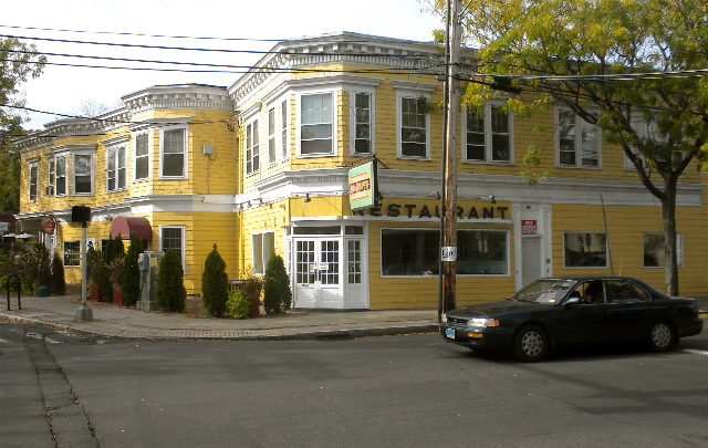
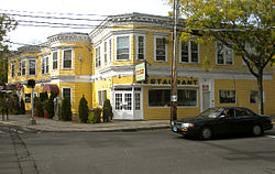 Hotel Edgewood (1913), 882-888 Whalley Ave.
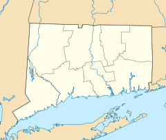

Location: Roughly along Blake St. and Whalley Ave. (original)
827 Whalley Ave. (increase), New Haven, ConnecticutCoordinates: 41°19′50″N 73°10′20″W / 41.33056°N 73.17222°WCoordinates: 41°19′50″N 73°10′20″W / 41.33056°N 73.17222°W Area: 22 acres (8.9 ha) (original) and less than one acre (increase) Built: 1912 (increase) Architect: multiple Architectural style: Federal, Greek Revival, et al. (original); Early Commercial (increase) Governing body: Private NRHP Reference#: 02001727 and 06000954[1] Added to NRHP: January 23, 2003 (original)
October 25, 2006 (increase)Westville Village Historic District is a historic district representing most of the commercial center of the Westville neighborhood of New Haven, Connecticut.[2] The district was listed on the National Register of Historic Places in 2003, and its boundaries were increased in 2006.[1]
In 2003, the listed area was 22 acres (8.9 ha) and there were 30 contributing buildings in the district.[1]
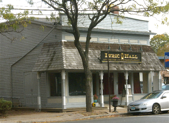
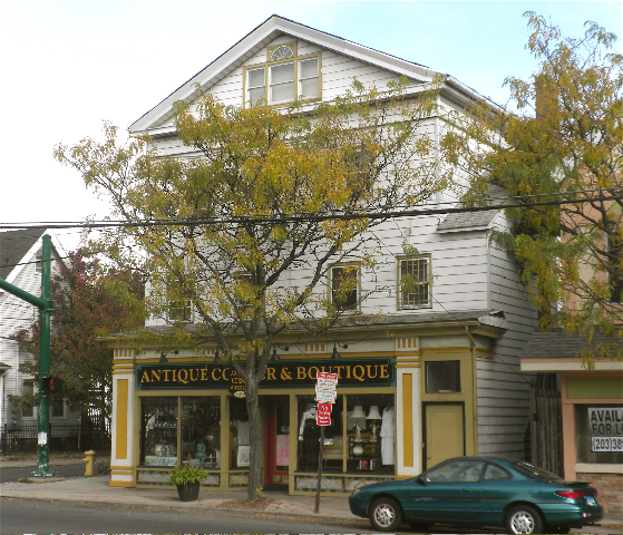
In 2006, the listing was amended to add the former Westville Theater building at 827 Whalley Avenue, an Early Commercial style building that was built in 1912.[1][3] The theater building is now occupied by an antiques store.[citation needed]
When listed, the district included 34 buildings, of which 30 were deemed contributing buildings. The contributing buildings are:
- 446 Blake Avenue, Greist Manufacturing Company
- 495 Blake Avenue, Geometric Tool Company
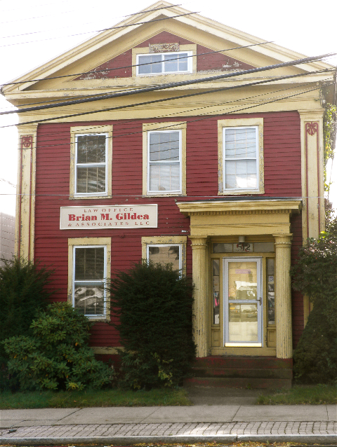
- 512 Blake Avenue, c. 1840 (See photo #13 in accompanying photo set)
- 15-17 Tour Avenue, Italianate, c.1905
- 23-25 Tour Avenue, Queen Anne, c.1905
- 413 West Rock Avenue, a Queen Anne style house
- 416-418 West Rock Avenue, Queen Anne
- 417 West Rock Avenue
- 420-422 West Rock Avenue
- 426 West Rock Avenue, Tudor Revival
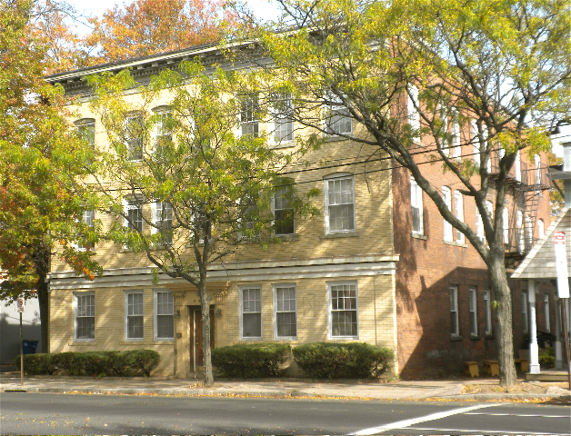
- 831-835 Whalley Avenue, the Alfred Minor Building
- 837-839 Whalley Avenue
- 843 Whalley Avenue
- 845-847 Whalley Avenue
- 859-861 Whalley Avenue
- 865 Whalley Avenue
- 867 Whalley Avenue
- 873-875 Whalley Avenue
- 879 Whalley Avenue
- 881 Whalley Avenue
- 882-888 Whalley Avenue, Hotel Edgewood (photo #9)
- 883-889 Whalley Avenue
- 893-901 Whalley Avenue
- 898 Whalley Avenue
- 900-902 Whalley Avenue
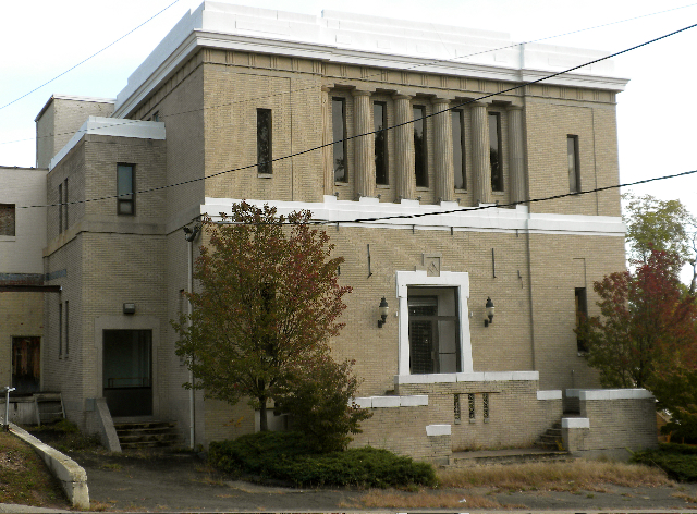
- 903-911 Whalley Avenue, a Masonic hall built for the Olive Branch Temple Corporation
- 904-906 Whalley Avenue
- 914-918 Whalley Avenue
- 920 Whalley Avenue
- 949 Whalley Avenue, the Westville Masonic Temple, from 1926 (see photo #6 in photos accompanying NRHP nomination)[4]
Gallery
-

Westville Theater (1915), 827 Whalley Ave.
-
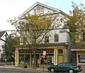
Alfred Minor Building (1906-7), 831-835 Whalley Ave.
-
859 Whalley Ave.
-
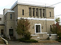
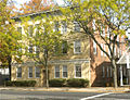
Westville Masonic Temple (1926), 949 Whalley Ave., R. W. Foote.
-

512 Blake Ave. (about 1840), Greek revival.
-

Geometric Tool Company (1906), 495 Blake Ave., Brown and VonBeren.
References
- ^ a b c d "National Register Information System". National Register of Historic Places. National Park Service. 2009-03-13. http://nrhp.focus.nps.gov/natreg/docs/All_Data.html.
- ^ The industrial complex at 446 Blake Street (now housing several offices) is technically part of the West Rock official neighborhood planning area.
- ^ Leah S. Glazer (November 25, 2005). "National Register of Historic Places Registration: Westville Village Historic District (Boundary Increase)". National Park Service. http://pdfhost.focus.nps.gov/docs/NRHP/Text/06000954.pdf. and Accompanying 18 photos, exterior and interior, undated
- ^ Mary Dunne (May 9, 2002). "National Register of Historic Places Registration: Westville Village Historic District". National Park Service. http://pdfhost.focus.nps.gov/docs/NRHP/Text/02001727.pdf. and Accompanying 17 photos, undated
External links
- Westville Village Historic District, New Haven Preservation Trust website (text excerpt from NRHP nomination)
U.S. National Register of Historic Places Topics Lists by states Alabama • Alaska • Arizona • Arkansas • California • Colorado • Connecticut • Delaware • Florida • Georgia • Hawaii • Idaho • Illinois • Indiana • Iowa • Kansas • Kentucky • Louisiana • Maine • Maryland • Massachusetts • Michigan • Minnesota • Mississippi • Missouri • Montana • Nebraska • Nevada • New Hampshire • New Jersey • New Mexico • New York • North Carolina • North Dakota • Ohio • Oklahoma • Oregon • Pennsylvania • Rhode Island • South Carolina • South Dakota • Tennessee • Texas • Utah • Vermont • Virginia • Washington • West Virginia • Wisconsin • WyomingLists by territories Lists by associated states Other Categories:- Historic districts in Connecticut
- Federal architecture in Connecticut
- Greek Revival architecture in Connecticut
- Early Commercial architecture in the United States
- Historic districts in New Haven, Connecticut
- Connecticut Registered Historic Place stubs


Wikimedia Foundation. 2010.