- Deir 'Ammar (camp)
-
Deir Ammar Refugee Camp Other transcription(s) - Arabic مخيّم دير عمّار Location of Deir Ammar Refugee Camp within the Palestinian territories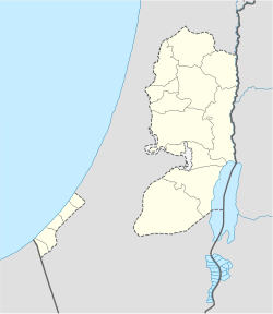
 Deir Ammar Refugee Camp
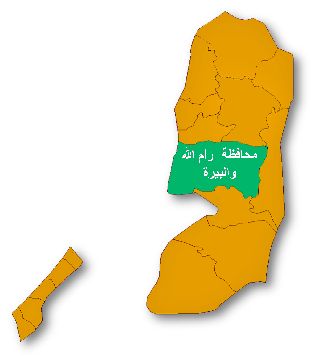
Coordinates: 31°57′57.22″N 35°05′55.98″E / 31.9658944°N 35.0988833°ECoordinates: 31°57′57.22″N 35°05′55.98″E / 31.9658944°N 35.0988833°E Governorate Ramallah & al-Bireh Government - Type Refugee Camp Area - Jurisdiction 145 dunams (0.1 km2 / 0.1 sq mi) Population (2006) - Jurisdiction 2,229 Deir Ammar (Arabic: مخيّم دير عمّار) is a Palestinian refugee camp in the Ramallah and al-Bireh Governorate, located 30 kilometers (19 mi) northwest of Ramallah in the northern West Bank. According to the Palestinian Central Bureau of Statistics (PCBS), the camp had a population of 2,229 inhabitants in mid-year 2006.[1]
The Deir Ammar camp was established in 1949 on a plot of land belonging to non-refugee residents of the village of Deir Ammar. In return, UNRWA's installations in the camp also provide services to non-refugee villagers. The camp falls under joint Israeli/Palestinian control in "Area B".[2] The refugee camp has 2 schools, the boys school has 680 pupils and the girls school has 735 pupils.[2]
Footnotes
- ^ Projected Mid -Year Population for Ramallah & Al Bireh Governorate by Locality 2004- 2006 Palestinian Central Bureau of Statistics (PCBS)
- ^ a b The Camp administered by the United Nations subsidiary organ, UNRWA
External links
- Deir 'Ammar, articles from UNWRA
Ramallah and al-Bireh Governorate Cities 

Municipalities Bani Zeid · Bani Zeid al-Sharqiya · Beit Liqya · Bir Zeit · Deir Dibwan · al-Mazra'a ash-Sharqiya · Ni'lin · Silwad · Sinjil · Turmus Ayya · al-Zaitounah (Abu Shukhaidem · al-Mazra'a al-Qibliya) · al-Ittihad (Beitillu · Deir 'Ammar · Jammala) · TaybehVillage councils Aboud · Abu Qash · Abwein · Ajjul · 'Atara · Beitin · Beit Ur al-Fauqa · Beit Ur al-Tahta · Bil'in · Beit Sira · Budrus · Burham · Burqa · Deir Ibzi · Deir Jarir · Deir Abu Mash'al · Deir Nidham · Deir Qaddis · Deir as-Sudan · Dura al-Qar' · Ein 'Arik · Ein Qiniya · Ein Siniya · Ein Yabrud · al-Janiya · Jifna · Kafr Ein · Kafr Malik · Kafr Ni'ma · Kharbatha al-Misbah · Kharbatha Bani Harith · Khirbet Abu Falah · Kobar · al-Lubban al-Gharbi · al-Midya · al-Mughayyir · Nabi Salih · Qarawat Bani Zeid · Qibya · Rammun · Rantis · Ras Karkar · Saffa · Shuqba · Surda · YabrudRefugee camps Palestinian refugee camps1 locations and populations as of 2005  Gaza Strip
986,034 refugees Jordan
2,127,877 refugees Lebanon
404,170 refugees Syria
Syria
432,048 refugees West Bank
699,817 refugeesAl-Shati (Beach) 76,109 Bureij 30,059 Deir al-Balah 20,188 Jabalya 175,646 Khan Yunis 60,662 Maghazi 22,536 Nuseirat 64,233 Rafah 90,638 Canada Camp disbanded Beddawi 15,695 Burj el-Barajneh 19,526 Burj el-Shemali 18,134 Dbayeh 4,223 Dikwaneh destroyed Ein el-Hilweh 44,133 El-Buss 9,840 Jisr el-Basha destroyed Mar Elias 1,406 Mieh Mieh 5,078 Nabatieh destroyed Nahr el-Bared 28,358 Rashidieh 24,679 Sabra Shatila 11,998 Tel al-Zaatar destroyed Wavel 7,357 Abu Dis Aida 3,260 Am'ari 8,083 Aqabat Jabr 5,197 al-'Arrub 9,180 Askar 31,894 'Azza 1,828 Balata 41,681 Deir Ammar 2,189 Dheisheh 10,923 Ein Beit al-Ma' 6,221 Ein as-Sultan 1,888 Far'a 12,836 Fawwar 7,072 Jalazone 9,284 Jenin 35,050 Kalandia 9,188 Nur Shams 8,179 Shuafat (Shu'fat) 9,567 Tulkarm 17,259 1 The UNRWA definition of a "Palestinian refugee" is a person "whose normal place of residence was Palestine between June 1946 and May 1948, who lost both their homes and means of livelihood as a result of the 1948 Arab-Israeli conflict ... UNRWA's definition of a refugee also covers the descendants of persons who became refugees in 1948." [1]Categories:- Ramallah and al-Bireh Governorate
- Palestine geography stubs
- Populated places established in 1949
- Palestinian refugee camps in the West Bank

Wikimedia Foundation. 2010.