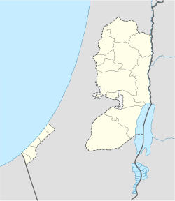
- Ajjul
-
This article is about the Palestinian village in the West Bank. For the archaeological site near Gaza, see Tall al-Ajjul.
Ajjul Other transcription(s) - Arabic عجّول - Also spelled 'Ajjul (official)
Ajoul (unofficial)Location of Ajjul within the Palestinian territories Coordinates: 32°01′22.35″N 35°10′48.75″E / 32.022875°N 35.1802083°ECoordinates: 32°01′22.35″N 35°10′48.75″E / 32.022875°N 35.1802083°E Governorate Ramallah & al-Bireh Government - Type Village Council - Head of Municipality Moussa Moussa Area - Jurisdiction 6,640 dunams (6.6 km2 / 2.6 sq mi) Population (2006) - Jurisdiction 1,237 Name meaning "Calves" Ajjul (Arabic: عجّول) is a Palestinian village in the Ramallah and al-Bireh Governorate in the northern West Bank, located about nineteen kilometers north of Ramallah. There are two archaeological sites or khirbets to the east of the village. One of the khirbets is dedicated to a former resident of Ajjul, Sheikh Abdul.[1] Ajjul is governed by a village council of three members.[2]
In the 18th and 19th centuries, Ajjul was controlled by the Bani Zeid tribe.
Contents
Geography
Ajjul lies at an altitude of 500 meters above sea level. Located twenty kilometers to the southeast is the city of Ramallah. Other nearby towns include Abwein to the northeast, 'Arura to the north and 'Atara to southwest. Ajjul's total land area amounts to 6,640 dunams, most of which is planted with olive and fig groves. About 200 dunams of land is classified as built-up area.[1]
Demographics
In 1922, the village had a population of 202 inhabitants and in 1945 it had a population of 350.[3] According to the Palestinian Central Bureau of Statistics (PCBS), Ajjul had a population of 1,450 inhabitants in mid-year 2006.[4]
In a 1997 PCBS census, only 4.2% of Ajjul's population — which was 1,026 — were Palestinian refugees.[5] The largest age group in the village were infants to 14-year olds, making up 44.2% of the population. About 25.3% of the population is between the ages of 15 and 29, 24.2% between 30 and 64 and residents 65 or older represent 6.3% of the population. There were slightly more males (51.7%) than females (49.3%) in Ajjul's gender make-up.[6] In the 2007 PCBS census, the figures of 'Ajjul's population showed a smaller population of 1,237 people, of which 601 were males and 636 were females.[7]
Infrastructure
Ajjul contains a clinic that's primarily involved in blood-testing. Most of the resident receive medical help from the Palestinian Red Crescent stationed in nearby Sinjil. The nearest hospital is in Ramallah. Two mosques are located in Ajjul: a modern one and an older renovated one.[1]
There is co-gender secondary school in the village, in which 400 students are enrolled. Students attend science and literature classes in the Prince Hassan School in Bir Zeit. Ajjul has about 50 college and university students. There is no postal service in the village.[1]
References
- ^ a b c d Ajjul Village Ajjul Village Council. (Translated from Arabic)
- ^ Village Council Members Ajjul Village Council. (Translated from Arabic)
- ^ Welcome to 'Ajjul PalestineRemembered.com.
- ^ Projected Mid -Year Population for Ramallah & Al Bireh Governorate by Locality 2004- 2006 Palestinian Central Bureau of Statistics.
- ^ Palestinian Population by Locality and Refugee Status Palestinian Central Bureau of Statistics (PCBS).
- ^ Palestinian Population by Locality, Sex and Age Groups in Years Palestinian Central Bureau of Statistics (PCBS).
- ^ 2007 PCBS Census. Palestinian Central Bureau of Statistics. p.113.
Ramallah and al-Bireh Governorate Cities 

Municipalities Bani Zeid · Bani Zeid al-Sharqiya · Beit Liqya · Bir Zeit · Deir Dibwan · al-Mazra'a ash-Sharqiya · Ni'lin · Silwad · Sinjil · Turmus Ayya · al-Zaitounah (Abu Shukhaidem · al-Mazra'a al-Qibliya) · al-Ittihad (Beitillu · Deir 'Ammar · Jammala) · TaybehVillage councils Aboud · Abu Qash · Abwein · Ajjul · 'Atara · Beitin · Beit Ur al-Fauqa · Beit Ur al-Tahta · Bil'in · Beit Sira · Budrus · Burham · Burqa · Deir Ibzi · Deir Jarir · Deir Abu Mash'al · Deir Nidham · Deir Qaddis · Deir as-Sudan · Dura al-Qar' · Ein 'Arik · Ein Qiniya · Ein Siniya · Ein Yabrud · al-Janiya · Jifna · Kafr Ein · Kafr Malik · Kafr Ni'ma · Kharbatha al-Misbah · Kharbatha Bani Harith · Khirbet Abu Falah · Kobar · al-Lubban al-Gharbi · al-Midya · al-Mughayyir · Nabi Salih · Qarawat Bani Zeid · Qibya · Rammun · Rantis · Ras Karkar · Saffa · Shuqba · Surda · YabrudRefugee camps Categories:- Ramallah and al-Bireh Governorate
- Villages in the West Bank
Wikimedia Foundation. 2010.

