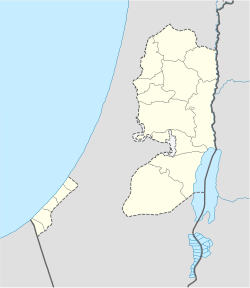
- Deir Jarir
-
Deir Jarir
دير جرير— Village — Location of Deir Jarir Coordinates: 31°57′52.18″N 35°17′44.47″E / 31.9644944°N 35.2956861°ECoordinates: 31°57′52.18″N 35°17′44.47″E / 31.9644944°N 35.2956861°E Governorate Ramallah and al-Bireh Area - Village 33.357 km2 (12.9 sq mi) - Metro 33.4 km2 (12.9 sq mi) Population (2007[1]) - Village 3,986 - Density 119.5/km2 (309.5/sq mi) Deir Jarir (Arabic: دير جرير) is a Palestinian agricultural town in the Ramallah and al-Bireh Governorate in the central West Bank, located eleven kilometers east of Ramallah. It is situated on a hilltop overlooking the Jordan Valley at an elevation of 900 meters.[2] According to the Palestinian Central Bureau of Statistics (PCBS), Deir Jarir had a population of approximately 3,986 inhabitants in mid-year 2006.[1]
It spreads along a large land area of 33,357 dunams (33.357 km2), of which 17.2% is under the civil jurisdiction of the Palestinian National Authority (PNA), while the remainder is under Israeli military control. Most of the land administered by the PNA is the city's built-up area and most of Deir Jarir's cultivated lands are grown with grape vines and fig and olive trees. Open-spaces make-up 76% of the town's area.[2]
In September 2005, hundreds of armed residents from Deir Jarir attacked the nearby town of Taybeh, which was provoked by a family feud. The feud was caused by a Christian man from Taybeh allegedly having intimate relations with a Muslim woman from Deir Jarir. The attack left dozens of houses burnt to the ground and three men were arrested (two from Deir Jarir and one from Taybeh). Despite the incident, the neighboring towns continue to have healthy relations; residents say "the people of Taybeh and the people of Deir Jarir are one family".[3]
References
- ^ a b 2007 PCBS Census. Palestinian Central Bureau of Statistics. p.113.
- ^ a b About Deir Jarir village The Applied Research Institute - Jerusalem. 2008-03-15.
- ^ A frightening family feud Williamson, Lucy. BBC News. 2005-09-10.
Ramallah and al-Bireh Governorate Cities 

Municipalities Bani Zeid · Bani Zeid al-Sharqiya · Beit Liqya · Bir Zeit · Deir Dibwan · al-Mazra'a ash-Sharqiya · Ni'lin · Silwad · Sinjil · Turmus Ayya · al-Zaitounah (Abu Shukhaidem · al-Mazra'a al-Qibliya) · al-Ittihad (Beitillu · Deir 'Ammar · Jammala) · TaybehVillage councils Aboud · Abu Qash · Abwein · Ajjul · 'Atara · Beitin · Beit Ur al-Fauqa · Beit Ur al-Tahta · Bil'in · Beit Sira · Budrus · Burham · Burqa · Deir Ibzi · Deir Jarir · Deir Abu Mash'al · Deir Nidham · Deir Qaddis · Deir as-Sudan · Dura al-Qar' · Ein 'Arik · Ein Qiniya · Ein Siniya · Ein Yabrud · al-Janiya · Jifna · Kafr Ein · Kafr Malik · Kafr Ni'ma · Kharbatha al-Misbah · Kharbatha Bani Harith · Khirbet Abu Falah · Kobar · al-Lubban al-Gharbi · al-Midya · al-Mughayyir · Nabi Salih · Qarawat Bani Zeid · Qibya · Rammun · Rantis · Ras Karkar · Saffa · Shuqba · Surda · YabrudRefugee camps Categories:- Ramallah and al-Bireh Governorate
- Towns in the West Bank
Wikimedia Foundation. 2010.

