- Kalandia
Infobox Palestinian Authority muni
name=Kalandia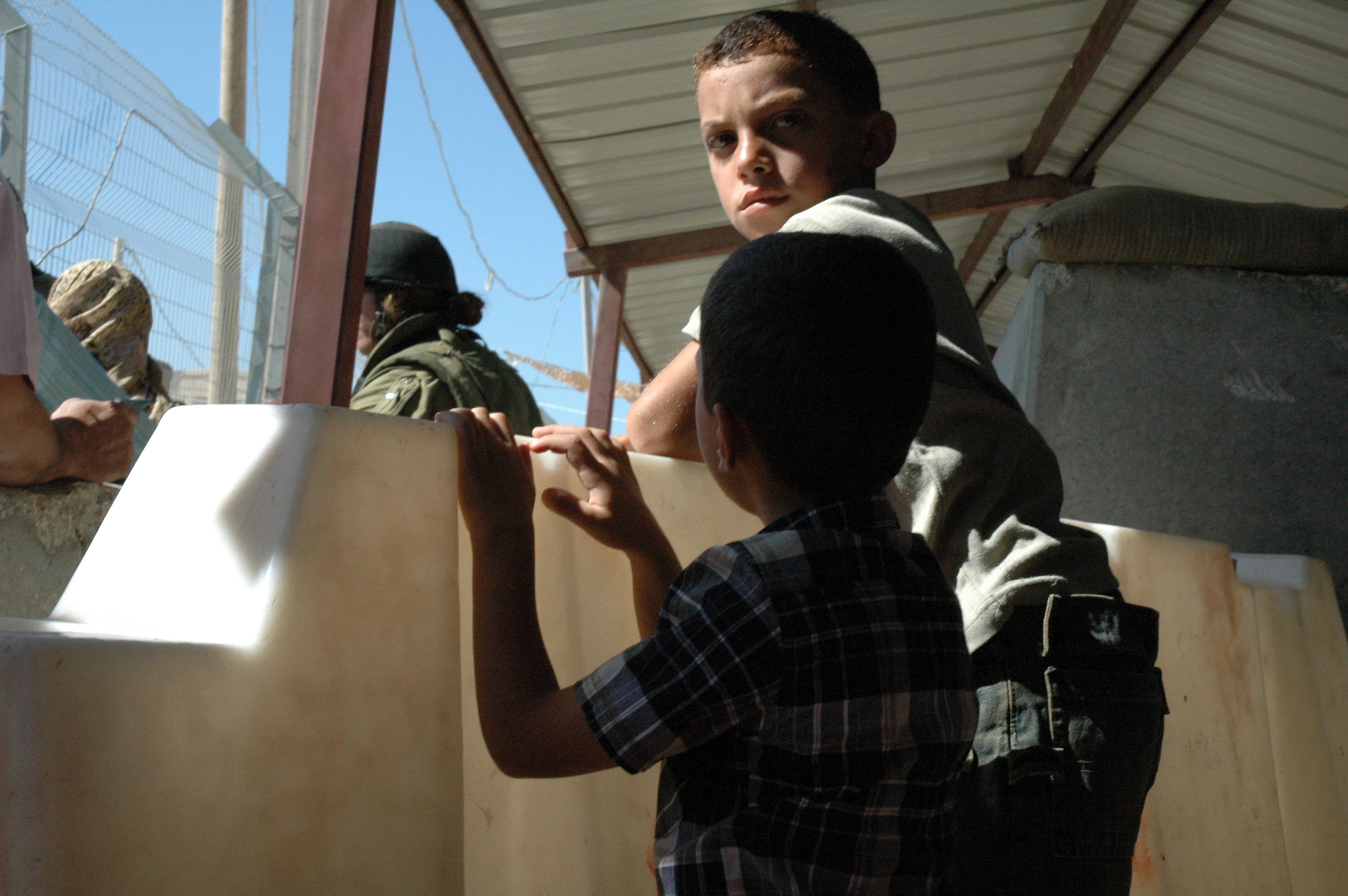
imgsize=250
caption=Children queuing at Kalandia Checkpoint.
arname=قلنديا
meaning=
founded=
type=mund
typefrom=
altOffSp=
altUnoSp=
governorate=jl
latd=31|latm=51|lats=47.21|latNS=N
longd=35 |longm=12|longs=27.30|longEW=E
population=25,595
popyear=2006
area=3,289
areakm=3.3
mayor=Kalandia ( _ar. قلنديا) also Qalandiya, refers to a
Palestinian village and arefugee camp located about halfway along the road fromJerusalem toRamallah . The village had a population of 1,154 inhabitants according to thePalestinian Central Bureau of Statistics , in 2006. [ [http://www.pcbs.gov.ps/Portals/_pcbs/populati/pop08.aspx Projected Mid -Year Population for Jerusalem Governorate by Locality 2004- 2006]Palestinian Central Bureau of Statistics .]Qalandia camp
Qalandia camp was established in
1949 on 353 dunums, and is home to 10,024 refugees, [ [http://www.un.org/unrwa/refugees/westbank/kalandia.html Kalandia Refugee Camp] ]Qalandia Crossing
Qalandia along with Shu’fat Camp, Zaytoun and
Gilo is one of the four majorIsraeli checkpoint crossings where Palestinians with permits can enter East Jerusalem for work, medical care, education or religious reasons. [ [http://www.ochaopt.org/documents/Commercial%20Crossings%20V5.pdf OCHA Commercial Crossings] report of 22 January 2008]References
External links
* [http://www.un.org/unrwa/refugees/westbank/kalandia.html UNRWA Profile: Kalandia Refugee Camp]
* [http://electronicintifada.net/v2/article4168.shtml Photostory: The Kalandia Terminal]
* [http://electronicintifada.net/bytopic/153.shtml EI BY TOPIC: Restrictions on Movement]
* [http://web.israelinsider.com/bin/en.jsp?enZone=Security&enDisplay=view&enPage=ArticlePage&enDispWhat=object&enDispWho=Article^l2860 "Wanted" Palestinians save Jewish family from refugee camp lynch]
Wikimedia Foundation. 2010.