- Nahr al-Bared
-
An-Nahr al-Bared
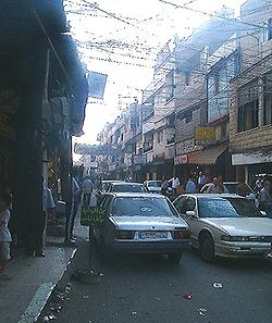
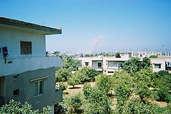
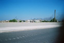
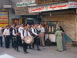
النهر البارد— refugee camp — Nahr al-Bared, summer 2005 Country Lebanon Population – Total approx. 30,000 Nahr al-Bared (Arabic: نهر البارد, literally: Cold River) is a Palestinian refugee camp in northern Lebanon, 16 km from the city of Tripoli. Some 30,000 displaced Palestinians and their descendents live in and around the camp, which was named after the river that runs south of the camp. Under the terms of the 1969 Cairo Agreement, the Lebanese Army does not conventionally enter the Palestinian camps, and internal security is provided by Palestinian factions.
The camp was established in December 1949 by the League of Red Cross Societies in order to accommodate the Palestinian refugees suffering from the difficult winter conditions in the Beqaa Valley and the suburbs of Tripoli. The camp was established outside any major Lebanese towns or settlements, which left Nahr al-Bared more isolated from the Lebanese society than many of the other camps in Lebanon. Despite this, due to its position on the main road to Syria and its proximity to the Syrian border, Nahr al-Bared grew to be a central commercial hub for the local Lebanese of the Akkar region.
Contents
Layout of the camp
Nahr al-Bared is located directly on the Mediterranean. It is made up of the "official" or "old" camp and the "unofficial" or "new" camp. The "old" camp is roughly 0.2km² and is under the responsibility of UNRWA. The "new" camp extends mainly to the north of the old camp, but also to lesser degrees to the east and south. It is less densely populated and many wealthier families have built their homes there in recent years.
The camp is oblong shaped with the main road running straight through it (South to North), and the Souq running east to west. The different sectors of the camp are named after areas of what is now the northern Galilee region : Safourieh, Sasa, Safad, etc. Other sectors are more commonly known by the origins of the families living there: e.g. the "Naseem" area where families originally from Acre, Canada or Morocco who had moved to Palestine in the 1930s now live.
2007 conflict
A bomb exploding in Nahr al-Bared refugee camp during the 2007 conflict with the Al-Qaida inspired militant group, Fatah al-Islam
Late in the night of Saturday May 19, 2007, a building was surrounded by Lebanese Internal Security Forces (ISF) in which a group of Fatah al-Islam militants accused of taking part in a bank robbery earlier that day were hiding. The ISF attacked the building early on Sunday May 20 2007, unleashing a day long battle between the ISF and Fatah al-Islam militants on 200 Street, Tripoli. As a response, members of Fatah al-Islam in Nahr al-Bared Camp (16 km from Tripoli) attacked an army checkpoint, killing several soldiers in their sleep. The army immediately responded by shelling the camp.
The camp became the centre of the fighting between the Lebanese Army and Fatah al-Islam. It sustained heavy shelling while under siege. Most of the inhabitants fled to the nearby Beddawi Palestinian refugee camp (doubling that camps population) or further south to Tripoli, Beirut and Saida. The last civilians (25 women and 38 children, the families of Fatah al-Islam members) were evacuated from the camp on Friday August 24, 2007.
The conflict between the Lebanese Army and Fatah al-Islam ended on Sunday September 2, 2007 with the Lebanese Army taking full control of the camp after eliminating the remaining terrorist pockets [1].
The United Nations Relief and Works Agency, or UNRWA, charged with the care of the Palestinians, struggled to contain the unprecedented humanitarian crisis. In the meantime, most of the displaced refugees waited in improvised shelters in Beddawi camp and elsewhere for a sustainable solution to arrive (http://www.pulitzercenter.org/openitem.cfm?id=814).
Nahr al-Bared was also home to the largest market in northern Lebanon; many Lebanese relied on the tax-free goods and black market prices to keep the cost of living down in a country with current inflation at 5.6%. The demise of Nahr al-Bared was a devastating blow to the local economy (http://www.pulitzercenter.org/openitem.cfm?id=835). The failure of the international community, and Arab states in particular, to fund an emergency humanitarian appeal for Nahr al-Bared means life for refugees living there is set to get harder. [1].
See also
References
- ^ UN IRIN news. "Life set to get harder for Nahr al-Bared refugees". Retrieved 5 November 2008.
External links
- Nahr al-Bared, articles from UNWRA
- Photo slideshow by UN IRIN news of ruined Nahr al-Bared camp
- Nahr Al Bared Pictures
- Nahr Al Bared Camp Official Site
- Nahr Al Bared Camp Blog
- Nahr al-Bared: Refuge in Ruin, a reporting project from the Pulitzer Center on Crisis Reporting
- In Video: Palestinian Refugees return to Nahr al-Bared, Don Duncan and Andrea de Marco, the Christian Science Monitor, March 4 2008
- In Pictures: Palestinians return to ruined Lebanese camp
- Fall of Nahr al-Bared devastates surrounding economy: Marketplace radio segment by Don Duncan, April 11, 2008
- Refugees Return to Camp, Don Duncan, The Washington Times, March 25, 2008
- Lebanese struggle with broken economy, Don Duncan, The San Francisco Chronicle, March 23, 2008
- As Rebuilding Begins at Lebanon's Nahr al-Bared, Displaced Refugees Eager to Return, William Wheeler and Don Duncan, World Politics review, 11 Mar 2008
- Palestinians' bittersweet homecoming in Lebanon, by William Wheeler and Don Duncan, The Christian Science Monitor, March 5, 2008
- "LPDC"
Coordinates: 34°30′47″N 35°57′40″E / 34.51306°N 35.96111°E
Palestinian refugee camps1 locations and populations as of 2005  Gaza Strip
986,034 refugees Jordan
2,127,877 refugees Lebanon
404,170 refugees Syria
Syria
432,048 refugees West Bank
699,817 refugeesAl-Shati (Beach) 76,109 Bureij 30,059 Deir al-Balah 20,188 Jabalya 175,646 Khan Yunis 60,662 Maghazi 22,536 Nuseirat 64,233 Rafah 90,638 Canada Camp disbanded Beddawi 15,695 Burj el-Barajneh 19,526 Burj el-Shemali 18,134 Dbayeh 4,223 Dikwaneh destroyed Ein el-Hilweh 44,133 El-Buss 9,840 Jisr el-Basha destroyed Mar Elias 1,406 Mieh Mieh 5,078 Nabatieh destroyed Nahr el-Bared 28,358 Rashidieh 24,679 Sabra Shatila 11,998 Tel al-Zaatar destroyed Wavel 7,357 Abu Dis Aida 3,260 Am'ari 8,083 Aqabat Jabr 5,197 al-'Arrub 9,180 Askar 31,894 'Azza 1,828 Balata 41,681 Deir Ammar 2,189 Dheisheh 10,923 Ein Beit al-Ma' 6,221 Ein as-Sultan 1,888 Far'a 12,836 Fawwar 7,072 Jalazone 9,284 Jenin 35,050 Kalandia 9,188 Nur Shams 8,179 Shuafat (Shu'fat) 9,567 Tulkarm 17,259 1 The UNRWA definition of a "Palestinian refugee" is a person "whose normal place of residence was Palestine between June 1946 and May 1948, who lost both their homes and means of livelihood as a result of the 1948 Arab-Israeli conflict ... UNRWA's definition of a refugee also covers the descendants of persons who became refugees in 1948." [2]Categories:- Palestinian refugee camps in Lebanon
- Populated places established in 1949
Wikimedia Foundation. 2010.


