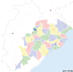
- Dagara, Baleswar
-
Dagara — village — Coordinates 21°33′59″N 87°19′24″E / 21.566389°N 87.3233°ECoordinates: 21°33′59″N 87°19′24″E / 21.566389°N 87.3233°E Country India State Orissa District(s) Baleswar Time zone IST (UTC+05:30) Area
• 23 metres (75 ft)
Codes-
• Pincode • 756083
Dagara (Oriya: ଡଗରା) is a coastal village in Baliapal block of Baleswar district of the Indian state of Orissa.[1][2]
'Dagara and Chaumukha are the two coastal villages in Baliapal Block broadly used to mention about the closer seaside and beach. The beach also special with the presence of other beaches like Chandipur and Talasari of Baleswar district with red crabs, silvery sand, casuariana forest. Fishing by small Boats with the local fisher flock is very interesting.
Transport
The nearest bus stop to reach Dagara is Jagai (9km). Dagara is 64 km from Baleswar. The nearest rail head is Jaleswar (58 km). Another railway station Basta is 65 km from here. Nearest airport is Bhubaneswar.
Reference
Baleswar Related topics Kirtania portCities and towns
in other districtsAngul · Balangir · Bargarh · Bhadrak · Boudh · Cuttack · Debagarh · Dhenkanal · Gajapati · Ganjam · Jagatsinghpur · Jajpur · Jharsuguda · Kalahandi · Kandhamal · Kendrapara · Kendujhar · Khordha · Koraput · Malkangiri · Mayurbhanj · Nabarangpur · Nayagarh · Nuapada · Puri · Rayagada · Sambalpur · Subarnapur · Sundergarh
Hydrology of Orissa Rivers Bhargavi • Baitarani • Brahmani • Budhabalanga • Daya • Devi • Kadua • Kharkai • Koina • Kushabhadra • Mahanadi • Malguni • Nagavali • Ong • Rushikulya • Sankh • South Karo • South Koel • Subarnarekha • Surubalijora • Tel • Telen • VamsadharaLakes Anshupa • ChilkaWaterfalls Hot springs Beaches Dams Bridges Second Mahanadi Rail BridgeHarbours/Ports/Proposed Ports Hydrology of surrounding areas Andhra Pradesh • Chhattisgarh • Jharkhand • BengalCategories:- Cities and towns in Balasore district
-
Wikimedia Foundation. 2010.


