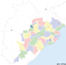
- Nayagarh district
-
This article is about the district. For its eponymous headquarters, see Nayagarh.
Nayagarh — district — Coordinates 20°06′58″N 85°00′36″E / 20.116°N 85.01°ECoordinates: 20°06′58″N 85°00′36″E / 20.116°N 85.01°E Country India State Orissa Headquarters Nayagarh Collector Dr.Mrinalini Darswal Member of Parliament Shri Rudra Madhab Ray Parliamentary constituency Kandhamal Population
• Density
535,385 (2001[update])
• 138 /km2 (357 /sq mi)
Sex ratio 0.994 ♂/♀ Official languages Oriya, Hindi, English Time zone IST (UTC+05:30) Area 3,890 square kilometres (1,500 sq mi) Climate
Aw (Köppen)
• 1,449.1 mm (57.05 in)
Codes-
• Pincode • 752 xxx • Vehicle • OR-25
Website nayagarh.nic.in/ Nayagarh district is one of the 30 districts of Orissa State in eastern India. It was created in 1995 when the erstwhile Puri District was split into three distinct districts. It is home to the Baisipali Wildlife Sanctuary.
Contents
History
Maoist attacks
The district is currently a part of the Red Corridor.[1] On 15 February 2008 A number of police facilities across the district came under attack from maoist rebels resulting in the death of 13 police officers and 1 civilian. During the raid the rebels stole a number of weapons.[2] Targets of the attack were the police training school the police armoury and a police station. The fighting lasted about one and a half hours.[3]
Geography
The District is located towards the west or Puri District surrounded by Cuttack District in the North, Phulbani District in the West, Ganjam District in the South and Khurda District in the East. The district covers an area of 3890 km².
This district is situated in the hilly ranges in the West and its North Eastern parts has formed a small well cultivated fertile valleys intersected by small streams. The river Mahanadi flows in the Eastern boundary. The climate of the District carries a high temperature in hot months and cooler in winter. The headquarters of the district is located in the town of Nayagarh.
Divisions
Blocks
1. Nayagarh 2. Odagaon 3. Nuagaon 4. Daspalla 5. Gania 6. Khandapada 7. Bhapur 8. Ranapur
Demographics
According to the 2011 census Nayagarh district has a population of 962,215,[4] roughly equal to the nation of Fiji[5] or the US state of Montana.[6] This gives it a ranking of 453rd in India (out of a total of 640).[4] The district has a population density of 247 inhabitants per square kilometre (640 /sq mi) .[4] Its population growth rate over the decade 2001-2011 was 11.3 %.[4] Nayagarh has a sex ratio of 916 females for every 1000 males,[4] and a literacy rate of 79.17 %.[4]
References
- ^ "83 districts under the Security Related Expenditure Scheme". IntelliBriefs. 2009-12-11. http://intellibriefs.blogspot.com/2009/12/naxal-menace-83-districts-under.html. Retrieved 2011-09-17.
- ^ "Indian Maoists kill 14 in Orissa". BBC. 2008-02-16. http://news.bbc.co.uk/1/hi/world/south_asia/7248177.stm. Retrieved 2008-02-16.
- ^ "13 police personnel killed in Naxal attack in Orissa". headlines india. http://www.headlinesindia.com/state/index.jsp?news_code=70622. Retrieved 2008-02-16.[dead link]
- ^ a b c d e f "District Census 2011". Census2011.co.in. 2011. http://www.census2011.co.in/district.php. Retrieved 2011-09-30.
- ^ US Directorate of Intelligence. "Country Comparison:Population". https://www.cia.gov/library/publications/the-world-factbook/rankorder/2119rank.html. Retrieved 2011-10-01. "Fiji 883,125 July 2011 est."
- ^ "2010 Resident Population Data". U. S. Census Bureau. http://2010.census.gov/2010census/data/apportionment-pop-text.php. Retrieved 2011-09-30. "Montana 989,415"
External links

Baudh district Anugul district Cuttack district 
Kandhamal district 
 Nayagarh district

Ganjam district Khordha district State of Orissa · 
Capital 
Topics Districts Angul · Balasore · Bargarh · Bhadrak · Balangir · Boudh · Cuttack · Debagarh · Dhenkanal · Gajapati · Ganjam · Jagatsinghpur · Jajpur · Jharsuguda · Kalahandi · Kandhamal · Kendrapara · Kendujhar · Khordha · Koraput · Malkangiri · Mayurbhanj · Nabarangpur · Nayagarh · Nuapada · Puri · Rayagada · Sambalpur · Subarnapur · Sundargarh
Cities Orissa Portal Cities and towns in Nayagarh district Nayagarh Chandapur · Kantilo · Khandapada · Nayagarh · Odagaon
Cities and towns
in other districtsAngul · Balangir · Balasore · Bargarh · Bhadrak · Boudh · Cuttack · Debagarh · Dhenkanal · Gajapati · Ganjam · Jagatsinghpur · Jajpur · Jharsuguda · Kalahandi · Kandhamal · Kendrapara · Kendujhar · Khordha · Koraput · Malkangiri · Mayurbhanj · Nabarangpur · Nuapada · Puri · Rayagada · Sambalpur · Subarnapur · Sundergarh
Districts of Orissa Angul · Balangir · Balasore · Bargarh · Bhadrak · Boudh · Cuttack · Debagarh · Dhenkanal · Gajapati · Ganjam · Jagatsinghpur · Jajpur · Jharsuguda · Kalahandi · Kandhamal · Kendrapara · Kendujhar · Khordha · Koraput · Malkangiri · Mayurbhanj · Nabarangpur · Nayagarh · Nuapada · Puri · Rayagada · Sambalpur · Subarnapur · SundergarhCategories:- Nayagarh district
- Orissa geography stubs
-
Wikimedia Foundation. 2010.


