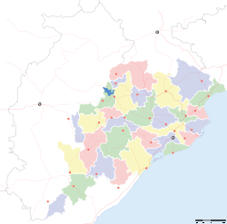
- Malkangiri district
-
This article is about the district. For its eponymous headquarters, see Malkangiri.
Malkangiri — district — Coordinates 18°15′N 82°08′E / 18.25°N 82.13°ECoordinates: 18°15′N 82°08′E / 18.25°N 82.13°E Country India State Orissa Headquarters Malkangiri Collector R. Vineel Krishna, I.A.S Member of Parliament Pradeep Kumar Majhi, INC Parliamentary constituency Nabarangpur Assembly constituency 2, Malkangiri, Chitrakonda Population
• Density
480,232 (2001[update])
• 83 /km2 (215 /sq mi)
Sex ratio 1.004 ♂/♀ Literacy
• Male
• Female31.26%
• 41.21%
• 21.28%Official languages Oriya, Hindi, English Time zone IST (UTC+05:30) Area
5,791 square kilometres (2,236 sq mi)
• 195 metres (640 ft)
Climate
• Precipitation
Temperature
• Summer
• WinterAw (Köppen)
• 1,700 mm (67 in)
• 47 °C (117 °F)
• 13 °C (55 °F)Codes-
• Pincode • 764 xxx • Vehicle • OR-10
Website malkangiri.nic.in Malkangiri district is a district of the state of Orissa, India.
Contents
History
This district was carved out as district from the undivided Koraput district on 2nd Oct, 1992. The administrative headquarters of this district is Malkangiri town.
Malkangiri is the new home of the Bangladeshi refugees, who were rehabilitated since 1965 under the Dandakaranya project. Also some Sri Lankan Tamil refugees were rehabilitated in Malkangiri town, following the armed struggle of LTTE in the early 90's (most of them have returned, baring a couple of house holds). Currently it is one of the most naxalite-affected areas of the state.
Geography
Some of the most beautiful locations are, the back waters of Balimela Dam, Satiguda Dam, Bonda Ghati (abode of the Bonda people, a primitive tribe).
Economy
This district has a Power Station at Balimela and the proposed Vijaywada-Ranchi corridor road will pass through it.
In 2006 the Ministry of Panchayati Raj named Malkangiri one of the country's 250 most backward districts (out of a total of 640).[1] It is one of the 19 districts in Orissa currently receiving funds from the Backward Regions Grant Fund Programme (BRGF).[1]
Demographics
According to the 2011 census Malkangiri district has a population of 612,727,[2] roughly equal to the nation of Solomon Islands[3] or the US state of Vermont.[4] This gives it a ranking of 523rd in India (out of a total of 640).[2] The district has a population density of 106 inhabitants per square kilometre (270 /sq mi) .[2] Its population growth rate over the decade 2001-2011 was 21.53 %.[2] Malkangiri has a sex ratio of 1016 females for every 1000 males,[2] and a literacy rate of 49.49 %.[2]
References
- ^ a b Ministry of Panchayati Raj (September 8, 2009). "A Note on the Backward Regions Grant Fund Programme". National Institute of Rural Development. http://www.nird.org.in/brgf/doc/brgf_BackgroundNote.pdf. Retrieved September 27, 2011.
- ^ a b c d e f "District Census 2011". Census2011.co.in. 2011. http://www.census2011.co.in/district.php. Retrieved 2011-09-30.
- ^ US Directorate of Intelligence. "Country Comparison:Population". https://www.cia.gov/library/publications/the-world-factbook/rankorder/2119rank.html. Retrieved 2011-10-01. "Solomon Islands 571,890 July 2011 est."
- ^ "2010 Resident Population Data". U. S. Census Bureau. http://2010.census.gov/2010census/data/apportionment-pop-text.php. Retrieved 2011-09-30. "Vermont 625,741"
External links

Dantewada district, Chhattisgarh Koraput district 

 Malkangiri district

Khammam district, Andhra Pradesh East Godavari district, Andhra Pradesh Visakhapatnam district, Andhra Pradesh State of Orissa · 
Capital 
Topics Districts Angul · Balasore · Bargarh · Bhadrak · Balangir · Boudh · Cuttack · Debagarh · Dhenkanal · Gajapati · Ganjam · Jagatsinghpur · Jajpur · Jharsuguda · Kalahandi · Kandhamal · Kendrapara · Kendujhar · Khordha · Koraput · Malkangiri · Mayurbhanj · Nabarangpur · Nayagarh · Nuapada · Puri · Rayagada · Sambalpur · Subarnapur · Sundargarh
Cities Cities and towns in Malkangiri district Malkangiri Cities and towns
in other districtsAngul · Balangir · Balasore · Bargarh · Bhadrak · Boudh · Cuttack · Debagarh · Dhenkanal · Gajapati · Ganjam · Jagatsinghpur · Jajpur · Jharsuguda · Kalahandi · Kandhamal · Kendrapara · Kendujhar · Khordha · Koraput · Mayurbhanj · Nabarangpur · Nayagarh · Nuapada · Puri · Rayagada · Sambalpur · Subarnapur · Sundergarh
Districts of Orissa Angul · Balangir · Balasore · Bargarh · Bhadrak · Boudh · Cuttack · Debagarh · Dhenkanal · Gajapati · Ganjam · Jagatsinghpur · Jajpur · Jharsuguda · Kalahandi · Kandhamal · Kendrapara · Kendujhar · Khordha · Koraput · Malkangiri · Mayurbhanj · Nabarangpur · Nayagarh · Nuapada · Puri · Rayagada · Sambalpur · Subarnapur · SundergarhCategories:- Malkangiri district
- Orissa
- Orissa geography stubs
-
Wikimedia Foundation. 2010.


