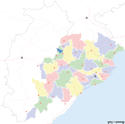
- Malkangiri
-
This article is about the municipality in Orissa, India. For its namesake district, see Malkangiri district.
Malkangiri — city — Coordinates 18°21′N 81°54′E / 18.35°N 81.90°ECoordinates: 18°21′N 81°54′E / 18.35°N 81.90°E Country India State Orissa District(s) Malkangiri Population 23,110 (2001[update]) Time zone IST (UTC+05:30) Area
• 178 metres (584 ft)
Codes-
• Pincode • 764 • Vehicle • OR-10
Malkangiri (Oriya: ମାଲକାନଗିରି) is a town and a notified area committee in Malkangiri district in the Indian state of Orissa. It is the headquarters of the Malkangiri district. Malkangiri is the new home of the Bangladeshi refugees, who were rehabilitated since 1965 under the Dandakaranya project. Also some Sri Lankan Tamil refugees were rehabilitated in Malkangiri town, following the armed struggle of LTTE in the early 90's (most of them have returned, baring a couple of house holds). Currently it is one of the most naxalite-affected areas of the state and is a part of the Red Corridor.[1]
Contents
Geography
Malkangiri is located at 18°21′N 81°54′E / 18.35°N 81.90°E.[2] It has an average elevation of 170 m (560 ft).
Demographics
As of 2001[update] India census,[3] Malkangiri had a population of 23,110. Males constitute 52% of the population and females 48%. Malkangiri has an average literacy rate of 57%, lower than the national average of 59.5%: male literacy is 65%, and female literacy is 48%. In Malkangiri, 15% of the population is under 6 years of age.
Politics
Current MLA from Malkangiri Assembly (SC) Constituency is Nimal Chandra Sarkar of INC, who won the seat in 2004. Previous MLAs from this seat were Arabinda Dhali of BJP in 2000 and in 1995, Naka Kanaya who won it for JD in 1990 and for JNP in 1977, Nadiabasi Biswas of INC in 1985, Naka Laxmaya of INC(I) in 1980.[4]
Malkangiri is part of Nowrangpur (Lok Sabha constituency).[5]
References
- ^ "83 districts under the Security Related Expenditure Scheme". IntelliBriefs. 2009-12-11. http://intellibriefs.blogspot.com/2009/12/naxal-menace-83-districts-under.html. Retrieved 2011-09-17.
- ^ Falling Rain Genomics, Inc - Malkangiri
- ^ "Census of India 2001: Data from the 2001 Census, including cities, villages and towns (Provisional)". Census Commission of India. Archived from the original on 2004-06-16. http://web.archive.org/web/20040616075334/http://www.censusindia.net/results/town.php?stad=A&state5=999. Retrieved 2008-11-01.
- ^ "State Elections 2004 - Partywise Comparison for 86-Malkangiri Constituency of ORISSA". Election Commission of India. http://archive.eci.gov.in/March2004/pollupd/ac/states/s18/Partycomp86.htm. Retrieved 2008-09-15.
- ^ "Assembly Constituencies - Corresponding Districts and Parliamentary Constituencies of Orissa". Election Commission of India. http://archive.eci.gov.in/se2000/background/S18/Orissa_AC_Dist_PC.pdf. Retrieved 2008-09-15.
External links
Cities and towns in Malkangiri district Malkangiri Cities and towns
in other districtsAngul · Balangir · Balasore · Bargarh · Bhadrak · Boudh · Cuttack · Debagarh · Dhenkanal · Gajapati · Ganjam · Jagatsinghpur · Jajpur · Jharsuguda · Kalahandi · Kandhamal · Kendrapara · Kendujhar · Khordha · Koraput · Mayurbhanj · Nabarangpur · Nayagarh · Nuapada · Puri · Rayagada · Sambalpur · Subarnapur · Sundergarh
Categories:- Cities and towns in Malkangiri district
- Malkangiri district
-
Wikimedia Foundation. 2010.


