- Chippewa Valley Regional Airport
-
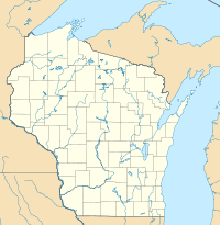
Chippewa Valley Regional Airport IATA: EAU – ICAO: KEAU – FAA LID: EAU Location of the Airport in Wisconsin Summary Airport type Public Owner Eau Claire County Serves Eau Claire, Wisconsin Location Chippewa County Elevation AMSL 913 ft / 278 m Coordinates 44°51′57″N 091°29′03″W / 44.86583°N 91.48417°W Website Runways Direction Length Surface ft m 4/22 8,101 2,469 Concrete 14/32 5,000 1,524 Asphalt/Concrete Statistics (2009) Aircraft operations 30,662 Based aircraft 78 Source: Federal Aviation Administration[1] Chippewa Valley Regional Airport (IATA: EAU, ICAO: KEAU, FAA LID: EAU) is a public-use airport located in Chippewa County, Wisconsin, United States. It is three nautical miles (6 km) north of the central business district of Eau Claire and is owned by Eau Claire County.[1]
It is the largest airport in the 30-county northern Wisconsin area, and serves primarily the Chippewa Valley region, operating on a budget approved by a commission equally representing the interests of Chippewa, Eau Claire and Dunn counties.
The airport is occasionally used as an alternative landing site for flights bound for Minneapolis-Saint Paul International Airport. As of April 2010, only one commercial airline, United Airlines, provides service for CVRA to Chicago O'Hare International.
A new $3.9M 65' control tower was built in 2005. In November 2006, the tower opened, thus making it safer for pilots. Passenger loading is from the tarmac.[2]
Contents
History
In 1923, 80 acres (320,000 m2) of land in Putnam Heights were purchased to build an airport. In 1929, Eau Claire Airways was started at the airport, offering training and scheduled taxi service to destinations in Wisconsin and Minnesota.
In 1939, work on a new airport started north of Eau Claire. In 1940, Eau Claire County Airport started operations at its current site. Eau Claire Municipal Airport opened in 1945, while Chippewa Valley Regional Airport was officially opened in 1947 with the arrival of a Northwest Airlines DC-3. At this time, Eau Claire had three airports. Upgrades at Chippewa Valley Regional Airport were made in further decades, with a terminal addition in 1981. Another Terminal Remodeling/ expansion was completed in 2009 thus making travel flow faster.[3]
Facilities and aircraft
Chippewa Valley Regional Airport covers an area of 1,100 acres (450 ha) at an elevation of 913 feet (278 m) above mean sea level. It has two runways: 4/22 is 8,101 by 150 feet (2,469 x 46 m) with a concrete surface; 14/32 is 5,000 by 100 feet (1,524 x 30 m) with an asphalt/concrete surface.[1]
For the 12-month period ending November 18, 2010, the airport had 30,622 aircraft operations, an average of 84 per day: 78% general aviation, 17% air taxi, 17% scheduled commercial and 4% military. At that time there were 78 aircraft based at this airport: 60 single-engine, 10 multi-engine, 7 jet and 1 helicopter.[1]
Airlines and destinations
The airport is mainly used for general aviation and business travel. Eau Claire owned Menards corporation uses CVRA to base their fleet of aircraft to serve their stores throughout the midwest.
Throughout the years, numerous airlines have served Eau Claire including North Central Airlines, Republic Airlines, Lakeland Airlines, Northwest Airlines, Mesaba Airlines, Skyway Airlines, Air Wisconsin, American Central Airlines, Great Lakes Aviation, Lakeland Airlines, Big Sky Airlines and Charter Airlines Allegiant Airlines and Sun Country often run charter service to popular casino destinations.
Airlines Destinations United Express operated by SkyWest Airlines Chicago-O'Hare Top Destinations
Busiest domestic routes out of EAU
(July 2010 - June 2011) [4]Rank City Passengers Carriers 1  Chicago O’Hare, IL
18,000 United 2  Laughlin, NV
1,000 - References
- ^ a b c d FAA Airport Master Record for EAU (Form 5010 PDF), effective 2009-08-27.
- ^ "Tower Struggle". Leader-Telegram story, Mar. 5, 2006, p. 1A.
- ^ http://www.cvrairport.com/history.htm
- ^ http://www.transtats.bts.gov/airports.asp?pn=1&Airport=EAU&Airport_Name=Eau%20Claire,%20WI:%20Chippewa%20Valley%20Regional&carrier=FACTS
External links
- Chippewa Valley Regional Airport, official website
- Airport page at Chippewa County website
- Chippewa Valley Regional AirportPDF page from the Wisconsin DOT Airport Directory
- FSS Eau Claire Airport history page
- Private Jet registration at the CVRA
- FAA Airport Diagram (PDF), effective 20 October 2011
- FAA Terminal Procedures for EAU, effective 20 October 2011
- Resources for this airport:
- AirNav airport information for KEAU
- ASN accident history for EAU
- FlightAware airport information and live flight tracker
- NOAA/NWS latest weather observations
- SkyVector aeronautical chart, Terminal Procedures for KEAU
Aviation in Wisconsin Primary Airports 
Airlines Aviation related List of airports in Wisconsin Lists of airports By IATA code A · B · C · D · E · F · G · H · I · J · K · L · M · N · O · P · Q · R · S · T · U · V · W · X · Y · Z
By ICAO code A · B · C · D · E · F · G · H · I · J · K · L · M · N · O · P · Q · R · S · T · U · V · W · X · Y · Z
By traffic Other lists Lists relating to aviation General Aircraft (manufacturers) · Aircraft engines (manufacturers) · Airlines (defunct) · Airports · Civil authorities · Museums · Registration prefixes · Rotorcraft (manufacturers) · TimelineMilitary Accidents/incidents Records Categories:- Airports in Wisconsin
- Eau Claire, Wisconsin
- Buildings and structures in Chippewa County, Wisconsin
Wikimedia Foundation. 2010.

