- Microsoft Streets & Trips
-
Microsoft Streets & Trips 
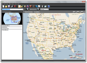
Microsoft Streets & Trips 2011 startup screenDeveloper(s) Microsoft Stable release Microsoft Streets & Trips 2011
18.00.23.0300 / February 10, 2011[1]Operating system Microsoft Windows Type Route planning software License Proprietary Website http://microsoft.com/streets/ Microsoft Streets & Trips, known in Europe as Microsoft AutoRoute, is mapping software developed and distributed by Microsoft. Functionally the latest version is a subset of Microsoft MapPoint targeted at the average consumer to do a variety of map related tasks in the North American region including the United States, Canada, and Mexico, such as route planning.
The European version is marketed as Microsoft AutoRoute and covers all of Europe, including European Russia, as well as Armenia, Azerbaijan, Georgia, Cyprus and all of Turkey. AutoRoute is also produced in several European languages besides English.
A version of the product is currently sold with a GPS (Global Positioning System) receiver to allow users use the product as a satellite navigation system. Since version 2008[2], Microsoft has started requiring Product Activation for Streets & Trips. [3]
Streets & Trips 2006 and later versions install the new text-to-speech voice, "Microsoft Anna", which is part of Windows Vista, onto Windows XP computers for the voice-prompt direction feature. Version 2006 of both Streets & Trips as well as AutoRoute is the last version for Windows 98/Me and version 2007 is the last version for Windows 2000.
Streets & Trips 2009[4] adds pronunciation of street names, as part of the voice directions prompts. The map of Mexico now includes street level data of even small towns, but the address-find feature still has not been enabled for there.
Version 2008 (and older) included 336 pushpin symbols. The new version 2009 replaced these symbols with a new set of 46 pushpins. The Streets and Trips user community thus created a default map template[5] wihich has the 2008 pin set in order to re-add them to the program. The former pushpins were restored in the 2010 version with updated visual styling.
Version 2010 [6] adds hide/show pushpinsets, hide/show information balloons, import/export GPX files, export to GPS navigation device, export to mobile phone, and 348 new pushpin symbols were added, the majority restored former pins as mentioned above.
Version 2011 [7] is mainly a database update adding 88,000 miles of new mapping to the program and the removal of support for the ending MSN Direct service and coupon data, while allowing direct map correction feedback to maps provider Navteq and the addition of cardinal direction guidance and alternate road names to direction data. This version came out in February rather than the traditional August/September release date due to unknown factors.
Contents
History
Originally created in the late 1980s by NextBase Ltd[8], a UK company, under the name "Autoroute", it was sold for DOS based PCs and later for the Apple Macintosh, Atari ST and Psion PDA. In the early 1990s it was ported to the Microsoft Windows operating system. The company created a version for the United States called Automap Road Atlas which it sold through its American subsidiary Automap Inc. in Bellevue, WA. In 1994 the product was sold to Microsoft. Microsoft combined the Encarta World Atlas Mapping Technology with new routing technology derived from Autoroute to create Automap Streets/Streets Plus and Automap Road Atlas/Automap Trip Planner products. These were produced under the Microsoft Home division and were later branded for a few releases as Expedia Streets and Expedia Trip Planner. After Microsoft spun off Expedia, they were merged into a single product called Microsoft Streets & Trips 2000, newer versions of which continue to be produced today in the USA. In Europe the Autoroute brand was retained. In 2000, Microsoft also developed Microsoft MapPoint as a business mapping program based on this technology. The technology was also used in MSN Maps which later became Bing Maps.
References
- ^ http://www.microsoft.com/downloads/en/details.aspx?FamilyID=7bd139dd-57de-448e-96b1-fc612607a717&displaylang=en
- ^ Microsoft Streets & Trips 2008: Review
- ^ Product activation FAQ and troubleshooting: MS KB927007
- ^ Streets & Trips 2009 review
- ^ Template adds old-style pushpins to Streets & Trips 2009 / MapPoint 2009
- ^ Version 2010 Review
- ^ http://www.laptopgpsworld.com/2380-review-microsoft-streets-trips
- ^ NextBase and Automap Products
External links
- Microsoft Streets & Trips review
- Microsoft Streets & Trips website
- Streets & Trips unofficial forum
- Streets & Trips blog by Microsoft employees
- Tips & Tricks for Streets & Trips
- Unofficial wish list for Streets & Trips
- Business uses for Microsoft Streets and Trips
- POI Mega File
AutoRoute
Categories:- Microsoft software
- Route planning software

Wikimedia Foundation. 2010.