- Nassawango Iron Furnace Site
-
Nassawango Iron Furnace Site
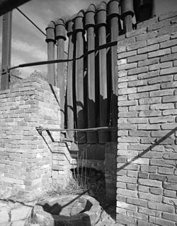

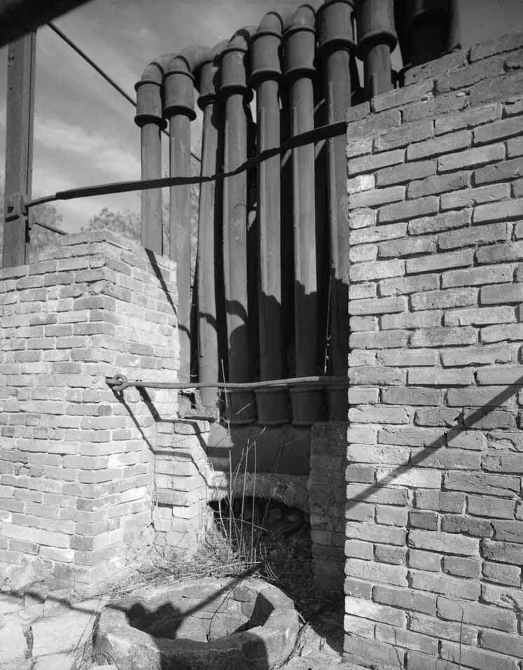
Nearest city: Snow Hill, Maryland Coordinates: 38°12′15″N 75°28′8″W / 38.20417°N 75.46889°WCoordinates: 38°12′15″N 75°28′8″W / 38.20417°N 75.46889°W Built: 1830 Architect: Unknown Governing body: Private NRHP Reference#: 75000935 Added to NRHP: October 31, 1975[1] The Nassawango Iron Furnace was built in 1830 by the Maryland Iron Company to produce iron from bog ore deposits in its vicinity. It is notable for its innovative use of a "hot blast" technique for smelting the iron, which had only been developed in England around 1828, and which may have been added to the Nassawango Furnace in 1837. Due to the variable nature of the bog ore deposits, the furnace stopped operations in 1849 [2].
The furnace is now centerpiece of the Furnace Town Living Heritage Museum.
References
- ^ "National Register Information System". National Register of Historic Places. National Park Service. 2008-04-15. http://nrhp.focus.nps.gov/natreg/docs/All_Data.html. Maryland Historical Trust
- ^ "Maryland Historical Trust". National Register of Historic Places: Properties in Worcester County. Maryland Historical Trust. 2008-06-07. http://www.mht.maryland.gov/nr/NRDetail.aspx?HDID=343&COUNTY=Worcester&FROM=NRCountyList.aspx?COUNTY=Worcester.
External links
- Nassawango Iron Furnace Site, Worcester County, including undated, at Maryland Historical Trust
- Nassawango Iron Furnace, Furnace Road, 1.2 miles west of Maryland Route 12, Snow Hill vicinity, Worcester County, MD: 12 drawings, 4 photos, 1 data page, 1 photo caption page, at Historic American Building Survey
U.S. National Register of Historic Places Topics Lists by states Alabama • Alaska • Arizona • Arkansas • California • Colorado • Connecticut • Delaware • Florida • Georgia • Hawaii • Idaho • Illinois • Indiana • Iowa • Kansas • Kentucky • Louisiana • Maine • Maryland • Massachusetts • Michigan • Minnesota • Mississippi • Missouri • Montana • Nebraska • Nevada • New Hampshire • New Jersey • New Mexico • New York • North Carolina • North Dakota • Ohio • Oklahoma • Oregon • Pennsylvania • Rhode Island • South Carolina • South Dakota • Tennessee • Texas • Utah • Vermont • Virginia • Washington • West Virginia • Wisconsin • WyomingLists by territories Lists by associated states Other  Category:National Register of Historic Places •
  Portal:National Register of Historic PlacesCategories:
- National Register of Historic Places in Maryland
- Buildings and structures in Worcester County, Maryland
- Maryland Registered Historic Place stubs

Wikimedia Foundation. 2010.