- Black Pig's Dyke
-
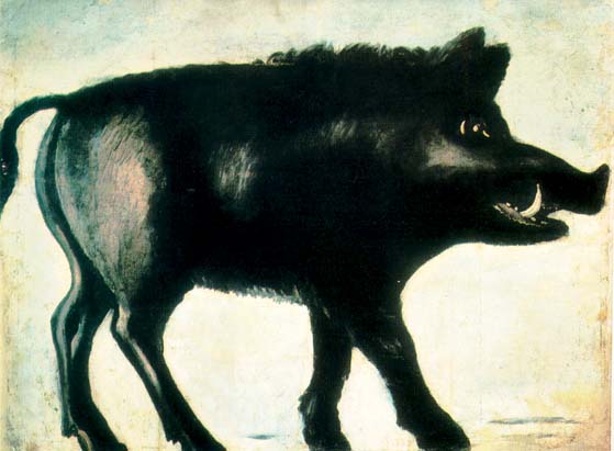
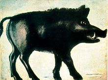 According to Irish folklore, the earthworks were created by the tusks of a huge black boar
The Black Pig's Dyke (Irish: Claí na Muice Duibhe)[1] or Worm's Ditch (Irish: Claí na Péiste)[1] is a series of discontinuous linear earthworks in southwest Ulster and northeast Connacht, Ireland. Remnants can be found in north County Leitrim, north County Longford, County Cavan and County Monaghan (see the map below). Sometimes, the Dorsy enclosure in County Armagh and the Dane's Cast in County Down are considered to be part of the dyke.
Similar earthworks can be found throughout Ireland,[2] although the Black Pig's Dyke is the most well-known. A notable example is the Claidh Dubh ("black ditch"), anglicized Clyduff or Cleeduff, in eastern County Cork. It has three sections, the longest of which runs north-south for 24 kilometres (15 mi) from the Ballyhoura Hills to the Nagle Mountains.[3][4][5]
Name
In counties Leitrim and Cavan the earthworks are generally called the Black Pig's Dyke or Dike. In County Longford it is called the Black Pig's Race, while in the Cavan–Monaghan border area it is called Black Pig's Dyke or Worm Ditch. The ditches take their names from Gaelic folklore. One tale says that a huge black boar tore-up the countryside with its large tusks. Another says that the ditches were made by a huge worm.
Construction and purpose
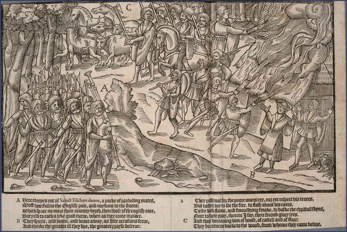
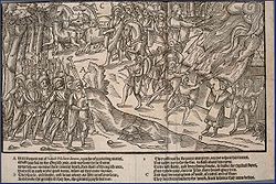 A depiction of a cattle raid in 16th century Gaelic Ireland - it is believed that the earthworks were built to prevent such raids
The earthworks usually consist of a bank with a ditch on either side. The bank is usually about 9 metres (30 ft) wide and the ditches are usually about 6 metres (20 ft) deep.[6] Excavation of a stretch in County Monaghan revealed that the original construction was of a substantial timber palisade with external ditch. Behind the palisade was a double bank with intervening ditch. The timber structure was radiocarbon dated to 390-370 BCE, so all of the earthworks may date to that period.[7] It has been suggested that they may have been modeled on the Ancient Roman limes.[8]
Some have put forward the idea that the earthworks marked the ancient border of Ulster.[8] However, there is no evidence that they "collectively constitute one border for one people" – the earthworks may not be contemporary and there are large gaps between them.[9] Others suggest that their sole purpose was to prevent cattle raiding, which was very common in ancient Ireland.[8] Two theories have been put forward to explain why there are large gaps between the earthworks. One is that they were simply built across trackways that were often used by cattle raiders, another is that the gaps between them were once heavily wooded and thus no manmade defense was needed.[2]
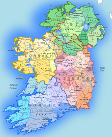 The modern counties and provinces of Ireland
Locations
The remains of the earthworks can be found in the following places:
- North County Leitrim: running northwest-southeast, from Lough Melvin to Lough MacNean, near the villages of Rossinver and Kiltyclogher.[6]
- Northeast County Longford: running northwest-southeast for 10 kilometres (6.2 mi), from Lough Gowna to Lough Kinale (crossing the N55), near the villages of Dring and Granard.[6]
- County Cavan–County Monaghan border: running roughly west-east from the Finn River (near the village of Redhills) to the townland of Corrinshigo (near the village of Drum).
- County Cavan: forming a wide semi-circle in the townland of Ardkill More, 3½ miles east of Bellananagh. This is one of the best surviving examples.[10] Cavan Heritage Group have called for the cessation of operations on a nearby quarry which they maintain is damaging part of the dyke at Ardkill More.[11]
References
- ^ a b Pig's Dyke&lang=1 Focal.ie
- ^ a b The Early Development of Irish Society. Cambridge University Press, 1969. pp.88-89
- ^ Eachtra Journal: Issue 10. p.11
- ^ http://www.excavations.ie/Pages/Details.php?County=Cork&Year=&id=2774
- ^ http://www.excavations.ie/Pages/Details.php?Year=&County=Cork&id=6087
- ^ a b c Antiquities of the Irish Countryside
- ^ J. T. Koch, An Atlas for Celtic Studies (2007), p. 110 and map 14.1;J. Waddell, The Prehistoric Archaeology of Ireland (1998).
- ^ a b c Ireland in Prehistory. Routledge, 1996. p.230
- ^ Ireland: An Oxford archaeological guide to sites from earliest times to AD 1600. Oxford University Press, 2006. p.155
- ^ Cavan Tourism website
- ^ Indymedia Ireland
Places in County Monaghan Towns 
Villages
and townlands- Annyalla
- Ballinode
- Castleshane
- Clontibret
- Corblonog
- Corlat
- Derryarrit
- Emyvale
- Glaslough
- Inniskeen
- Killycarnan
- Killymarron
- Knockacullion
- Knockatallon
- Newbliss
- Rockcorry
- Scotshouse
- Scotstown
- Sheskin
- Skeatry
- Smithborough
- Tirnaneill
- Tydavnet
- Tyholland
Landforms - Black Pig's Dyke
- Dartrey Forest
- Dún na Rí Forest Park
- Lough Egish
- Rossmore Forest Park
- Sliabh Beagh
- List of townlands in County Monaghan
- Category:Mountains and hills of County Monaghan
- Category:Geography of County Monaghan
Places in County Cavan Towns 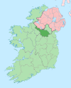
Villages - Agharaskilly
- Aghavoher
- Arvagh
- Ballinagh (Bellananagh)
- Ballyconnell
- Ballyhaise
- Ballymagauran
- Ballymagovern
- Bawnboy
- Berrymount
- Blacklion
- Butlersbridge
- Canningstown
- Cavanagh
- Cloncollow
- Crossdoney
- Cullyleenan
- Derryginny
- Dowra
- Kilcogy
- Killashandra
- Kilnacreeva
- Kilnaleck
- Lisnahederna
- Milltown
- Mountnugent
- Mullagh
- Mullaghduff
- Rakeelan
- Redhills
- Stradone
- Swanlinbar
Landforms - Black Pig's Dyke
- Dún na Rí Forest Park
- Glengevlin
- Lough Gowna
- Lough Oughter
- Lough Ramor
- Lough Sillan
- Magh Slécht
- Shannon Cave
- Shannon Pot
- Slieve Cuilcagh
- Slieve Rushen
Category:Geography of County CavanPlaces in County Longford Towns 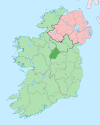
Villages and
Townlands- List of townlands in County Longford
- Category:Mountains and hills of County Longford
- Category:Rivers of County Longford
- Category:Geography of County Longford
Places in County Leitrim Towns 
Villages and
Townlands- Aghamore
- Ballinaglera
- Bornacoola
- Buckode
- Carrigallen
- Cloone
- Dowra
- Drumcong
- Dromahair
- Drumkeeran
- Drumsna
- Dromod
- Eslinbridge
- Fenagh
- Fivemilebourne
- Garadice
- Glenfarne
- Jamestown
- Keshcarrigan
- Kinlough
- Kiltyclogher
- Killargue
- Largydonnell
- Leitrim
- Lurganboy
- Newtowngore
- Rossinver
- Roosky
- Tarmon
- Tullaghan
- Tully
- List of townlands in County Leitrim
- Category:Mountains and hills of County Leitrim
- Category:Rivers of County Leitrim
- Category:Geography of County Leitrim
Categories:- Ancient dykes
- Prehistoric sites in Ireland
- Archaeological sites in Ireland
- History of Ireland
- Archaeological sites in County Cavan
- Archaeological sites in County Monaghan
- Archaeological sites in County Leitrim
- Archaeological sites in County Longford


Wikimedia Foundation. 2010.