- Mullaghduff
-
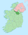
Mullaghduff is a townland in the Parish of Tomregan, Barony of Tullyhaw, County Cavan and Ireland. The townland name is an anglicisation of the Gaelic placename ‘Mullach Dubh’ which means “The Black Hilltop”, which possibly derives from the blackish soil which covers the hill. The 1609 Ulster Plantation map spells the name as ‘Mulladuff’, the 1641 Rebellion Depositions as 'Mullaighduffe' and the 1659 Down Survey map spells it as ‘Mullaghduffe’. It is bounded on the north by Annagh and Corranierna townlands, on the west by Cullyleenan and Agharaskilly townlands, on the south by Cavanagh townland and on the east by Cranaghan townland. Its chief geographical features are Killywilly Lough on its eastern boundary and a central drumlin hill which rises to 309 feet above sea level. Mullaghduff is traversed by the Belturbet road, the Yellow road, Murray’s Lane and by the disused Cavan & Leitrim Railway.
The townland covers 253 statute acres, including three acres of water. It formed part of the Manor of Calva which was granted to Walter Talbot in 1610 as part of the Plantation of Ulster. The 1641 Rebellion Depositions for County Cavan state that the following Irish rebels lived in Mullaghduff at the time- Farrell Og McKiernan, Turlogh McFarrell McKiernan, Owen McFarrell McKiernan, Patrick McIlmartin and Hugh McIlmartin. Griffith’s Valuation of 1857 lists the landlord of the townland as Netterfield and the tenants as Cochrane, Quinn, Fallon, Moore, Faris, McGinn, Reilly, Graham, Gallahar and Roe. The 1841 Census of Ireland gives a population of 87 in Mullaghduff, of which 44 were males and 43 were females, with 18 houses. The 1851 Census of Ireland gives a population of 54, a decrease of 33 on the 1841 figure, due to the intervening Irish Famine of 1845–47, of which 26 were males and 28 were females, with 9 houses.In the 1911 census of Ireland, there were seven families in the townland.[1]
The only items of historical interest are the disused Cavan & Leitrim Railway and a sandpit.
References
External links
Places in County Cavan County town: Cavan Towns Villages Agharaskilly • Aghavoher • Arvagh • Ballinagh (Bellananagh) • Ballyconnell • Ballyhaise • Ballymagauran • Ballymagovern • Bawnboy • Berrymount • Blacklion • Butlersbridge • Canningstown • Cavanagh • Cloncollow • Crossdoney • Cullyleenan • Derryginny • Dowra • Kilcogy • Killashandra • Kilnacreeva • Kilnaleck • Lisnahederna • Milltown • Mountnugent • Mullagh • Mullaghduff • Rakeelan • Redhills • Stradone • SwanlinbarLandforms Black Pig's Dyke • Dún na Rí Forest Park • Glengevlin • Lough Gowna • Lough Oughter • Lough Ramor • Lough Sillan • Magh Slécht • Shannon Cave • Shannon Pot • Slieve Cuilcagh • Slieve RushenCategory:Geography of County Cavan Categories:- Townlands of County Cavan
- County Cavan geography stubs
Wikimedia Foundation. 2010.

