- Cuilcagh
-
Cuilcagh Binn Chuilceach 
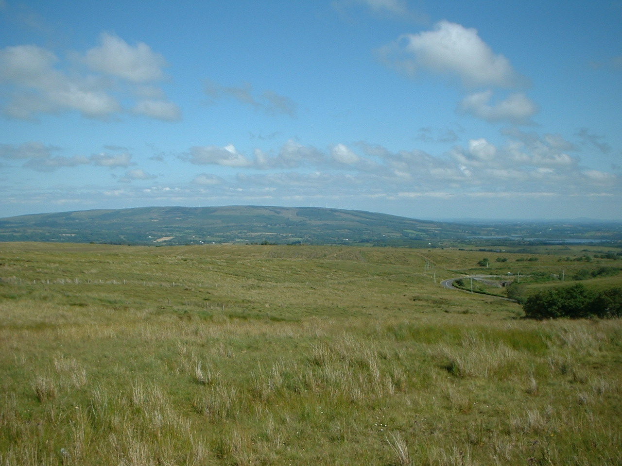
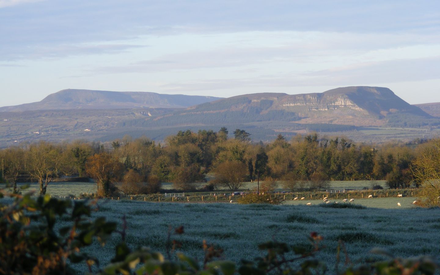
View from CuilcaghElevation 665 m (2,182 ft) Prominence 606 m (1,988 ft) Listing Marilyn, Hewitt Translation Chalky peak (Irish) Pronunciation Irish: [bʲiːnʲ ˈxɪlʲcəx] Location Location Fermanagh, Northern Ireland & Cavan, Republic of Ireland Topo map OSi Discovery 26 OSI/OSNI grid H123280 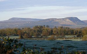 Benaughlin viewed from South Fermanagh in November 2007; Cuilcagh can be seen on the upper left
Cuilcagh, historically Slieve Cuilcagh[1] (from Irish: Sliabh Chuilceach/Binn Chuilceach, meaning "chalky mountain/chalky peak"), is the highest mountain in the Breifne area and the 165th highest on the island of Ireland [2]. The summit lies on the border between County Fermanagh (in Northern Ireland) and County Cavan (in the Republic of Ireland), and is the highest point in both counties. Water from the southern slope flows underground until it emerges some miles away in the Shannon Pot, the traditional source of the River Shannon.
Contents
Flora and fauna
Cuilcagh Mountain has one of the largest expanses of blanket bog in Northern Ireland, on a relatively high elevation upland landscape, bounded by limestone grassland to the north and montane habitats to the south. The blanket bog exhibits a wide range of characteristic vegetation and structural features, with well-developed pool, hummock and lawn features, acid flushes and bog bursts. The bog vegetation is characterised by luxuriant Sphagnum mosses but over most of the site dwarf-shrubs and graminoid herbaceous species dominate. The Cuilcagh area supports a rich assemblage of upland insects, and is one of the most important sites in Ireland for these species. Species recorded include the water beetles Agabus melanarius, Agabus arcticus, Dytiscus lapponicus, Stictotarsus multilineatus, Hydroporus longicornis and Hydroporus morio and the water bugs Glaenocorisa propinqua and Callicorixa wollastoni. Lough Atona is the main locality for these species.[3]
Geopark
Main article: Marble Arch Caves Global GeoparkIn 2007 the Cuilcagh Mountain Park was joined with popular tourist attraction the Marble Arch Caves and the Cladagh Glen Nature Reserve to make the Marble Arch Caves and Cuilcagh Mountain European Geopark. In September 2008 the park was given UNESCO Global Geopark status under the name of the Marble Arch Caves Global Geopark. The Geopark is protected and managed by Fermanagh District Council through the staff of the Marble Arch Caves Visitor Centre.
Ramsar site
The Cuilcagh Mountain Ramsar site (wetlands of international importance designated under the Ramsar Convention), is 2744.45 hectares in area, at Latitude 54 13 26 N and Longitude 07 48 17 W. It was designated a Ramsar site on 31 December 1998. The site qualified under Criterion 1 of the Ramsar Convention because is a large and relatively intact example of a blanket bog and one of the best examples of this habitat in the United Kingdom. It also contains a comparatively high-altitude example of an oligotrophic lake, Lough Atona. The site also qualified under Criterion 2 because it supports numbers of rare, vulnerable or endangered species. It is one of the most important upland breeding sites in Northern Ireland for Eurasian Golden Plover, an Irish Red Data Book Species. Other Irish Red Data book bird species occurring on the site include Merlin. The bog is also occasionally used for feeding by Greater White-fronted Geese.[4]
History
In the 1609 Plantation of Ulster, Cuilcagh formed part of lands which were granted to John Sandford Esq. by letters patent dated 7th July 1613 (Pat. 11 James I – LXXI – 38, ‘Quilkagh’). It was later granted to Sir Toby Caulfield, Master of the Ordnance by letters patent of 12th July 1620 (Pat. 19 James I. XI. 45, ‘Quilkagh’).
References
- ^ Fullarton, A (1856). A Gazetteer of the World: Volume 3. Royal Geographical Society. p. 527. http://books.google.ie/books?id=srgNAAAAQAAJ&pg=PA527&dq=%22slieve+cuilcagh%22&hl=en&ei=PrRUTIzBAsiOjAfEutDDBA&sa=X&oi=book_result&ct=result&resnum=4&ved=0CDQQ6AEwAw#v=onepage&q=%22slieve%20cuilcagh%22&f=false. Retrieved 2010-08-01.
- ^ "Cuilcagh". Mountainviews.ie. http://mountainviews.ie/mv/index.php?mtnindex=165. Retrieved May 19, 2007.
- ^ "Designated and Proposed Ramsar sites in Northern Ireland" (PDF). Joint Nature Conservation Committee. http://www.jncc.gov.uk/pdf/RIS/UK12005.pdf. Retrieved 2008-07-07.
- ^ "Designated and Proposed Ramsar sites in Northern Ireland" (PDF). Joint Nature Conservation Committee. http://www.jncc.gov.uk/pdf/RIS/UK12005.pdf. Retrieved 2008-07-07.
See also
External links
- BBC Learning Northern Ireland: Landscapes Unlocked - Aerial footage from the Sky High series explaining the physical, social and economic geography of Northern Ireland.
Coordinates: 54°12′00″N 7°48′40″W / 54.200°N 7.811°W
Categories:- Mountains and hills of County Fermanagh
- Mountains and hills of County Cavan
- Marilyns of Ireland
- Marilyns of Northern Ireland
- Ramsar sites in Northern Ireland
- Republic of Ireland–United Kingdom border
- International mountains of Europe
Wikimedia Foundation. 2010.