- Killadeas
Infobox Irish Place|thumb|left|name = Killadeas
irish = Cill Chéile Dé
scots =
map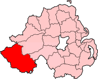
pin coords =
north coord = | west coord =
province =Ulster
county =County Fermanagh
NI district =Fermanagh
UK constituency = Fermanagh and South Tyrone
stdcode = 028, +44 28
posttown =
postcode =
population = 90
census yr = 2001
web = www.fermanagh.gov.uk |sKilladeas (derive|Irish|Cill Chéile Dé|The Church of Culdees, an order of priests predominant in Ireland in the Middle Ages) is a small
village inCounty Fermanagh ,Northern Ireland , about 7 miles north ofEnniskillen near the shores of LowerLough Erne . In the 2001 Census it had a population of 90 people. It is within theFermanagh District Council area.History
*In the cemetery of the Parish 'Priory' Church of Killadeas are several interesting stones, probably the most noted is known as the Bishops Stone, a carved figure. To the west of this stone is a large slab, one side of which has at least ten cup-shaped hollows, which suggest this may be a multiple bullaun stone. Near to this is a holde stone and a pillar.
*Near Killadeas, on Lower Lough Erne, is
Gublusk Bay which was aRoyal Air Force base forShort Sunderland andPBY Catalina flying boat s duringWorld War II . Building atRAF Killadeas started in January1941 and the first Catalinas arrived in March 1941. The site is now the home of the Lough Erne Yacht Club.*The Manor House (Hotel), a converted and extended 19th century country manor, is also situated in Killadeas. The Killadeas Estate was acquired by Captain J Irvine in 1660, and the Manor House, previously konwn as 'Rockfield' (rebuilt 1860) remained part of the Irvine Estate until 1957, when it was purchased for use as a hotel. The Manor House, which has seen many alterations to its design over the centures, was for a brief period, used as an Officer's Mess and Headquarters for the American Forces, during
World War II References
* [http://www.ninis.nisra.gov.uk/ NI Neighbourhood Information Service]
* [http://www.megalithicireland.com/Killadeas.htm Megalithic Ireland - Killadeas]
* [http://cloghmore.bravepages.com/fermanagh/killadeas.html Killadeas Stones]
* [http://www.homepages.mcb.net/bones/06airfields/UK/uki.htm Northern Ireland Airfields]
* [http://www.manor-house-hotel.com/Article_Listings.aspx?tscategory_id=5&category_name=History History of The Manor House]External links
* [http://www.killadeaspb.plus.com/ Killadeas Pipe Band]
* [http://worldwar2airfields.fotopic.net/c758854.html World War II Airfields - Killadeas]
* [http://clogher.anglican.org/index_files/Page4971.htm Killadeas Church and Churchyard]See also
*
List of villages in Northern Ireland
*List of towns in Northern Ireland
Wikimedia Foundation. 2010.