- Letterbreen
Infobox Irish Place|thumb|left|name = Letterbreen
irish = "Leitir Bhrúin
scots =
map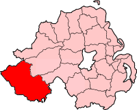
pin coords =
north coord = 54.310 | west coord = 7.735
province =Ulster
county =County Fermanagh
NI district =Fermanagh
UK constituency = Fermanagh and South Tyrone
stdcode = 028, +44 28
posttown =
postcode =
population =
census yr = 2001
web = www.fermanagh.gov.ukLetterbreen ("Leitir Bhrúin" in Irish) is a hamlet in
County Fermanagh ,Northern Ireland , 5 miles south-west ofEnniskillen on the main route toSligo . It lies in the foothills ofBelmore Mountain . "Leitir Bhrúin" meaning "Brún's wet hillside" is testament to a line of spring wells emerging from the settlement's northern hillside. The name Brún may be linked to an antiquity on Belmore Mountain: a chambered giant's grave.The village contains a
Methodist church, aChurch of Ireland church hall, a shop, a post office, a pub and several houses. It is served by a primary school at nearbyFlorencecourt . New residential developments earmarked for construction hint at a growing trend ofdormitory town developments in very small villages surrounding Enniskillen.It lies within the
Fermanagh District Council area.See also
*
List of villages in Northern Ireland
*List of towns in Northern Ireland
Wikimedia Foundation. 2010.