- Knockatallon
Infobox Irish Place
name = Knockatallan
gaeilge =
crest
motto =
map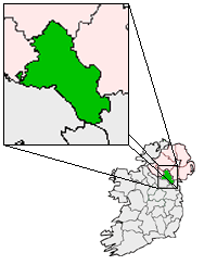
pin coords = left: 40px; top: 40px
north coord = 54.295841| west coord = 7.149224 | irish grid =
area =
elevation =
population =
census yr =
province =Ulster
county =County Monaghan
unit = Townland
terrain = Blanket Bog, Hills
web = |Knockatallon or Knockatallan is a
townland in the north ofCounty Monaghan in Ireland in theparish ofTydavnet . It is located to the west ofSheskin . The Knockatallan name is also used by locals to refer to a larger area including several other townlands such asKnockacullion andCorlat .Not quite a village, Knockatallon's diminishing business/social community is centered around what is known as the cross roads. This includes Knockatallon's national school, St. Joseph's National school, a small grocery store and until recently a post office (closed in August, 2007).
In recent times Knockatallon has been largely eclipsed by a neighbouring townland of
Corlat as a community center.External links
* [http://www.knockatallon.com/ Sliabh Beagh Tourism Center]
* [http://www.knockatallon.com/walking.htm Walks in the Area]
* [http://www.anbhoth.ie Scoil Cheoil na Botha]
Wikimedia Foundation. 2010.