- Sheskin
Infobox Irish Place
name = Sheskin
gaeilge = Seiscenn
crest
motto =
map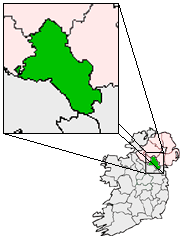
pin coords = left: 40px; top: 40px
north coord = 54.291667| west coord = 7.116667 | irish grid =
area =
elevation = 306 Meters, 1003 feet
population = 83
census yr = 2006
province =Ulster
county =County Monaghan
unit = Townland
terrain = Blanket Bog, Hills
web = |Sheskin or traditionally 'Sheskinmore' (Irish place name|Seiscenn|) is a
townland in the north ofCounty Monaghan inRepublic of Ireland . It is in thefoothills ofSliabh Beagh . Sheskin is part of theParish ofTydavnet , situated about 3 miles from the village ofScotstown and about 8 miles fromMonaghan town. Sheskin is straddled in the east by the River Blackwater and in the south by one of itstributaries , which converge at the south eastern corner of the townland.Other townlands and places in Ireland have the same name, or similar derivatives. The name derives from the
Irish Gaelic word formarsh [http://www.booksulster.com/library/plnm/placenamesS.php From 'Irish Local Names Explained' by P. W. JOYCE, LL.D., M.R.I.A.] , and refers to the significant area of blanket bog within the townland.History
There is no evidence of Ring forts or other early historic remains in Sheskin. Like most of the uplands, it is not thought to have been permanently inhabited through the
middle ages . In the 17th century, as theUlster Plantation got underway, Sheskin and the other uplands were common lands for the lower lying districts around Scotstown, and so would have been cleared, but have remained fairly open. In the 18th century, land would have started to be allocated to tenants, and so the process of enclosing parcels into fields would have begun.Sheskin is one of the larger townlands of the Parish of Tydavnet, which reflects the poorer land quality. Sheskin would have been classified as a townland during the
Ulster Plantation in the 17th century, and probably would have been assigned from a previously existing tate of the same geographic area and name. Tate was a local term for an area of land, used inMonaghan , which was typically smaller than ploughlands which were used elsewhere, and so resulted in smaller townlands on average than in other counties.It is understood that Sheskin is the location where Potato blight was first identified in Monaghan, in the Autumn of 1845, the disease that ultimately led to the
Irish Famine . This event is now commemorated by the "famine stone" located at the bottom of the "Black Hill", in the south east of the townland. In Monaghan alone anywhere from 20-30% of the population would ultimately die during the famine. Although the upland districts of the north were not as badly hit as the south of county Monaghan, the Parish of Tydavent did have a population of 11600 in 1841, and 8,400 in 1851.Corblonog , the townland just to the east of Sheskin, still has a location known as Porridge Hill, where the Williamson family providedgruel to those who needed it during the famine.In the first half of the 20th Century, a field at the top of the "Black Hill" served as a Gaelic football field for locals. Sheskin is on record as having a
blacksmith in 1938. Electricity came to Sheskin in 1948.Sheskin was the location of Killycarnan
National School , a two classroom building, before it was closed in the 1980s and the students relocated to eitherKnockatallon National School or Urbleshanny National School inScotstown . The school has now been renovated into a private residence. The nameKillycarnan comes from the name of another townland adjacent to Sheskin and the site of a previous national school which pre-dated the Sheskin school.References
External links
* [http://maps.google.com/maps?f=q&hl=en&geocode=&q=sheskin,+monaghan,+ireland&ie=UTF8&ll=54.293086,-7.131844&spn=0.044684,0.082569&t=h&z=13 Satellite view of Sheskin from Google]
Wikimedia Foundation. 2010.