- New Byth
-
Coordinates: 57°34′26″N 2°18′00″W / 57.574°N 2.300°W
New Byth 
Entering New Byth from the south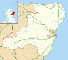
 New Byth
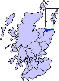
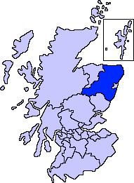
New Byth shown within AberdeenshireOS grid reference NJ821538 Council area Aberdeenshire Lieutenancy area Aberdeenshire Country Scotland Sovereign state United Kingdom Post town TURRIFF Postcode district AB53 Dialling code 01888 Police Grampian Fire Grampian Ambulance Scottish EU Parliament Scotland UK Parliament Banff and Buchan Scottish Parliament Banff and Buchan List of places: UK • Scotland • New Byth is a small inland planned village in the Banff and Buchan committee area of Aberdeenshire, Scotland that lies a few miles northeast of Cuminestown and was built in the 18th century.
Sources
- New Byth in the Gazetteer for Scotland.
Settlements and places of interest in Banff and Buchan, Aberdeenshire Primary settlements Aberchirder · Banff · Fraserburgh · Gardenstown · Inverallochy and Cairnbulg · Macduff · Portsoy · Rosehearty · Sandhaven · Whitehills
Other settlements Boyndie · Broadsea · Cornhill · Cortes · Crovie · Fordyce · King Edward · Memsie · Netherbrae · New Aberdour · New Byth · Pennan · Sandend
Places of interest Areas and primary settlements in Aberdeenshire
(see also: Aberdeen City)in Banff and Buchan Aberchirder · Banff · Fraserburgh · Gardenstown · Inverallochy and Cairnbulg · Macduff · Portsoy · Rosehearty · Sandhaven · Whitehills
in Buchan Boddam · Crimond · Cruden Bay · Fetterangus · Hatton · Longside · Maud · Mintlaw · New Deer · New Pitsligo · Peterhead · St Combs · St Fergus · Strichen · Stuartfield
in Formartine Balmedie · Cuminestown · Ellon · Fyvie · Newburgh · Oldmeldrum · Pitmedden · Potterton · Rothienorman · Tarves · Turriff
in Garioch in Kincardine and Mearns Drumoak · Fettercairn · Gourdon · Inverbervie · Johnshaven · Laurencekirk · Newtonhill · Portlethen · St Cyrus · Stonehaven
in Marr Categories:- Villages in Aberdeenshire
- Aberdeenshire geography stubs


Wikimedia Foundation. 2010.