- Otway, Ohio
-
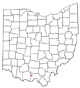
Otway, Ohio — Village — Location of Otway, Ohio
Coordinates: 38°51′50″N 83°11′20″W / 38.86389°N 83.18889°WCoordinates: 38°51′50″N 83°11′20″W / 38.86389°N 83.18889°W Country United States State Ohio County Scioto Area – Total 0.2 sq mi (0.6 km2) – Land 0.2 sq mi (0.6 km2) – Water 0.0 sq mi (0.0 km2) Elevation[1] 597 ft (182 m) Population (2000) – Total 86 – Density 388.1/sq mi (149.8/km2) Time zone Eastern (EST) (UTC-5) – Summer (DST) EDT (UTC-4) ZIP code 45657 Area code(s) 740 FIPS code 39-59066[2] GNIS feature ID 1065223[1] Otway is a village in Scioto County, Ohio, United States. The population was 86 at the 2000 census.
The first house in Otway Village was built in 1841, and the first post office served the area in 1847. The village was platted March 29, 1884.[3]
Geography
Otway is located at 38°51′50″N 83°11′20″W / 38.86389°N 83.18889°W (38.863899, -83.188860)[4].
According to the United States Census Bureau, the village has a total area of 0.2 square miles (0.52 km2), all of it land.
Demographics
As of the census[2] of 2000, there were 86 people, 40 households, and 26 families residing in the village. The population density was 388.1 people per square mile (150.9/km²). There were 59 housing units at an average density of 266.2 per square mile (103.5/km²). The racial makeup of the village was 96.51% White, 1.16% Native American, 2.33% from other races. Hispanic or Latino of any race were 2.33% of the population.
There were 40 households out of which 17.5% had children under the age of 18 living with them, 47.5% were married couples living together, 12.5% had a female householder with no husband present, and 35.0% were non-families. 35.0% of all households were made up of individuals and 20.0% had someone living alone who was 65 years of age or older. The average household size was 2.15 and the average family size was 2.77.
In the village the population was spread out with 16.3% under the age of 18, 14.0% from 18 to 24, 23.3% from 25 to 44, 20.9% from 45 to 64, and 25.6% who were 65 years of age or older. The median age was 44 years. For every 100 females there were 79.2 males. For every 100 females age 18 and over, there were 75.6 males.
The median income for a household in the village was $27,500, and the median income for a family was $35,000. Males had a median income of $32,500 versus $25,625 for females. The per capita income for the village was $12,966. There were 11.5% of families and 14.1% of the population living below the poverty line, including 21.1% of under eighteens and 15.8% of those over 64.
References
- ^ a b "US Board on Geographic Names". United States Geological Survey. 2007-10-25. http://geonames.usgs.gov. Retrieved 2008-01-31.
- ^ a b "American FactFinder". United States Census Bureau. http://factfinder.census.gov. Retrieved 2008-01-31.
- ^ "Portsmouth Area Resource Guide, 2007-2008". The Community Common. 2007-07-29. p. 7.
- ^ "US Gazetteer files: 2010, 2000, and 1990". United States Census Bureau. 2011-02-12. http://www.census.gov/geo/www/gazetteer/gazette.html. Retrieved 2011-04-23.
Municipalities and communities of Scioto County, Ohio City 
Villages New Boston | Otway | Rarden | South Webster
Townships CDPs Unincorporated
communitiesClarktown | Coles Park | Friendship | Haverhill | McDermott | Minford | Mule Town | Scioto Furnace
Categories:- Populated places in Scioto County, Ohio
- Villages in Ohio

Wikimedia Foundation. 2010.