- Rosemount, Ohio
Infobox Settlement
official_name = Rosemount, Ohio
settlement_type = CDP
nickname =
motto =
imagesize =
image_caption =
image_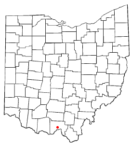
mapsize = 250x200px
map_caption = Location of Rosemount, Ohio
mapsize1 =
map_caption1 =subdivision_type = Country
subdivision_name =United States
subdivision_type1 = State
subdivision_name1 =Ohio
subdivision_type2 = County
subdivision_name2 = Sciotogovernment_footnotes =
government_type =
leader_title =
leader_name =
leader_title1 =
leader_name1 =
established_title =
established_date =unit_pref = Imperial
area_footnotes =area_magnitude =
area_total_km2 = 14.9
area_land_km2 = 14.9
area_water_km2 = 0.0
area_total_sq_mi = 5.8
area_land_sq_mi = 5.8
area_water_sq_mi = 0.0population_as_of = 2000
population_footnotes =
population_total = 2043
population_density_km2 = 137.1
population_density_sq_mi = 355.0timezone = Eastern (EST)
utc_offset = -5
timezone_DST = EDT
utc_offset_DST = -4
elevation_footnotes = GR|3
elevation_m = 185
elevation_ft = 607
latd = 38 |latm = 47 |lats = 1 |latNS = N
longd = 82 |longm = 58 |longs = 25 |longEW = Wpostal_code_type =
postal_code =
area_code =
blank_name = FIPS code
blank_info = 39-68546GR|2
blank1_name = GNIS feature ID
blank1_info = 1056496GR|3
website =
footnotes =Rosemount is a
census-designated place (CDP) in Clay Township, Scioto County,Ohio ,United States . The population was 2,043 at the 2000 census. [ [http://www.osuedc.org/profiles/population/places.php?sid=41&fips=390145 Scioto County, Ohio — Population by Places Estimates]Ohio State University , 2007. Accessed 15 May 2007.]Geography
Rosemount is located at coor dms|38|47|1|N|82|58|25|W|city (38.783723, -82.973576)GR|1.
According to the
United States Census Bureau , the CDP has a total area of 5.8square mile s (14.9km² ), all of it land.Demographics
As of the
census GR|2 of 2000, there were 2,043 people, 844 households, and 602 families residing in the CDP. Thepopulation density was 355.0 people per square mile (137.2/km²). There were 901 housing units at an average density of 156.6/sq mi (60.5/km²). The racial makeup of the CDP was 98.34% White, 0.24% African American, 0.20% Native American, 0.05% Asian, 0.05% Pacific Islander, 0.05% from other races, and 1.08% from two or more races. Hispanic or Latino of any race were 0.20% of the population.There were 844 households out of which 28.9% had children under the age of 18 living with them, 60.9% were married couples living together, 7.8% had a female householder with no husband present, and 28.6% were non-families. 25.6% of all households were made up of individuals and 13.7% had someone living alone who was 65 years of age or older. The average household size was 2.42 and the average family size was 2.89.
In the CDP the population was spread out with 22.6% under the age of 18, 6.6% from 18 to 24, 26.7% from 25 to 44, 25.7% from 45 to 64, and 18.4% who were 65 years of age or older. The median age was 41 years. For every 100 females there were 87.3 males. For every 100 females age 18 and over, there were 83.1 males.
The median income for a household in the CDP was $40,625, and the median income for a family was $46,071. Males had a median income of $36,612 versus $23,603 for females. The
per capita income for the CDP was $20,978. About 5.6% of families and 8.3% of the population were below thepoverty line , including 11.2% of those under age 18 and 2.4% of those age 65 or over.Public services
Residents of Rosemount are served by the
Clay Local School District , thePortsmouth Public Library , and avolunteer fire department .Notable residents
*
Dale Bandy - He is a 1956 Clay High School graduate and the son of long-time Clay administrator, Carl Bandy.cite news|author=Clay Local School District|title=Clay High School Souvenir Booklet|publisher=Kah Printing Co.|date=22 April 1956 |page=2-5] He went on to play baseball and basketball atOhio University . He was an assistant under legendary OU basketball coachJim Snyder before taking over the reins in 1974 (1974-1980).cite web|url=http://www.cstv.com/auto_pdf/p_hotos/s_chools/ohio/sports/m-baskbl/auto_pdf/0607_records|title=Ohio University Men's Basketball Records|accessdate=2007-05-25|author=Ohio University Athletic Department] He currently lives in Texas half of the year. The other half of the year he lives in Pennsylvania and is an assistant men's basketball coach for theCalifornia University of Pennsylvania Vulcans' squad under Bill Brown. cite web|url=http://www.calvulcans.com/coaches.php?sport=AMB|title=Vulcans' Men's Basketball Coaching Staff|publisher=California University of Pennsylvania|accessdate=2007-08-13]Education
Local students attend the schools of the
Clay Local School District , including Clay High School.References
External links
* [http://www.clay.k12.oh.us Clay District Website]
Wikimedia Foundation. 2010.