- Cimarron, New Mexico
-
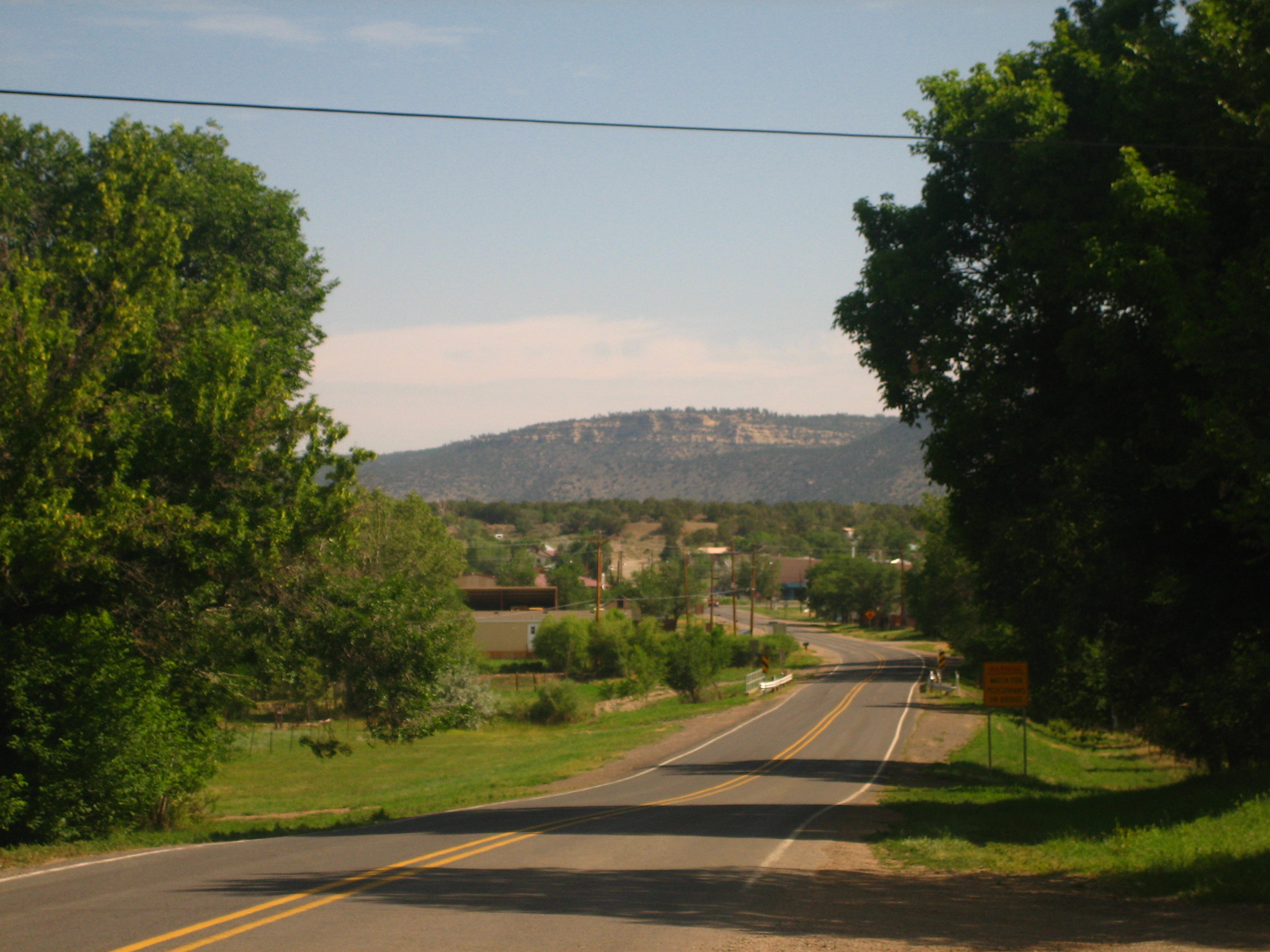
Cimarron, New Mexico — Village — Scenic mountain drive South of Cimarron Location of Cimarron, New Mexico
 U.S. Census Map
Coordinates: 36°30′34″N 104°54′56″W / 36.50944°N 104.91556°WCoordinates: 36°30′34″N 104°54′56″W / 36.50944°N 104.91556°W Country United States State New Mexico County Colfax Area – Total 1.9 sq mi (5.0 km2) – Land 1.9 sq mi (5.0 km2) – Water 0.0 sq mi (0.0 km2) Elevation 6,430 ft (1,960 m) Population (2000) – Total 917 – Density 479.5/sq mi (185.1/km2) Time zone Mountain (MST) (UTC-7) – Summer (DST) MDT (UTC-6) ZIP code 87714 Area code(s) 575 FIPS code 35-15440 GNIS feature ID 0887606 Website http://villageofcimarron.com/ Cimarron is a village in Colfax County, New Mexico, United States. The population was 917 at the 2000 census.
Philmont Scout Ranch,[1] an extensive "high-adventure base" operated by the Boy Scouts of America, is located just south of Cimarron. The Chase Ranch (famous for its heart-shaped brand and allegedly the Marlboro Man's place of origin), Ted Turner's Vermejo Park Ranch,[2] the CS Ranch,[3] the UU Bar Ranch[4] (formerly the property of Waite Phillips), the Elliott Barker State Wildlife Area, the Valle Vidal, Cimarron Canyon State Park, [5] and Carson National Forest[6] are also located in the Cimarron area.
The village is a pioneer of the four-day school week, which it originally implemented in the early 1970s, during a time of rising fuel and utility prices.[7]
Contents
History
To avoid the rocky and mountainous Raton Pass, wagon traffic used the Cimarron Cutoff of the Santa Fe Trail during the 1840s. Thereafter, Mountain Branch near Raton Pass became more popular with traders, immigrants, gold-seekers, and government supply trains.
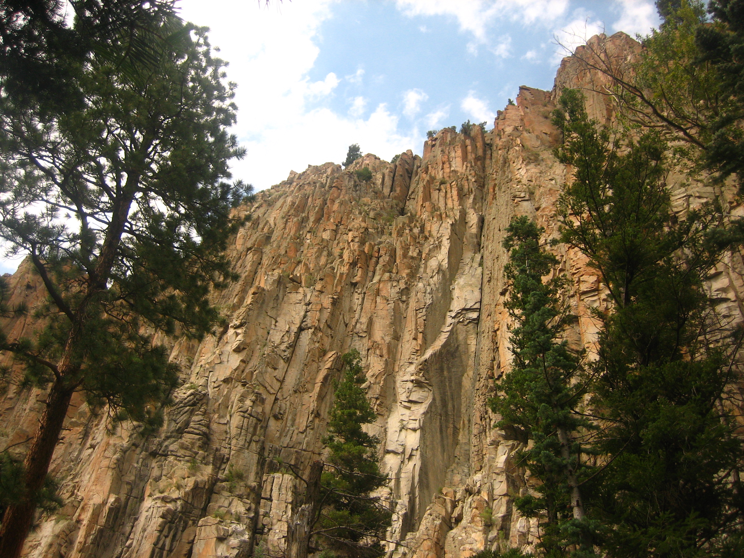
West of Cimarron is Palisades Sill, with high cliffs surrounding a modest flow of the Cimarron River.
In 1842, Lucien B. Maxwell, a fur trapper, came to the Beaubien-Miranda Ranch in northern New Mexico and courted and married Luz Beaubien, one of the owner's six daughters. He eventually inherited the ranch and built a huge mansion in 1858 on the future town site.
Lucien B. Maxwell built the Aztec Mill in 1864. It is preserved as the Old Mill Museum, operated by the Cimarron Historical Society. The museum's collection includes working mill parts, Native American tools, weapons and pottery; Maxwell Land Grant paperwork and documents, and other materials as well.
Cimarron was officially chartered in 1859 and was named for the Spanish word used to describe a mustang, meaning "wild" and "unbroken". Cimarron was the county seat of Colfax County beginning in 1872, when it replaced Elizabethtown. At that time, Cimarron was a stage stop on the Mountain Branch of the Santa Fe Trail. In 1881, the county seat was moved to Springer, a town on the Atchison, Topeka, and Santa Fe Railway. It was during this time that Lucien Maxwell sold the Maxwell Land Grant to a group of investors, with the resultant Colfax County War in which more than two hundred persons were killed.
Final homeport of USS Cimarron
As a tribute to many dedicated crew members, USS Cimarron's key artifacts were donated to Cimarron, since it is the closest village to the Cimarron River's headwaters at Eagle Nest, New Mexico. Her ship's bell became the village high school's bell.
Geography
Cimarron is located at 36°30′34″N 104°54′56″W / 36.50944°N 104.91556°W (36.509467, -104.915496)[8].
According to the United States Census Bureau, the village has a total area of 1.9 square miles (4.9 km2), all land.
Climate data for Cimarron Month Jan Feb Mar Apr May Jun Jul Aug Sep Oct Nov Dec Year Average high °F (°C) 47
(8)51
(11)56
(13)63
(17)72
(22)81
(27)84
(29)81
(27)77
(25)68
(20)55
(13)49
(9)64 Average low °F (°C) 16
(−9)19
(−7)25
(−4)31
(−1)39
(4)48
(9)52
(11)51
(11)44
(7)33
(1)23
(−5)17
(−8)31 Precipitation inches (mm) 0.3
(8)0.3
(8)0.6
(15)1.7
(43)2.3
(58)1.4
(36)3.3
(84)2.6
(66)0.9
(23)1.1
(28)0.5
(13)0.4
(10)15.5
(394)Source: [9] Demographics
 Cliffs of Palisades Sill
 Mountainview Cemetery in Cimarron
As of the census[10] of 2000, there were 917 people, 382 households, and 255 families residing in the village. The population density was 479.5 people per square mile (185.4/km²). There were 449 housing units at an average density of 234.8 per square mile (90.8/km²). The racial makeup of the village was 77.54% White, 0.11% African American, 1.09% Native American, 0.11% Asian, 17.23% from other races, and 3.93% from two or more races. Hispanic or Latino of any race were 58.89% of the population.
There were 382 households out of which 34.0% had children under the age of 18 living with them, 49.2% were married couples living together, 8.1% had a female householder with no husband present, and 33.0% were non-families. 29.1% of all households were made up of individuals and 13.6% had someone living alone who was 65 years of age or older. The average household size was 2.40 and the average family size was 2.89.
In the village the population was spread out with 27.0% under the age of 18, 7.6% from 18 to 24, 25.1% from 25 to 44, 24.1% from 45 to 64, and 16.1% who were 65 years of age or older. The median age was 40 years. For every 100 females there were 106.5 males. For every 100 females age 18 and over, there were 102.7 males.
The median income for a household in the village was $27,875, and the median income for a family was $30,677. Males had a median income of $26,125 versus $19,792 for females. The per capita income for the village was $14,248. About 9.1% of families and 12.5% of the population were below the poverty line, including 16.1% of those under age 18 and 8.6% of those age 65 or over.
See also
- Cimarron Historic District
- Ernest Thompson Seton - story-teller
- St. James Hotel (Cimarron, New Mexico)
- Villa Philmonte - Built in 1926 by oil magnate Waite Phillips
References
- ^ Philmont Scout Ranch
- ^ VPR invite
- ^ CS Cattle Co. - Welcome!
- ^ Express UU Bar Ranches
- ^ Coalition for the Valle Vidal - New Mexico - an Endangered American Treasure
- ^ Carson National Forest - Welcome
- ^ Schools eye four-day week to cut fuel costs | Lifestyle | Living | Reuters
- ^ "US Gazetteer files: 2010, 2000, and 1990". United States Census Bureau. 2011-02-12. http://www.census.gov/geo/www/gazetteer/gazette.html. Retrieved 2011-04-23.
- ^ weatherbase.com
- ^ "American FactFinder". United States Census Bureau. http://factfinder.census.gov. Retrieved 2008-01-31.
External links
- Cimarron Chamber of Commerce
- Cimarron visitors information
- Cimarron High School's Weather-Webcam
- I-25 Corridor RV Blogger
- Troutman Studio: Historic Postcards from Cimarron, New Mexico
Municipalities and communities of Colfax County, New Mexico City 
Town Villages Angel Fire | Cimarron | Eagle Nest | Maxwell
Unincorporated
communitiesMiami | Rayado | Sunny Side | Ute Park
Ghost towns Categories:- Populated places in Colfax County, New Mexico
- Villages in New Mexico
- Philmont Scout Ranch
- American Old West
- Santa Fe Trail
- Populated places in New Mexico with Hispanic majority populations


Wikimedia Foundation. 2010.