- Maxwell, New Mexico
-
Maxwell, New Mexico — Village — Location of Maxwell, New Mexico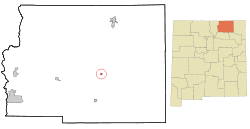
Coordinates: 36°32′22″N 104°32′33″W / 36.53944°N 104.5425°WCoordinates: 36°32′22″N 104°32′33″W / 36.53944°N 104.5425°W Country United States State New Mexico County Colfax Area – Total 0.5 sq mi (1.2 km2) – Land 0.5 sq mi (1.2 km2) – Water 0.0 sq mi (0.0 km2) Elevation 5,925 ft (1,806 m) Population (2000) – Total 274 – Density 577.5/sq mi (223.0/km2) Time zone Mountain (MST) (UTC-7) – Summer (DST) MDT (UTC-6) ZIP code 87728 Area code(s) 575 FIPS code 35-47080 GNIS feature ID 0891692 Maxwell is a village in Colfax County, New Mexico, United States. The population was 274 at the 2000 census. Unlike nearby Springer, the village has been losing population due to the rural exodus. Maxwell was established in 1879 as a railroad town on the Atchison, Topeka, and Santa Fe. It was named in honor of Lucien Maxwell, who provided the land for the original townsite from his Maxwell Land Grant.[citation needed]
Geography
Maxwell is located at 36°32′22″N 104°32′33″W / 36.53944°N 104.5425°W (36.539487, -104.542630)[1].
According to the United States Census Bureau, the village has a total area of 0.5 square miles (1.3 km2), all of it land.
Demographics
As of the census[2] of 2000, there were 274 people, 117 households, and 76 families residing in the village. The population density was 577.5 people per square mile (225.1/km²). There were 148 housing units at an average density of 311.9 per square mile (121.6/km²). The racial makeup of the village was 86.50% White, 4.01% Native American, 7.30% from other races, and 2.19% from two or more races. Hispanic or Latino of any race were 55.47% of the population.
There were 117 households out of which 29.9% had children under the age of 18 living with them, 51.3% were married couples living together, 11.1% had a female householder with no husband present, and 34.2% were non-families. 29.9% of all households were made up of individuals and 14.5% had someone living alone who was 65 years of age or older. The average household size was 2.34 and the average family size was 2.91.
In the village the population was spread out with 25.2% under the age of 18, 6.9% from 18 to 24, 24.5% from 25 to 44, 23.7% from 45 to 64, and 19.7% who were 65 years of age or older. The median age was 41 years. For every 100 females there were 101.5 males. For every 100 females age 18 and over, there were 86.4 males.
The median income for a household in the village was $23,750, and the median income for a family was $28,750. Males had a median income of $22,083 versus $20,625 for females. The per capita income for the village was $11,231. About 22.0% of families and 21.9% of the population were below the poverty line, including 24.6% of those under the age of eighteen and 8.0% of those sixty five or over.
References
- ^ "US Gazetteer files: 2010, 2000, and 1990". United States Census Bureau. 2011-02-12. http://www.census.gov/geo/www/gazetteer/gazette.html. Retrieved 2011-04-23.
- ^ "American FactFinder". United States Census Bureau. http://factfinder.census.gov. Retrieved 2008-01-31.
Municipalities and communities of Colfax County, New Mexico City 
Town Villages Angel Fire | Cimarron | Eagle Nest | Maxwell
Unincorporated
communitiesMiami | Rayado | Sunny Side | Ute Park
Ghost towns Categories:- Populated places in Colfax County, New Mexico
- Villages in New Mexico
- Populated places in New Mexico with Hispanic majority populations


Wikimedia Foundation. 2010.