- Interstate 675 (Ohio)
-
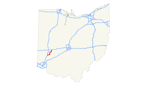
Interstate 675
Route information Maintained by ODOT Length: 26.53 mi[1] (42.70 km) Existed: 1987 – present Major junctions South end:  I-75 near Miamisburg
 US 35 near Beavercreek
North end: 
 I-70 / SR 4 / Clark CR 335 near Fairborn
Highway system Auxiliary route of the Interstate Highway System
Main • Auxiliary • BusinessOhio highways
Interstates • U.S. Routes • State Routes←  SR 674
SR 676  →
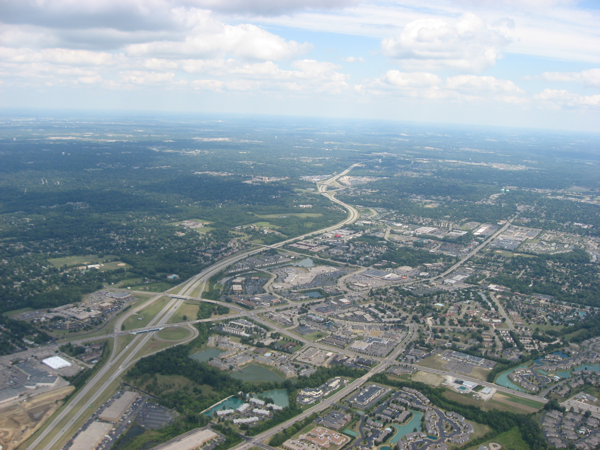
→ Double interchange on the southern half of Interstate 675
Interstate 675 (I-675) is an auxiliary interstate highway in the suburbs of Dayton in the U.S. state of Ohio. Interstate 675 serves as an eastern bypass of Dayton. I-675 measures 26.53 miles (42.70 km) in length. As originally proposed, the route was to reconnect with I-75 north of Dayton near Northridge rather than going east towards Springfield and I-70 (this was later rejected because part of the right-of-way would have gone through the Wright-Patterson Air Force Base). Construction was completed in 1987, though some have lobbied to extend the highway west of Dayton.
Contents
Route description
From the north, the highway intersects with Interstate 70 near Fairborn where it starts as a four-lane highway. The highway opens to six lanes just after the intersection with N. Fairfield Rd. in Beavercreek. The next major junction is made with U.S. Route 35 which is a full-access interchange. The highway continues with three lanes each way and ends at Interstate 75 in Miami Township.
Exit list
County Location Mile # Destinations Notes Montgomery Miamisburg 0.00 I-75 – Cincinnati, ToledoSouthbound exit and northbound entrance 1.64 2  SR 725 – Centerville, Miamisburg
Centerville 4.34 4  SR 48 – Centerville, Kettering
Signed as exits 4A (south) and 4B (north) northbound 6.96 7 Wilmington Pike - Bellbrook Greene Beavercreek 10.06 10 Indian Ripple Road, Dorothy Lane - Kettering 12.88 13 US 35 – Xenia, DaytonSigned as exits 13A (east) and 13B (west) 15.19 15 Colonel Glenn Highway - Wright-Patterson AFB Area B Fairborn 15.91 16 Grange Hall Road Southbound exit and northbound entrance 17.23 17  SR 844 north / North Fairfield Road - Wright-Patterson AFB Areas A and C, & Wright State University
20.07 20 Dayton-Yellow Springs Road 22.38 22  SR 235 – Xenia, Fairborn
Bath Township 24.50 24  SR 444 – Enon, Fairborn, Wright-Patterson AFB Areas A and C
Clark Mad River Township 25.91 26 I-70 / SR 4 – Springfield, Columbus, IndianapolisSigned as exits 26A (east) and 26B (west) 26.43 Spangler Road – Springfield Northbound exit and southbound entrance (freeway ends; road becomes Spangler Road) References
External links
Auxiliary routes of Interstate 75  Categories:
- Three-digit Interstate Highways
- Interstate Highways in Ohio
- Interstate 75
- Transportation in Dayton, Ohio
- Transportation in Montgomery County, Ohio
- Transportation in Greene County, Ohio


Wikimedia Foundation. 2010.