- Maryland Route 76
-
Maryland Route 76
Motters Station Road 
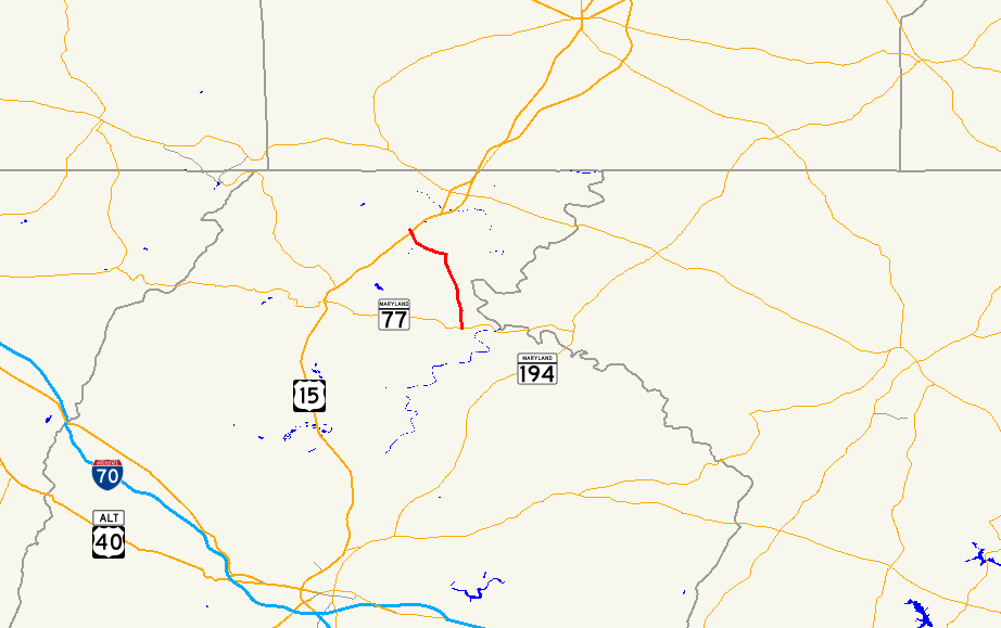
Route information Maintained by MDSHA Length: 5.69 mi[1] (9.16 km) Major junctions South end:  MD 77 near Rocky Ridge
North end:  US 15 near Emmitsburg
Location Counties: Frederick Highway system Maryland highway system
Interstate • US • State • Minor • Former • Turnpikes←  MD 75
MD 75MD 77 →Maryland Route 76 (MD 76) is a state highway in the U.S. state of Maryland. Known as Motters Station Road, the state highway runs 5.69 miles (9.16 km) from MD 77 in Rocky Ridge north to U.S. Route 15 (US 15) near Emmitsburg in northern Frederick County. MD 76 was constructed in two sections in the early 1920s and late 1930s.
Contents
Route description
MD 76 begins at an intersection with MD 77 (Rocky Ridge Road) in the village of Rocky Ridge. The roadway continues south as county-maintained Longs Mill Road. The state highway heads north as a two-lane road that meets the Maryland Midland Railway at grade and parallels the Monocacy River from a distance. In the hamlet of Motters, MD 76 intersects Four Point Roads, which leads east to the historic Fourpoints Bridge over Toms Creek, and makes a turn to the west. The state highway intersects Old Frederick Road and curves to the northwest before reaching its northern terminus at US 15 (Catoctin Mountain Highway) south of Emmitsburg. The roadway continues west as county-maintained Motters Station Road to St. Anthony Road, the old alignment of US 15 that leads to Mount St. Mary's University and the National Shrine Grotto of Our Lady of Lourdes.[1][2]
History
The first section of MD 76 was completed by 1921 as a concrete road from US 15 to Motters, a station on the Emmitsburg branch of the Western Maryland Railway.[3] The highway between Rocky Ridge and Motters was completed in 1938.[4] Aside from minor improvements, MD 76 has not changed since.
Junction list
The entire route is in Frederick County.
Location Mile[1] Destinations Notes Rocky Ridge 0.00 MD 77 (Rocky Ridge Road) / Longs Mill Road south – Thurmont, TaneytownSouthern terminus Emmitsburg 5.69 US 15 (Catoctin Mountain Highway) / Motters Station Road north – Frederick, GettysburgNorthern terminus 1.000 mi = 1.609 km; 1.000 km = 0.621 mi References
- ^ a b c "Highway Location Reference: Frederick County" (PDF). Maryland State Highway Administration. 2009. http://www.marylandroads.com/Location/2009_FREDERICK.pdf. Retrieved 2011-03-20.
- ^ Google, Inc. Google Maps – Maryland Route 76 (Map). Cartography by Google, Inc. http://maps.google.com/maps?f=d&source=s_d&saddr=MD-76+S%2FMotters+Station+Rd&daddr=MD-76+S%2FMotters+Station+Rd&hl=en&geocode=FRZUXAIdKjVk-w%3BFWRkXQIdNqdj-w&mra=ls&sll=39.640125,-77.336895&sspn=0.1195,0.308647&ie=UTF8&t=h&z=12. Retrieved 2011-03-20.
- ^ Maryland Geological Survey. Map of Maryland: Showing State Road System and State Aid Roads (Map) (1921 ed.).
- ^ Maryland State Roads Commission. Map of Maryland Showing State Road System (Map) (1938 ed.).
External links
Roads in Frederick County, Maryland State highways 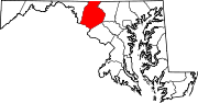
U.S. Highways Interstate Highways Categories:- State highways in Maryland
- Roads in Frederick County, Maryland


Wikimedia Foundation. 2010.