- Broad Street (ward)
-
Coordinates: 51°30′58″N 0°05′06″W / 51.5161°N 0.085°W
Ward of Broad Street
 Ward of Broad Street shown within Greater London
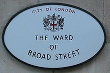
OS grid reference TQ329814 Sui generis City of London Administrative area Greater London Region London Country England Sovereign state United Kingdom Post town LONDON Postcode district EC2 Dialling code 020 Police City of London Fire London Ambulance London EU Parliament London UK Parliament Cities of London and Westminster London Assembly City and East List of places: UK • England • London Broad Street is one of the 25 ancient wards in the City of London.
In mediaeval times it was divided into ten precincts[1] and contained six churches,[2] of which only two, St Margaret Lothbury and All Hallows-on-the-Wall now survive:[3] St Bartholomew-by-the-Exchange was demolished in 1840, St Benet Fink in 1844, St Martin Outwich 1874 and St Peter le Poer in 1907.[4]
The ward’s northern boundary along London Wall and Blomfield Street borders Coleman Street ward, before curving to the north-east along Liverpool Street, the division with Bishopsgate. From here Old Broad Street travels south-west along the border with Cornhill where it joins Throgmorton Street, its southern boundary- to the south of which are the Stock Exchange and Bank of England in Walbrook Ward. The western boundary follows a series of small courts and alleys adjacent to Moorgate. A busy commercial area[5] it also contains two Livery halls (Carpenter’s[6] and Draper’s,[7]). Like many of the City Wards it has a social club for people who work in the area,[8] which celebrated its 30th anniversary in March 2006.[9]
At the top of Old Broad Street, adjacent to Liverpool Street station, was Broad Street station, which closed in 1986 — the only London terminus station to have permanently closed.
Contents
Politics
Broad Street is one of 25 wards in the City of London, each electing an Alderman, to the Court of Aldermen and Commoners (the City equivalent of a Councillor) to the Court of Common Council of the City of London Corporation. Only electors who are Freeman of the City of London are eligible to stand.
Ward Club
The Broad Street Ward Club was formed in October 1976 to provide a meeting ground for those working within the Ward. More details:[10]
References
- ^ Book 2, Ch. 12: Broad Street Ward, A New History of London: Including Westminster and Southwark (1773), pp. 566-76 accessed: 23 September 2007
- ^ The Dutch Church at Austin Friars was originally a monastic foundation Churches of City of London, Reynolds,H (Bodley Head 1922)
- ^ 1750 map of Broad Street & Cornhill Ward (London Ancestor) accessed: 23 September 2007
- ^ Genealogical web-site
- ^ Police overview
- ^ Livery Carpenter’s Web-site
- ^ Draper’s Information
- ^ Ward Club
- ^ Ward Newsletter
- ^ www.broadstreetwardclub.org
External links
- Broad Street Ward The Official Ward Website
- City of London Corporation Map of Broad Street ward (2003 —)
- Map of Early Modern London: Broad Street Ward - Historical Map and Encyclopedia of Shakespeare's London (Scholarly)
City of London Wards Aldersgate · Aldgate · Bassishaw · Billingsgate · Bishopsgate · Bread Street · Bridge · Broad Street · Candlewick · Castle Baynard · Cheap · Coleman Street · Cordwainer · Cornhill · Cripplegate · Dowgate · Farringdon Within · Farringdon Without · Langbourn · Lime Street · Portsoken · Queenhithe · Tower · Vintry · Walbrook
Enclaves Localities Attractions Bank of England Museum · Barbican Centre · Clockmakers' Museum · Dr. Johnson's House · Guildhall Art Gallery · London Mithraeum · London Stone · Mansion House · The Monument · Museum of London · Old Bailey · St. Paul's Cathedral · Smithfield MarketCivil parishes Bridges Tube and rail stations Categories:- Wards of the City of London
Wikimedia Foundation. 2010.


