- Cordwainer (ward)
-
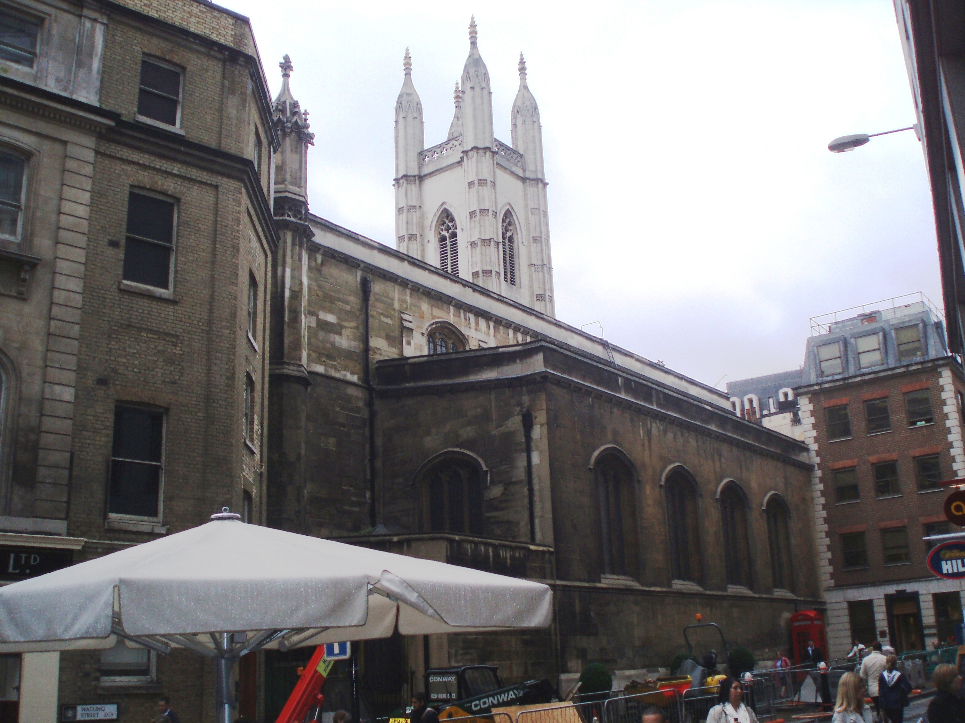
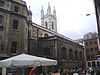 St Mary-le-Bow
Coordinates: 51°30′46″N 0°05′36″W / 51.51285°N 0.09324°W
Ward of Cordwainer 
 Ward of Cordwainer
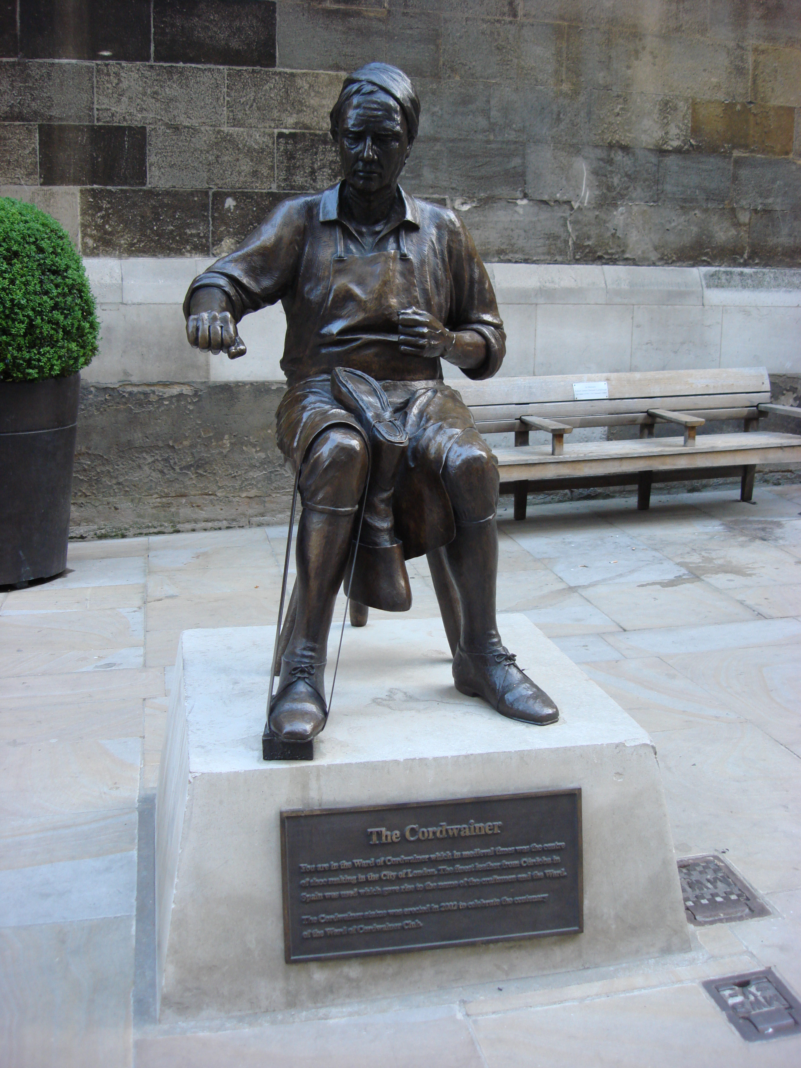
Ward of Cordwainer shown within Greater LondonOS grid reference TQ323811 Sui generis City of London Administrative area Greater London Region London Country England Sovereign state United Kingdom Post town LONDON Postcode district EC2 Dialling code 020 Police City of London Fire London Ambulance London EU Parliament London UK Parliament Cities of London and Westminster London Assembly City and East List of places: UK • England • London 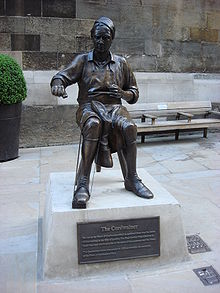 A statue of a cordwainer in the ward
Cordwainer is a small ward[1] in the City of London, England. It is named after the Cordwainers,[2] the professional shoemakers who historically lived and worked in this particular area of London; there is a City livery company (a guild) for the trade — the Worshipful Company of Cordwainers. The ward is sometimes referred to as the "Cordwainers' ward".
It is bounded[3] to the north by Cheapside (the boundary with Cheap Ward), to the west by the eponymous Bread Street (Ward), to the south by Cannon Street (Vintry Ward) and to the east, Wallbrook (ward). Within its boundaries are, amongst others, Bow Lane, Budge Row, Pancras Lane and part of Watling Street. Queen Street runs north-south through the centre of the ward.
Contents
Precincts
In mediaeval times the ward was divided into eight precincts.[4] These were
- St. Mary, Aldermary, upper and lower
- Allhallows, Bread Street
- St. Mary-le-Bow
- St. Antholin, upper and lower
- St. Pancras
- St. Bennet, Sherehog and St. John
- St. Thomas the Apostle
- Trinity[5]
Modern day
Today it is home to many large businesses and new initiatives such as Bow Bells House,[6] named after the bells of St Mary-le-Bow [7] due for completion at the end of 2007. The ward contains one other church (St Mary Aldermary) and the site of Antholin’s Budge Row, demolished in 1875.[8] Cordwainer Ward is quite distinctive for its high number of licensed premises, but in addition has its own club[9] dedicated to promoting the area positively.[10]
Politics
Cordwainer is one of twenty-five wards in the City of London, each electing an alderman to the Court of Aldermen and Commoners (the City equivalent of a councillor elected to the Court of Common Council of the City of London Corporation.) Only electors who are Freemen of the City of London are eligible to stand for election.
References
- ^ Ward Map
- ^ Chambers Dictionary 9th Edition (2003) p335 ISBN 0-550-10105-5
- ^ City of London Police Force description
- ^ Book 2, Ch. 17: Cordwainer Ward , A New History of London: Including Westminster and Southwark (1773), pp. 597-600 25 September 2007
- ^ Thomas Allen, The City of London and Parts Adjacent: Volume 3
- ^ Details of Project
- ^ and not as sometimes thought, the area of Bow in the East End
- ^ Vanished Churches of the City of London Huelin,G: Guildhall Library Publishing, London, 1996 ISBN ISBN 0-900422-42-4
- ^ Club Website
- ^ Ward Newsletter
External links
- Cordwainer The Official Ward Website
City of London Wards Aldersgate · Aldgate · Bassishaw · Billingsgate · Bishopsgate · Bread Street · Bridge · Broad Street · Candlewick · Castle Baynard · Cheap · Coleman Street · Cordwainer · Cornhill · Cripplegate · Dowgate · Farringdon Within · Farringdon Without · Langbourn · Lime Street · Portsoken · Queenhithe · Tower · Vintry · Walbrook
Enclaves Localities Attractions Bank of England Museum · Barbican Centre · Clockmakers' Museum · Dr. Johnson's House · Guildhall Art Gallery · London Mithraeum · London Stone · Mansion House · The Monument · Museum of London · Old Bailey · St. Paul's Cathedral · Smithfield MarketCivil parishes Bridges Tube and rail stations  Category ·
  CommonsCategories:
- Wards of the City of London


Wikimedia Foundation. 2010.