- Ninth Street Historic District
-
Ninth Street Historic District
 Houses in the district
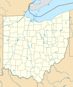
Location: 9th St. between Vine and Plum Sts., Cincinnati, Ohio Coordinates: 39°6′17″N 84°30′59″W / 39.10472°N 84.51639°WCoordinates: 39°6′17″N 84°30′59″W / 39.10472°N 84.51639°W Area: 9 acres (3.6 ha) Architect: Walter & Wilson; Et al. Architectural style: Greek Revival, Italianate, Queen Anne Governing body: Private NRHP Reference#: 80003067[1] Added to NRHP: November 25, 1980 The Ninth Street Historic District is a group of historic buildings located along Ninth Street on the northern side of downtown Cincinnati, Ohio, United States. Composed of buildings constructed between the second quarter of the nineteenth century and the second quarter of the twentieth,[2] it was primarily built between 1840 and 1890, when Cincinnati was experiencing its greatest period of growth. The district embraces the blocks of Ninth Street between Plum and Vine Streets,[3] which includes forty-four buildings that contribute to the district's historic nature.[1]
Few Cincinnati streets retain such a cohesive collection of nineteenth-century architecture as do these three blocks of Ninth Street. Although the buildings were erected over a span of more than a century, they are remarkably similar in their construction: examples of the Queen Anne, Italianate, and Greek Revival styles of architecture are found in the district. Throughout the years that the district was constructed, Cincinnati was a city of pedestrians, and the diversity of the district's buildings highlight this status: within the district's boundaries can be found shops, houses, apartment buildings, and other commercial structures.[3] Among the most important buildings in the district are the Abraham J. Friedlander House, the Brittany and Saxony Apartment Buildings, and the Phoenix Club,[4] all of which were listed on the National Register of Historic Places between May 1979 and March 1980. Eighth months after the last of these four buildings was added to the National Register, the district itself was accorded a similar distinction.[1]
References
- ^ a b c "National Register Information System". National Register of Historic Places. National Park Service. 2009-03-13. http://nrhp.focus.nps.gov/natreg/docs/All_Data.html.
- ^ Ninth Street Historic District, Ohio Historical Society, 2007. Accessed 2011-03-23.
- ^ a b Owen, Lorrie K., ed. Dictionary of Ohio Historic Places. Vol. 1. St. Clair Shores: Somerset, 1999, 638.
- ^ National Register District Address Finder, Ohio Historical Society, 2011. Accessed 2011-03-23.
U.S. National Register of Historic Places Topics Lists by states Alabama • Alaska • Arizona • Arkansas • California • Colorado • Connecticut • Delaware • Florida • Georgia • Hawaii • Idaho • Illinois • Indiana • Iowa • Kansas • Kentucky • Louisiana • Maine • Maryland • Massachusetts • Michigan • Minnesota • Mississippi • Missouri • Montana • Nebraska • Nevada • New Hampshire • New Jersey • New Mexico • New York • North Carolina • North Dakota • Ohio • Oklahoma • Oregon • Pennsylvania • Rhode Island • South Carolina • South Dakota • Tennessee • Texas • Utah • Vermont • Virginia • Washington • West Virginia • Wisconsin • WyomingLists by territories Lists by associated states Other Categories:- Historic districts in Ohio
- Greek Revival architecture in Ohio
- Historic districts in Cincinnati, Ohio
- Italianate architecture in Ohio
- National Register of Historic Places in Cincinnati, Ohio
- Queen Anne architecture in Ohio
Wikimedia Foundation. 2010.

