- Chester, California
-
For the former settlement in Merced County with this name, see Chester, Merced County, California.
Chester — census-designated place — Main St., Old Town Chester Location in Plumas County and the state of California
Coordinates: 40°18′09″N 121°14′05″W / 40.3025°N 121.23472°WCoordinates: 40°18′09″N 121°14′05″W / 40.3025°N 121.23472°W Country  United States
State  California
County Plumas Area[1] - Total 7.369 sq mi (19.084 km2) - Land 7.288 sq mi (18.875 km2) - Water 0.081 sq mi (0.210 km2) 1.1% Elevation[2] 4,534 ft (1,382 m) Population (2010) - Total 2,144 - Density 290.9/sq mi (112.3/km2) Time zone Pacific (PST) (UTC-8) - Summer (DST) PDT (UTC-7) ZIP code 96020 Area code(s) 530 FIPS code 06-12930 GNIS feature IDs 277487; 2408021 U.S. Geological Survey Geographic Names Information System: Chester, California; U.S. Geological Survey Geographic Names Information System: Chester, California Chester (formerly, Big Meadows) is a census-designated place (CDP) in Plumas County, California, United States.[2] Chester is located on Lake Almanor, 30 miles (48.3 km) north-northwest of Quincy.[3] The town is located along State Route 36. The US Postal Service ZIP code for the community is 96020. The population was 2,144 at the 2010 census, down from 2,316 at the 2000 census.
The primary industries in Chester are lumber manufacturing and tourism. Chester serves as the retail center for the Lake Almanor region of California, and derives a significant portion of its economy from the tourist trade, and to a lesser degree from construction to service new residents and businesses.
Contents
History
The town was founded and named by two settlers, one from Chester, Vermont and another from Chester, Missouri.[3] The Chester post office opened in 1894 and moved in 1908.[3]
Geography
Chester is located at 40°18′10″N 121°14′5″W / 40.30278°N 121.23472°W (40.302395, -121.234672)[4].
According to the United States Census Bureau, the CDP has a total area of 10.1 km2 (3.9 sq mi). 18.9 km2 (7.3 sq mi) of it is land and 0.2 km2 (0.077 sq mi) of it (1.10%) is water.
Chester is situated almost directly over the buried North end of The Sierra Nevada.[5]
Demographics
2010
The 2010 United States Census[6] reported that Chester had a population of 2,144. The population density was 291.0 people per square mile (112.3/km²). The racial makeup of Chester was 1,954 (91.1%) White, 10 (0.5%) African American, 46 (2.1%) Native American, 21 (1.0%) Asian, 4 (0.2%) Pacific Islander, 37 (1.7%) from other races, and 72 (3.4%) from two or more races. Hispanic or Latino of any race were 178 persons (8.3%).
The Census reported that 2,131 people (99.4% of the population) lived in households, 1 (0%) lived in non-institutionalized group quarters, and 12 (0.6%) were institutionalized.
There were 943 households, out of which 249 (26.4%) had children under the age of 18 living in them, 454 (48.1%) were opposite-sex married couples living together, 81 (8.6%) had a female householder with no husband present, 46 (4.9%) had a male householder with no wife present. There were 73 (7.7%) unmarried opposite-sex partnerships, and 3 (0.3%) same-sex married couples or partnerships. 288 households (30.5%) were made up of individuals and 95 (10.1%) had someone living alone who was 65 years of age or older. The average household size was 2.26. There were 581 families (61.6% of all households); the average family size was 2.81.
The population was spread out with 465 people (21.7%) under the age of 18, 154 people (7.2%) aged 18 to 24, 456 people (21.3%) aged 25 to 44, 758 people (35.4%) aged 45 to 64, and 311 people (14.5%) who were 65 years of age or older. The median age was 44.9 years. For every 100 females there were 101.7 males. For every 100 females age 18 and over, there were 98.7 males.
There were 1,237 housing units at an average density of 167.9 per square mile (64.8/km²), of which 568 (60.2%) were owner-occupied, and 375 (39.8%) were occupied by renters. The homeowner vacancy rate was 3.5%; the rental vacancy rate was 15.7%. 1,317 people (61.4% of the population) lived in owner-occupied housing units and 814 people (38.0%) lived in rental housing units.
2000
As of the 2000 census[7], there were 2,316 people, 956 households, and 647 families residing in the CDP. The population density was 320.5 people per square mile (123.7/km²). There were 1,130 housing units at an average density of 156.4 per square mile (60.3/km²). The racial makeup of the CDP was 92.62% White, 0.22% Black or African American, 2.12% Native American, 0.47% Asian, 0.13% Pacific Islander, 1.55% from other races, and 2.89% from two or more races. 6.04% of the population were Hispanic or Latino of any race.
There were 956 households out of which 32.4% had children under the age of 18 living with them, 54.1% were married couples living together, 9.5% had a female householder with no husband present, and 32.3% were non-families. 28.1% of all households were made up of individuals and 11.2% had someone living alone who was 65 years of age or older. The average household size was 2.38 and the average family size was 2.90.
In the CDP the population was spread out with 27.1% under the age of 18, 4.6% from 18 to 24, 25.0% from 25 to 44, 27.6% from 45 to 64, and 15.6% who were 65 years of age or older. The median age was 41 years. For every 100 females there were 98.3 males. For every 100 females age 18 and over, there were 94.2 males.
The median income for a household in the CDP was $33,413, and the median income for a family was $45,195. Males had a median income of $33,417 versus $26,164 for females. The per capita income for the CDP was $17,569. About 9.6% of families and 12.4% of the population were below the poverty line, including 11.7% of those under age 18 and 6.5% of those age 65 or over.
History and Features
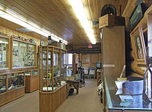 Chester Museum, an addition to the Chester Library.
Economy
The primary industries in Chester are lumber manufacturing and tourism. Collins Pine (a division of The Collins Companies) has been in operation since the 1940s under a truly "sustained yield" management plan using selective harvesting. The company's forest management practices have been certified as FSC sustainable by Scientific Certification Systems, which designated it a "state-of-the-art well-managed forest." [1] Collins no longer maintains the distinction of Chester's dominant employer, though it remains the single business with the most employees.
Other logging companies operating in the area are Roseburg Forest Products, and Sierra Pacific Industries, the latter of which locally utilizes clear-cutting, rather than more environmentally sound practices.[8]
Lake Almanor has developed as a vacation/tourist destination and Chester serves as the retail center for the area. Four of the Almanor basin's six gas stations are located in Chester, as well as the Almanor basin's only full-sized grocery store.
Media
The primary local news source is the Chester Progressive, a local newspaper published every Wednesday.
Resident Celebrities
Chuck Norris, whose wife Gena Norris is a Chester native, has a vacation home in Chester.
Politics
In the state legislature Chester is located in the 1st Senate District, represented by Republican Ted Gaines, and in the 3rd Assembly District, represented by Republican Dan Logue. Federally, Chester is located in California's 4th congressional district, which has a Cook PVI of R +11[9] and is represented by Republican Tom McClintock.
References
- ^ U.S. Census
- ^ a b U.S. Geological Survey Geographic Names Information System: Chester, California
- ^ a b c Durham, David L. (1998). California's Geographic Names: A Gazetteer of Historic and Modern Names of the State. Quill Driver Books. p. 364. ISBN 9781884995149.
- ^ "US Gazetteer files: 2010, 2000, and 1990". United States Census Bureau. 2011-02-12. http://www.census.gov/geo/www/gazetteer/gazette.html. Retrieved 2011-04-23.
- ^ Roadside Geology of Northern California. Alt and Hyndman 1975.Map Page 222
- ^ All data are derived from the United States Census Bureau reports from the 2010 United States Census, and are accessible on-line here. The data on unmarried partnerships and same-sex married couples are from the Census report DEC_10_SF1_PCT15. All other housing and population data are from Census report DEC_10_DP_DPDP1. Both reports are viewable online or downloadable in a zip file containing a comma-delimited data file. The area data, from which densities are calculated, are available on-line here. Percentage totals may not add to 100% due to rounding. The Census Bureau defines families as a household containing one or more people related to the householder by birth, opposite-sex marriage, or adoption. People living in group quarters are tabulated by the Census Bureau as neither owners nor renters. For further details, see the text files accompanying the data files containing the Census reports mentioned above.
- ^ "American FactFinder". United States Census Bureau. http://factfinder.census.gov. Retrieved 2008-01-31.
- ^ Curiel, Jonathan. "Getting Clear With Sierra Pacific Industries". San Francisco Chronicle. http://www.sfgate.com/cgi-bin/article.cgi?f=/c/a/2008/02/29/BAE7UTPD6.DTL. Retrieved 2009-02-27.
- ^ "Will Gerrymandered Districts Stem the Wave of Voter Unrest?". Campaign Legal Center Blog. http://www.clcblog.org/blog_item-85.html. Retrieved 2007-10-20.
Municipalities and communities of Plumas County, California City 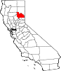
CDPs Almanor | Beckwourth | Belden | Blairsden | Bucks Lake | C-Road | Canyondam | Caribou | Chester | Chilcoot-Vinton | Clio | Crescent Mills | Cromberg | Delleker | East Quincy | East Shore | Gold Mountain | Graeagle | Greenhorn | Greenville | Hamilton Branch | Indian Falls | Iron Horse | Johnsville | Keddie | La Porte | Lake Almanor Country Club | Lake Almanor Peninsula | Lake Almanor West | Lake Davis | Little Grass Valley | Mabie | Meadow Valley | Mohawk Vista | Paxton | Plumas Eureka | Prattville | Quincy | Spring Garden | Storrie | Taylorsville | Tobin | Twain | Valley Ranch | Warner Valley | Whitehawk
Unincorporated
communitiesBuckeye | Cascade | Cedar Mill | Chilcoot | Drakesbad | Feather River Inn | Feather River Park | Five Points | Foxwood | Genesee | Grays Flat | Hawley | Hot Springs | Longville | Massack | Merlin | Moccasin | Mohawk | Quincy Junction | Rock Creek | Rock Creek Camp | Rock Crest | Rodgers Flat | Seneca | Sloat | Spanish Ranch | Two Rivers | Vinton | Virgilia
Ghost towns Argentine | Bells Bar | Bontes | Chases | China Gulch | Crow | Delaney | Dentens | Dutch Hill | Edmanton | English Bar | Hartwell | Hindu | Hopnomkoyo | Jamison | Keep | Kerby | Kettle | Kotasi | Little Jamison | Lovejoy | Nakankoyo | Richmond Hill | Round Valley | Silver Creek | Squirrel Creek | Summit | Tasikoyo | Walkermine | Wonderland
Categories:- Company towns in California
- Census-designated places in Plumas County, California


Wikimedia Foundation. 2010.