- Meadow Valley, California
-
Meadow Valley — census-designated place — Location in Plumas County and the state of California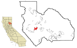
Coordinates: 39°56′13″N 121°3′43″W / 39.93694°N 121.06194°WCoordinates: 39°56′13″N 121°3′43″W / 39.93694°N 121.06194°W Country  United States
State  California
County Plumas Area[1] – Total 8.520 sq mi (22.066 km2) – Land 8.520 sq mi (22.066 km2) – Water 0 sq mi (0 km2) 0% Elevation 3,776 ft (1,151 m) Population (2010) – Total 464 – Density 54.5/sq mi (21/km2) Time zone Pacific (PST) (UTC-8) – Summer (DST) PDT (UTC-7) ZIP code 95956 Area code(s) 530 FIPS code 06-46618 GNIS feature ID 1659096 Meadow Valley is a census-designated place (CDP) in Plumas County, California, United States. The population was 464 at the 2010 census, down from 575 at the 2000 census.
Contents
Geography
Meadow Valley is located at 39°56′13″N 121°3′43″W / 39.93694°N 121.06194°W (39.936921, -121.062051)[2].
According to the United States Census Bureau, the CDP has a total area of 8.5 square miles (22 km2), all of it land.
Demographics
2010
The 2010 United States Census[3] reported that Meadow Valley had a population of 464. The population density was 54.5 people per square mile (21.0/km²). The racial makeup of Meadow Valley was 435 (93.8%) White, 0 (0.0%) African American, 13 (2.8%) Native American, 0 (0.0%) Asian, 0 (0.0%) Pacific Islander, 4 (0.9%) from other races, and 12 (2.6%) from two or more races. Hispanic or Latino of any race were 21 persons (4.5%).
The Census reported that 464 people (100% of the population) lived in households, 0 (0%) lived in non-institutionalized group quarters, and 0 (0%) were institutionalized.
There were 231 households, out of which 41 (17.7%) had children under the age of 18 living in them, 115 (49.8%) were opposite-sex married couples living together, 7 (3.0%) had a female householder with no husband present, 5 (2.2%) had a male householder with no wife present. There were 15 (6.5%) unmarried opposite-sex partnerships, and 0 (0%) same-sex married couples or partnerships. 82 households (35.5%) were made up of individuals and 39 (16.9%) had someone living alone who was 65 years of age or older. The average household size was 2.01. There were 127 families (55.0% of all households); the average family size was 2.62.
The population was spread out with 62 people (13.4%) under the age of 18, 25 people (5.4%) aged 18 to 24, 84 people (18.1%) aged 25 to 44, 201 people (43.3%) aged 45 to 64, and 92 people (19.8%) who were 65 years of age or older. The median age was 52.4 years. For every 100 females there were 106.2 males. For every 100 females age 18 and over, there were 104.1 males.
There were 304 housing units at an average density of 35.7 per square mile (13.8/km²), of which 171 (74.0%) were owner-occupied, and 60 (26.0%) were occupied by renters. The homeowner vacancy rate was 3.4%; the rental vacancy rate was 3.2%. 351 people (75.6% of the population) lived in owner-occupied housing units and 113 people (24.4%) lived in rental housing units.
2000
As of the census[4] of 2000, there were 575 people, 263 households, and 173 families residing in the CDP. The population density was 67.8 people per square mile (26.1/km²). There were 311 housing units at an average density of 36.6 per square mile (14.1/km²). The racial makeup of the CDP was 94.26% White, 0.17% African American, 3.13% Native American, 0.17% Asian, 0.70% from other races, and 1.57% from two or more races. Hispanic or Latino of any race were 4.17% of the population.
There were 263 households out of which 25.9% had children under the age of 18 living with them, 55.5% were married couples living together, 6.8% had a female householder with no husband present, and 34.2% were non-families. 28.1% of all households were made up of individuals and 10.3% had someone living alone who was 65 years of age or older. The average household size was 2.19 and the average family size was 2.66.
In the CDP the population was spread out with 21.2% under the age of 18, 5.0% from 18 to 24, 25.4% from 25 to 44, 33.4% from 45 to 64, and 15.0% who were 65 years of age or older. The median age was 44 years. For every 100 females there were 113.0 males. For every 100 females age 18 and over, there were 106.8 males.
The median income for a household in the CDP was $33,571, and the median income for a family was $45,469. Males had a median income of $40,000 versus $30,667 for females. The per capita income for the CDP was $19,726. About 10.6% of families and 11.5% of the population were below the poverty line, including 9.8% of those under age 18 and 9.0% of those age 65 or over.
Media
The primary local news source is the Feather River Bulletin, a newspaper published every Wednesday.
Politics
In the state legislature Meadow Valley is located in the 1st Senate District, represented by Republican Dave Cox, and in the 3rd Assembly District, represented by Republican Dan Louge. Federally, Meadow Valley is located in California's 4th congressional district, which has a Cook PVI of R +11[5] and is represented by Republican John Doolittle.
References
- ^ U.S. Census
- ^ "US Gazetteer files: 2010, 2000, and 1990". United States Census Bureau. 2011-02-12. http://www.census.gov/geo/www/gazetteer/gazette.html. Retrieved 2011-04-23.
- ^ All data are derived from the United States Census Bureau reports from the 2010 United States Census, and are accessible on-line here. The data on unmarried partnerships and same-sex married couples are from the Census report DEC_10_SF1_PCT15. All other housing and population data are from Census report DEC_10_DP_DPDP1. Both reports are viewable online or downloadable in a zip file containing a comma-delimited data file. The area data, from which densities are calculated, are available on-line here. Percentage totals may not add to 100% due to rounding. The Census Bureau defines families as a household containing one or more people related to the householder by birth, opposite-sex marriage, or adoption. People living in group quarters are tabulated by the Census Bureau as neither owners nor renters. For further details, see the text files accompanying the data files containing the Census reports mentioned above.
- ^ "American FactFinder". United States Census Bureau. http://factfinder.census.gov. Retrieved 2008-01-31.
- ^ "Will Gerrymandered Districts Stem the Wave of Voter Unrest?". Campaign Legal Center Blog. http://www.clcblog.org/blog_item-85.html. Retrieved 2007-10-20.
Municipalities and communities of Plumas County, California City 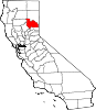
CDPs Almanor | Beckwourth | Belden | Blairsden | Bucks Lake | C-Road | Canyondam | Caribou | Chester | Chilcoot-Vinton | Clio | Crescent Mills | Cromberg | Delleker | East Quincy | East Shore | Gold Mountain | Graeagle | Greenhorn | Greenville | Hamilton Branch | Indian Falls | Iron Horse | Johnsville | Keddie | La Porte | Lake Almanor Country Club | Lake Almanor Peninsula | Lake Almanor West | Lake Davis | Little Grass Valley | Mabie | Meadow Valley | Mohawk Vista | Paxton | Plumas Eureka | Prattville | Quincy | Spring Garden | Storrie | Taylorsville | Tobin | Twain | Valley Ranch | Warner Valley | Whitehawk
Unincorporated
communitiesBuckeye | Cascade | Cedar Mill | Chilcoot | Drakesbad | Feather River Inn | Feather River Park | Five Points | Foxwood | Genesee | Grays Flat | Hawley | Hot Springs | Longville | Massack | Merlin | Moccasin | Mohawk | Quincy Junction | Rock Creek | Rock Creek Camp | Rock Crest | Rodgers Flat | Seneca | Sloat | Spanish Ranch | Two Rivers | Vinton | Virgilia
Ghost towns Argentine | Bells Bar | Bontes | Chases | China Gulch | Crow | Delaney | Dentens | Dutch Hill | Edmanton | English Bar | Hartwell | Hindu | Hopnomkoyo | Jamison | Keep | Kerby | Kettle | Kotasi | Little Jamison | Lovejoy | Nakankoyo | Richmond Hill | Round Valley | Silver Creek | Squirrel Creek | Summit | Tasikoyo | Walkermine | Wonderland
Categories:- Census-designated places in Plumas County, California


Wikimedia Foundation. 2010.