- Spring Garden, California
Infobox Settlement
official_name = Spring Garden, California
settlement_type = CDP
imagesize =
image_caption =
image_
imagesize =
image_caption =
image_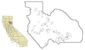
mapsize = 250x200px
map_caption = Location in Plumas County and the state ofCalifornia
mapsize1 =
map_caption1 =
subdivision_type = Country
subdivision_type1 = State
subdivision_type2 = County
subdivision_name =United States
subdivision_name1 =California
subdivision_name2 = Plumas
government_type =
leader_title =
leader_name =
established_date =
area_magnitude =
area_total_km2 = 1.7
area_total_sq_mi = 0.6
area_land_km2 = 1.7
area_land_sq_mi = 0.6
area_water_km2 = 0
area_water_sq_mi = 0
elevation_ft = 3999
elevation_m = 1219
population_as_of = 2000
population_footnotes =
population_total = 55
population_metro =
population_density_km2 = 32.4
population_density_sq_mi = 91.7
timezone = Pacific (PST)
utc_offset = -8
latd = 39 |latm = 54 |lats = 25 |latNS = N
longd = 120 |longm = 47 |longs = 49 |longEW = W
timezone_DST = PDT
utc_offset_DST = -7
postal_code_type =ZIP code
postal_code = 95971
area_code = 530
blank_name = FIPS code
blank_info = 06-73654
blank1_name = GNIS feature ID
blank1_info = 1659845
footnotes =
website =Spring Garden is a
census-designated place (CDP) in Plumas County,California ,United States . The population was 55 at the 2000 census.Geography
Spring Garden is located at coor dms|39|54|25|N|120|47|49|W|city (39.907076, -120.796812)GR|1.
According to the
United States Census Bureau , the CDP has a total area of 0.6square mile s (1.7km² ), all of it land.Demographics
As of the
census GR|2 of 2000, there were 55 people, 23 households, and 14 families residing in the CDP. Thepopulation density was 85.3 people per square mile (33.2/km²). There were 26 housing units at an average density of 40.3/sq mi (15.7/km²). The racial makeup of the CDP was 100.00% White. Hispanic or Latino of any race were 3.64% of the population.There were 23 households out of which 17.4% had children under the age of 18 living with them, 47.8% were married couples living together, 8.7% had a female householder with no husband present, and 39.1% were non-families. 34.8% of all households were made up of individuals and 13.0% had someone living alone who was 65 years of age or older. The average household size was 2.39 and the average family size was 2.93.
In the CDP the population was spread out with 23.6% under the age of 18, 3.6% from 18 to 24, 18.2% from 25 to 44, 43.6% from 45 to 64, and 10.9% who were 65 years of age or older. The median age was 46 years. For every 100 females there were 96.4 males. For every 100 females age 18 and over, there were 133.3 males.
The median income for a household in the CDP was $30,179, and the median income for a family was $30,179. Males had a median income of $0 versus $21,250 for females. The
per capita income for the CDP was $12,062. None of the population and none of the families were below thepoverty line .Media
The primary local news source is the [http://www.plumasnews.com Feather River Bulletin] , a newspaper published every Wednesday.
Politics
In the state legislature Spring Garden is located in the 1st Senate District, represented by Republican
Dave Cox , and in the 3rd Assembly District, represented by RepublicanRick Keene . Federally, Spring Garden is located inCalifornia's 4th congressional district , which has a Cook PVI of R +11 [cite web | title = Will Gerrymandered Districts Stem the Wave of Voter Unrest? | publisher = Campaign Legal Center Blog | url=http://www.clcblog.org/blog_item-85.html | accessdate = 2007-10-20] and is represented by RepublicanJohn Doolittle .References
External links
Wikimedia Foundation. 2010.