- Moccasin, Plumas County, California
-
Moccasin — Unincorporated community — Location in California
 Moccasin
Coordinates: 40°04′37″N 120°56′11″W / 40.07694°N 120.93639°WCoordinates: 40°04′37″N 120°56′11″W / 40.07694°N 120.93639°W Country  United States
State  California
County Plumas County Elevation[1] 3,517 ft (1,072 m) Moccasin is an unincorporated community in Plumas County, California.[1] It lies at an elevation of 3517 feet (1072 m).[1] Moccasin is located on the Western Pacific Railroad, 2.25 miles (3.6 km) southwest of Crescent Mills.[2]
References
Municipalities and communities of Plumas County, California City 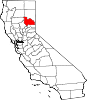
CDPs Almanor | Beckwourth | Belden | Blairsden | Bucks Lake | C-Road | Canyondam | Caribou | Chester | Chilcoot-Vinton | Clio | Crescent Mills | Cromberg | Delleker | East Quincy | East Shore | Gold Mountain | Graeagle | Greenhorn | Greenville | Hamilton Branch | Indian Falls | Iron Horse | Johnsville | Keddie | La Porte | Lake Almanor Country Club | Lake Almanor Peninsula | Lake Almanor West | Lake Davis | Little Grass Valley | Mabie | Meadow Valley | Mohawk Vista | Paxton | Plumas Eureka | Prattville | Quincy | Spring Garden | Storrie | Taylorsville | Tobin | Twain | Valley Ranch | Warner Valley | Whitehawk
Unincorporated
communitiesBuckeye | Cascade | Cedar Mill | Chilcoot | Drakesbad | Feather River Inn | Feather River Park | Five Points | Foxwood | Genesee | Grays Flat | Hawley | Hot Springs | Longville | Massack | Merlin | Moccasin | Mohawk | Quincy Junction | Rock Creek | Rock Creek Camp | Rock Crest | Rodgers Flat | Seneca | Sloat | Spanish Ranch | Two Rivers | Vinton | Virgilia
Ghost towns Argentine | Bells Bar | Bontes | Chases | China Gulch | Crow | Delaney | Dentens | Dutch Hill | Edmanton | English Bar | Hartwell | Hindu | Hopnomkoyo | Jamison | Keep | Kerby | Kettle | Kotasi | Little Jamison | Lovejoy | Nakankoyo | Richmond Hill | Round Valley | Silver Creek | Squirrel Creek | Summit | Tasikoyo | Walkermine | Wonderland
Categories:- Populated places in Plumas County, California
- Unincorporated communities in California
- Shasta Cascade geography stubs


Wikimedia Foundation. 2010.