- Beckwourth, California
Infobox Settlement
official_name = Beckwourth, California
settlement_type = CDP
imagesize =
image_caption =
image_
imagesize =
image_caption =
image_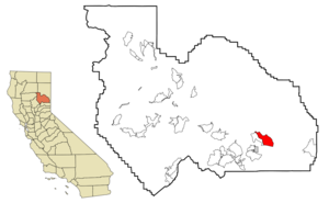
mapsize = 250x200px
map_caption = Location in Plumas County and the state ofCalifornia
mapsize1 =
map_caption1 =
subdivision_type = Country
subdivision_type1 = State
subdivision_type2 = County
subdivision_name =United States
subdivision_name1 =California
subdivision_name2 = Plumas
government_type =
leader_title =
leader_name =
established_date =
area_magnitude =
area_total_km2 = 30.2
area_total_sq_mi = 11.7
area_land_km2 = 30.2
area_land_sq_mi = 11.7
area_water_km2 = 0
area_water_sq_mi = 0
elevation_ft = 4911
elevation_m = 1497
population_as_of = 2000
population_footnotes =
population_total = 342
population_metro =
population_density_km2 = 11.3
population_density_sq_mi = 29.2
timezone = Pacific (PST)
utc_offset = -8
latd = 39 |latm = 49 |lats = 39 |latNS = N
longd = 120 |longm = 24 |longs = 13 |longEW = W
timezone_DST = PDT
utc_offset_DST = -7
postal_code_type =ZIP code
postal_code = 96129
area_code = 530
blank_name = FIPS code
blank_info = 06-04772
blank1_name = GNIS feature ID
blank1_info = 1658022
footnotes =
website =Beckwourth is a
census-designated place (CDP) in Plumas County,California ,United States . The population was 342 at the 2000 census. According to the USGS National Geographic Names Database, a variant spelling was Beckwith and its name comes from an early explorer who had changed his name from Beckwith to Beckwourth:Named for James P. Beckwourth (d.1867), adventurer, trapper, and trail blazer who discovered
Beckwourth Pass in 1851. Beckwourth built the first house in the Sierra Valley where he operated an inn and trading post. During the 1850's,Beckwourth Pass was the portal of an immigrant route into California through Lassen, Plumas, Butte and Yuba counties known as the Beckwourth Trail.Geography
Beckwourth is located at coor dms|39|49|39|N|120|24|13|W|city (39.827528, -120.403710)GR|1.
According to the
United States Census Bureau , the CDP has a total area of 11.7 square miles (30.3 km²), all of it land.Nervino Airport (FAA identifier: O02 or "oh-zero-two") is plotted three quarters of a mile east of Beckwourth along State Route 70 on the Reconnaissance Peak, California 7.5 minute quadrangle. It has a convert|4600|ft|m|sing=on runway and is located at coor dms|39|49|05|N|120|21|20|W. [US Geological Survey, Reconnaissance Peak, California, 7.5 minute quadrangle, 1994.] The US Geological Survey says variant names for the airport are "Beckwourth Airport" and "Plumas County Airport". [ US Geological Survey, National Geographic Names Database.]
State facilities in the town may include a State of California, Department of Water Resources maintenance yard and a Caltrans Maintenance Station. These appear to be collocated, (at the same site).
Demographics
As of the
census GR|2 of 2000, there were 342 people, 147 households, and 108 families residing in the CDP. Thepopulation density was 29.3 people per square mile (11.3/km²). There were 225 housing units at an average density of 19.3/sq mi (7.4/km²). The racial makeup of the CDP was 93.86% White, 2.05% Native American, 0.88% Pacific Islander, 1.46% from other races, and 1.75% from two or more races. 2.92% of the population were Hispanic or Latino of any race.There were 147 households out of which 23.8% had children under the age of 18 living with them, 66.0% were married couples living together, 5.4% had a female householder with no husband present, and 25.9% were non-families. 19.7% of all households were made up of individuals and 10.9% had someone living alone who was 65 years of age or older. The average household size was 2.33 and the average family size was 2.67.
In the CDP the population was spread out with 19.0% under the age of 18, 3.5% from 18 to 24, 21.3% from 25 to 44, 33.6% from 45 to 64, and 22.5% who were 65 years of age or older. The median age was 48 years. For every 100 females there were 94.3 males. For every 100 females age 18 and over, there were 100.7 males.
The median income for a household in the CDP was $47,813, and the median income for a family was $52,031. Males had a median income of $49,219 versus $31,250 for females. The
per capita income for the CDP was $16,928. None of the families and 2.8% of the population were living below thepoverty line , including no under eighteens and 4.8% of those over 64.Media
Local news sources are the [http://www.plumasnews.com Portola Reporter] and the Sierra Booster.
Politics
In the state legislature Beckwourth is located in the 1st Senate District, represented by Republican
Dave Cox , and in the 3rd Assembly District, represented by RepublicanRick Keene . Federally, Beckwourth is located inCalifornia's 4th congressional district , which has a Cook PVI of R +11 [cite web | title = Will Gerrymandered Districts Stem the Wave of Voter Unrest? | publisher = Campaign Legal Center Blog | url=http://www.clcblog.org/blog_item-85.html | accessdate = 2007-10-20] and is represented by RepublicanJohn Doolittle .References
ee also
*
Beckwourth Pass
*State Route 70
*Hallelujah Junction, California
*Loyalton, California
*Plumas National Forest
*Portola, California
*Vinton, California External links
* [http://hotels-california.org/city/California_Plumas_County_Beckwourth_hotel.php Hotels]
Wikimedia Foundation. 2010.