- Concho County, Texas
-
Concho County, Texas 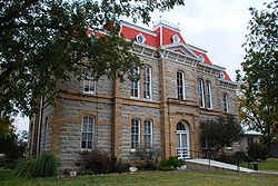
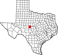
Location in the state of Texas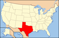
Texas's location in the U.S.Founded 1858 Seat Paint Rock Area
- Total
- Land
- Water
994 sq mi (2,574 km²)
991 sq mi (2,567 km²)
3 sq mi (8 km²), 0.22%Population
- (2000)
- Density
3,966
5/sq mi (2/km²)Website www.co.concho.tx.us 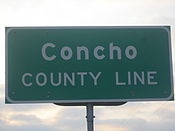 Concho County marker
Concho County is a county located on the Edwards Plateau in the U.S. state of Texas. The population was 3,966 at the 2000 census. Concho was founded in 1858. Its county seat is Paint Rock.[1] Concho is named for the Concho River.
Contents
History Timeline
- 8000 BC – 1800’s Paleo-Indians in the county leave behind archealogical remains of a burned-rock midden. Athabascan-speaking Indians associated with the prehorse Plains culture live in this part of Texas. Later native inhabitants include Jumano, Tonkawa, Comanche and Lipan Apache.[2]
- 1847 John O. Meusebach sends surveyors into the area.[2]
- 1849 Robert Simpson Neighbors leads a small expedition through the area.[2]
- 1858 The legislature forms Concho County from Bexar County.[2]
- 1874 Ranald S. Mackenzie campaign to drive out remaining Indians establishes the Mackenzie Trail.[2]
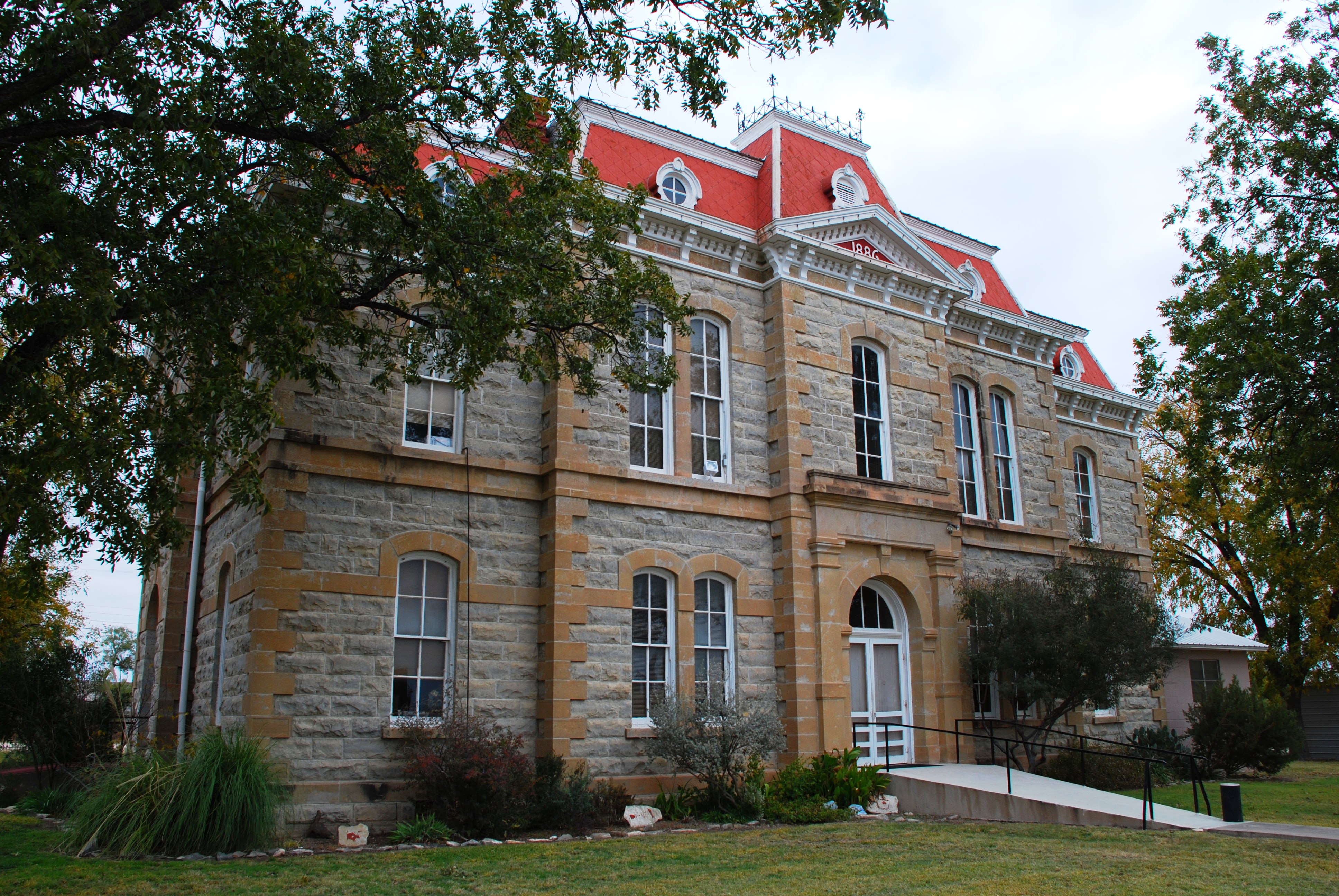
- 1879 The county is organized. The county seat is named Paint Rock after the nearby pictographs.[3]
- 1882 Eden community is established.[4]
- 1909 Lowake community is established.[5]
- 1910 The Concho, San Saba and Llano Valley railroad is completed to Paint Rock.[2]
- 1911 The Fort Worth and Rio Grande Railway is completed across the southeastern corner of the county.[2]
- 1912 The Gulf, Colorado and Santa Fe railroad finishes a line to Eden.[2]
- 1930 - 449 farms are operated by owners and 682 by tenants, of whom 619 are sharecropping.[2]
- 1940 Concho County becomes part of a soil-conservation district.[2]
- 1970 Over 100 Czechs reside in the vicinity of Eola.[6]
- 1985 Texas Water Commission grants permission to impound 554,000 acre feet (683,000,000 m3) of water on the Colorado River at Stacy, to create the O. H. Ivie Reservoir.[7]
- 1988 Concho County is the leading sheep-producing county in Texas.[2]
Geography
According to the U.S. Census Bureau, the county has a total area of 994 square miles (2,574.4 km2), of which 991 square miles (2,566.7 km2) is land and 3 square miles (7.8 km2) (0.22%) is water.
Major highways
 U.S. Highway 87
 U.S. Highway 83
 State Highway 153
 State Highway 206
Adjacent counties
- Runnels County (north)
- Coleman County (northeast)
- McCulloch County (east)
- Menard County (south)
- Tom Green County (west)
Demographics
As of the census[8] of 2000, there were 3,966 people, 1,058 households, and 757 families residing in the county. The population density was 4 people per square mile (2/km²). There were 1,488 housing units at an average density of 2 per square mile (1/km²). The racial makeup of the county was 88.20% White, 0.98% Black or African American, 0.48% Native American, 0.08% Asian, 0.10% Pacific Islander, 8.93% from other races, and 1.24% from two or more races. 41.33% of the population were Hispanic or Latino of any race.
There were 1,058 households out of which 29.80% had children under the age of 18 living with them, 59.40% were married couples living together, 9.70% had a female householder with no husband present, and 28.40% were non-families. 26.60% of all households were made up of individuals and 14.20% had someone living alone who was 65 years of age or older. The average household size was 2.45 and the average family size was 2.97.
In the county, the population was spread out with 16.10% under the age of 18, 10.40% from 18 to 24, 38.20% from 25 to 44, 21.50% from 45 to 64, and 13.80% who were 65 years of age or older. The median age was 36 years. For every 100 females there were 181.30 males. For every 100 females age 18 and over, there were 209.90 males.
The median income for a household in the county was $31,313, and the median income for a family was $36,894. Males had a median income of $20,750 versus $21,458 for females. The per capita income for the county was $15,727. About 7.50% of families and 11.90% of the population were below the poverty line, including 15.80% of those under age 18 and 14.20% of those age 65 or over.
Cities and towns
See also
References
- ^ "Find a County". National Association of Counties. http://www.naco.org/Counties/Pages/FindACounty.aspx. Retrieved 2011-06-07.
- ^ a b c d e f g h i j k Standifer, Mary M. "Concho County, Texas". Handbook of Texas Online. Texas State Historical Association. http://www.tshaonline.org/handbook/online/articles/hcc21. Retrieved 30 November 2010.
- ^ "Paint Rock Pictographs". Texas Beyond History. http://www.texasbeyondhistory.net/plateaus/images/he4.html. Retrieved 30 November 2010.
- ^ "Eden, Texas". Texas Escapes. Texas Escapes - Blueprints For Travel, LLC. http://www.texasescapes.com/TexasPanhandleTowns/EdenTexas/EdenTexas.htm. Retrieved 30 November 2010.
- ^ "Lowake, Texas". Texas Escapes. Texas Escapes - Blueprints For Travel, LLC. http://www.texasescapes.com/TexasTowns/LowakeTexas/LowakeTexas.htm. Retrieved 30 November 2010.
- ^ "Eola, Texas". Texas Escapes. Texas Escapes - Blueprints For Travel, LLC. http://www.texasescapes.com/TexasTowns/Eola-Texas.htm. Retrieved 30 November 2010.
- ^ "O. H. Ivie Reservoir". Handbook of Texas Online. Texas State Historical Association. http://www.tshaonline.org/handbook/online/articles/roogh. Retrieved 30 November 2010.
- ^ "American FactFinder". United States Census Bureau. http://factfinder.census.gov. Retrieved 2008-01-31.
External links
- Concho County government’s website
- Concho County in Handbook of Texas Online at the University of Texas

Runnels County Coleman County Tom Green County 
McCulloch County  Concho County, Texas

Menard County Municipalities and communities of Concho County, Texas Towns 
Unincorporated
communitiesEola | Lowake | Millersview
Categories:- Texas counties
- Concho County, Texas
- 1858 establishments in the United States


Wikimedia Foundation. 2010.