- Coombe, Bude
-
For other settlements in Cornwall named Coombe, see Coombe, Cornwall (disambiguation).
Coordinates: 50°52′39″N 4°32′51″W / 50.8776°N 4.5476°W
Coombe Cornish: Komm 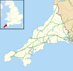
 Coombe
Coombe shown within CornwallOS grid reference SS209118 Parish Morwenstow Unitary authority Cornwall Ceremonial county Cornwall Region South West Country England Sovereign state United Kingdom Post town BUDE Postcode district EX23 Dialling code 01288 Police Devon and Cornwall Fire Cornwall Ambulance South Western EU Parliament South West England UK Parliament North Cornwall List of places: UK • England • Cornwall Coombe (Cornish: Komm) is a hamlet in northeast Cornwall, United Kingdom.[1]
Combe is situated in the civil parish of Morwenstow three miles (5 km) north of Bude. Most houses in the settlement are owned by the Landmark Trust[2]
Coombe Mill
Coombe Mill, a disused mill built on 4 levels, lies at the bottom of Coombe Valley. It is a Site of Special Scientific Interest, noted for its various species of bat that inhabit the mill's buildings.[3]
References
- ^ Ordnance Survey: Landranger map sheet 190 Bude & Clovelly ISBN 9780319231456
- ^ Landmark Trust website, Featured buildings, Coombe
- ^ "Coombe Mill". Natural England. 2000. http://www.sssi.naturalengland.org.uk/citation/citation_photo/2000394.pdf. Retrieved 26 October 2011.
External links
 Media related to Landmark Trust properties at Wikimedia Commons
Geography of Cornwall Cornwall Portal Unitary authorities Major settlements Bodmin • Bude • Callington • Camborne • Camelford • Falmouth • Fowey • Hayle • Helston • Launceston • Liskeard • Looe • Lostwithiel • Marazion • Newlyn • Newquay • Padstow • Par • Penryn • Penzance • Porthleven • Redruth • Saltash • St Austell • St Blazey • St Columb Major • St Ives • St Just-in-Penwith • St Mawes • Stratton • Torpoint • Truro • Wadebridge
See also: Civil parishes in CornwallRivers Topics History • Status debate • Flag • Culture • Places • People • The Duchy • Diocese • Politics • Hundreds/shires • Places of interest • full list...Categories:- Villages in Cornwall
- Populated coastal places in Cornwall
- Sites of Special Scientific Interest in Cornwall
- Cornwall geography stubs

Wikimedia Foundation. 2010.