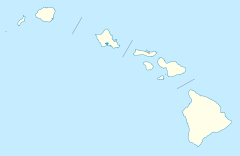
- Opana Radar Site
-
Opana Radar Site
Location: Kawela Bay, Hawaii Coordinates: 21°41′8″N 158°0′36″W / 21.68556°N 158.01°WCoordinates: 21°41′8″N 158°0′36″W / 21.68556°N 158.01°W Built: 1941[2] Governing body: US Navy NRHP Reference#: 91001379 [1] Significant dates Added to NRHP: September 19, 1991 Designated NHL: April 19, 1984[3] The Opana Radar Site is a National Historic Landmark and IEEE Milestone that commemorates the first operational use of radar by the United States in wartime, during the attack on Pearl Harbor.[3][4] It is located off the Kamehameha Highway just inland from the north shore of Oahu, Hawaii, south of Kawela Bay.[5] It is not open to the public.
Contents
History
In December 1939, the U.S. military established an Aircraft Warning Service (AWS) using radar to defend American territory. It employed the SCR-270 radar, the first United States long-range search radar created at the Signal Corps laboratories at Fort Monmouth, New Jersey, circa 1937. The radar's operating frequency was 106 megacycles, with a maximum range of 150 miles, or greater if the equipment was at an elevated site, and was suitable for detecting aircraft propellers.
Under the command of Col. Wilfred H. Tetley the AWS established six mobile radar detector sets in Hawaii at Kawaiola, Wainae, Kaawa, Kokohead, Schofield Barracks, and Fort Shafter. On Thanksgiving Day in 1941, the Schofield Barracks radar set was moved to the Opana Radar Site, a location 532 feet above sea level with unobstructed view of the Pacific Ocean. The set comprised four trucks carrying the transmitter, modulator, water cooler, receiver, oscilloscope, operator, generator and antenna.
Attack on Pearl Harbor
On December 7, 1941, the Opana Radar Site was manned by Private Joseph L. Lockard and Private George Elliot, who detected approaching aircraft at 7:02am (past the end of the site's scheduled operating day) since the truck to take them to breakfast was late the pair continuined to practice with the radar equipment. [6]
The men reported their findings to the temporary information center at Fort Shafter. The information center staff had gone to breakfast and Lt. Kermit Tyler, who died January 23, 2010, aged 96,[7] received the report. Tyler reasoned that the activity was a flight of Army B-17 Flying Fortress bombers scheduled to arrive at that morning and advised the radar crew not to worry. Elliot and Lockard continued plotting the incoming planes until 7:40 when contact was lost. Shortly before 8:00 AM they headed to Kawailoa for breakfast and only learned about the attack when they arrived. Elliot and Lockard rushed back to Opana and operated the radar until the attack ended.
Today
Today, a modern Navy telecommunications station occupies the top of the Opana Hill adjacent to the site. Since the 1941 radar was a mobile, there is no physical evidence of the historic unit at the site.[8] There is a commemorative plaque on the grounds of the Turtle Bay Resort at the foot of Opana Hill.
See also
References
- ^ "National Register Information System". National Register of Historic Places. National Park Service. 2007-01-23. http://nrhp.focus.nps.gov/natreg/docs/All_Data.html.
- ^ NHL Summary[dead link]
- ^ a b "Opana Radar Site". National Historic Landmark summary listing. National Park Service. http://tps.cr.nps.gov/nhl/detail.cfm?ResourceId=2108&ResourceType=Site. Retrieved 2008-07-04.
- ^ "Milestones:Opana Radar Site, 1941". IEEE Global History Network. IEEE. http://www.ieeeghn.org/wiki/index.php/Milestones:Opana_Radar_Site,_1941. Retrieved 03 August 2011.
- ^ The National Register system lists it at or near Kawela, Hawaii, which is more commonly used as the name of a different location on Maui Island.
- ^ Interview with Warrant Officer Robert S. McMurtrie,attached to Early Warning Radar and a top sergant at Schofield barracks radar operations during WWII. Then private McMurtrie recalls that Radar was top secret at the time and radar, and ones efforts went largely unrecognized. Radar units were also conspicuously using large amounts of fuel relative to the motorpool's supply. McMurtrie recalls reading an order by General Short specifying that the sites were to shut down from dawn to dusk to conserve fuel. McMurtrie also notes that the Army was also poorly prepared to mount an defensive air response, even with advance warning, as the only planes at the that allowed to be fully armed were planes flying out of Haleiwa to practice live fire missions on Kahoolawe.
- ^ "The Times obituary Kermit Tyler". The Times (London). 2010-02-27. http://www.timesonline.co.uk/tol/comment/obituaries/article7042650.ece. Retrieved 2010-05-20.
- ^ Harry A. Butowsky (March 10, 1993). "Opana Radar Site nomination form". National Historic Landmark program. National Park Service. http://pdfhost.focus.nps.gov/docs/NHLS/Text/91001379.pdf. Retrieved November 6, 2010.
External links
- Aviation: From Sand Dunes to Sonic Booms, a National Park Service Discover Our Shared Heritage Travel Itinerary
- IEEE History Center: Opana Radar Center
U.S. National Register of Historic Places Topics Lists by states Alabama • Alaska • Arizona • Arkansas • California • Colorado • Connecticut • Delaware • Florida • Georgia • Hawaii • Idaho • Illinois • Indiana • Iowa • Kansas • Kentucky • Louisiana • Maine • Maryland • Massachusetts • Michigan • Minnesota • Mississippi • Missouri • Montana • Nebraska • Nevada • New Hampshire • New Jersey • New Mexico • New York • North Carolina • North Dakota • Ohio • Oklahoma • Oregon • Pennsylvania • Rhode Island • South Carolina • South Dakota • Tennessee • Texas • Utah • Vermont • Virginia • Washington • West Virginia • Wisconsin • WyomingLists by territories Lists by associated states Other Categories:- NRHP articles with dead external links
- National Historic Landmarks in Hawaii
- World War II radars
Wikimedia Foundation. 2010.

