- Mount Rogers National Recreation Area
-
Mount Rogers National Recreation Area Part of Jefferson National Forest National Recreation Area 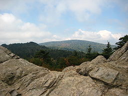
Country United States State Virginia Counties Grayson, Smyth, Washington, Wythe, Carroll Location Elk Garden - elevation 4,475 ft (1,364 m) - coordinates 36°38′46″N 81°34′58″W / 36.64611°N 81.58278°W Highest point Mount Rogers - location southwest of Troutdale - elevation 5,729 ft (1,746.2 m) - coordinates 36°39′35″N 81°32′41″W / 36.65972°N 81.54472°W Area 154,816 acres (62,651.8 ha) Established 1966-05-31 Management George Washington and Jefferson National Forests Owner US Forest Service IUCN category V - Protected Landscape/Seascape Nearest city Abingdon, Virginia 
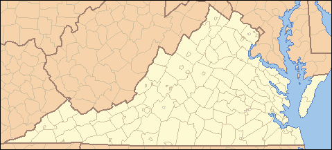
 Location of Mount Rogers National Recreation Area in Virginia
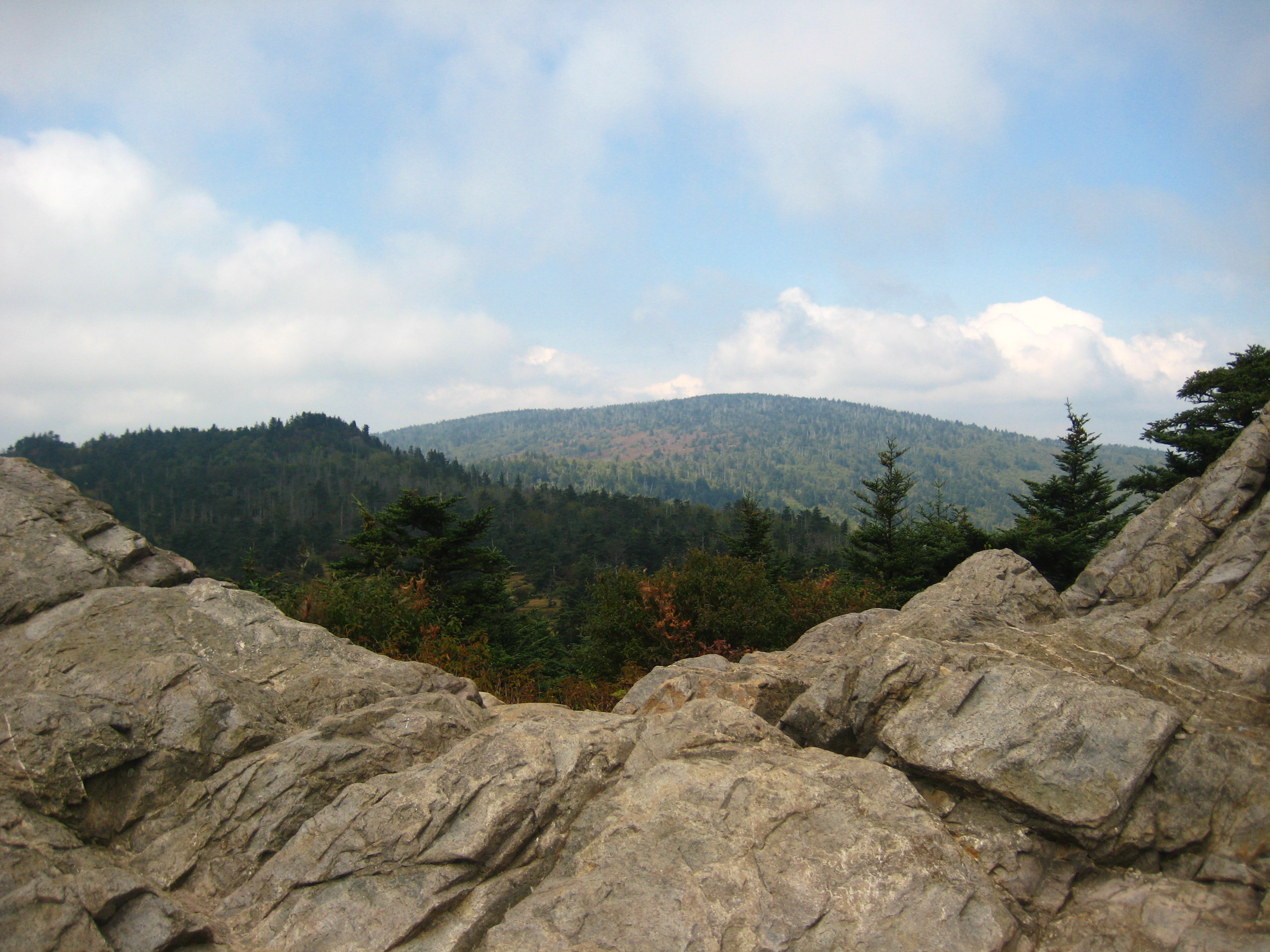
Wikimedia Commons: Mount Rogers National Recreation Area Website: Mount Rogers National Recreation Area Mount Rogers National Recreation Area is a United States National Recreation Area located in southwestern Virginia near the border with Tennessee and North Carolina. The centerpiece of the recreation area is Mount Rogers, the highest point in the state of Virginia with a summit elevation of 5,729 feet (1746 m). Most of the recreation area is under the jurisdiction of the George Washington and Jefferson National Forests, except for a 5,000 acres (20 km2) section near Mount Rogers that is managed by Grayson Highlands State Park. The recreation area was established by an act of the United States Congress on May 31, 1966.
Contents
Hiking
There are nearly 500 miles (800 kilometers) of hiking trails within Mount Rogers NRA making it one of the premier hiking hotspots in the Appalachian Mountains. Some of the trails in Mount Rogers NRA include:
- A 78 mile (124.8 kilometer) segment of the Appalachian Trail. The Appalachian Trail itself does not reach the summit of Mount Rogers but rather passes about a half mile below it. A short spur trail leads hikers to the summit. As along the entire Appalachian Trail, there are several shelters for thru-hikers along this section of the trail.
- The shortest route to the summit of Mount Rogers is a 4.5-mile (7.2 km) hike from either Grayson Highlands State Park or from State Route 600 at Elk Garden.
Wilderness
There are two federally designated wilderness areas in Mount Rogers NRA:
- Lewis Fork Wilderness
- Little Wilson Creek Wilderness
Together, these two wilderness areas comprise about 10,000 acres (40.47 km²) of forest.
Other activities
- Camping: There are seven campgrounds, four horse camps, and two rental cabins in the recreation area.
- Horseback riding
- Hunting
- Fishing
- Mountain biking
External links
National Recreation Areas of the United States Administered by the
National Park ServiceAmistad • Big South Fork • Bighorn Canyon • Boston Harbor Islands • Chattahoochee River • Chickasaw • Curecanti • Delaware Water Gap • Gateway • Gauley River • Glen Canyon • Golden Gate • Lake Chelan • Lake Mead • Lake Meredith • Lake Roosevelt • Mississippi • Ross Lake • Santa Monica Mountains • Whiskeytown-Shasta-TrinityAdministered by
other agenciesAllegheny • Angel Peak • Arapaho • Datil Well • Flaming Gorge • Grand Island • Hells Canyon • Land Between The Lakes • Moosalamoo • Mount Baker • Mount Rogers • Oregon Dunes • Orilla Verde • Pine Ridge • Rattlesnake • Sawtooth • Smith River • Spring Mountains • Spruce Knob-Seneca Rocks • Valley of Fires • White Mountains • White Rocks • Wild Rivers • Winding Stair MountainCategories:- National Recreation Areas of the United States
- Protected areas of Virginia
- George Washington and Jefferson National Forests
- Protected areas of Carroll County, Virginia
- Protected areas of Grayson County, Virginia
- Protected areas of Smyth County, Virginia
- Protected areas of Washington County, Virginia
- Protected areas of Wythe County, Virginia
Wikimedia Foundation. 2010.