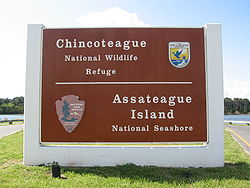
Chincoteague National Wildlife Refuge
- Chincoteague National Wildlife Refuge
-
Coordinates: 37°57′15″N 75°19′00″W / 37.95417°N 75.3166667°W / 37.95417; -75.3166667
The Chincoteague National Wildlife Refuge is a 14,000-acre (57 km2) wildlife preserve operated by the U.S. Fish & Wildlife Service. It is primarily located on the Virginia side of Assateague Island with portions (only about 3%) located on the Maryland side of the island as well as Morris Island and Wildcat Marsh. The refuge contains a large variety of wildlife animals and birds including the Chincoteague Pony.[1]
Other attractions within the refuge include:[1]
- Herbert H. Bateman Education & Administration Center
- Woodland Trail observation deck
- Assateague Lighthouse
- Beach Road
Gallery
See also
Notes
- ^ a b c d Chincoteague Chamber of Commerce. "Natural Attractions", Discover the Spirit of Chincoteague Island Virginia Visitor’s Guide 2008, 2008, p. 6 and 8.
External links
Categories: - Protected areas of Accomack County, Virginia
- National Wildlife Refuges in Maryland
- National Wildlife Refuges in Virginia
- Protected areas of Worcester County, Maryland
Wikimedia Foundation.
2010.
Look at other dictionaries:
Wallops Island National Wildlife Refuge — The Wallops Island National Wildlife Refuge is a National Wildlife Refuge located on Wallops Island, Virginia; the refuge was created on July 10, 1975, with the transfer of 373 acres of land from the National Aeronautics and Space Administration … Wikipedia
Nansemond National Wildlife Refuge — Coordinates: 36°49′02″N 76°33′00″W / 36.81722°N 76.55°W / 36.81722; 76.55 The Nansemond National Wildlife Refuge i … Wikipedia
Occoquan Bay National Wildlife Refuge — Coordinates: 38°38′39″N 77°14′09″W / 38.64417°N 77.23583°W / 38.64417; 77.23583 The Occoquan Bay National Wildlife … Wikipedia
Elizabeth Hartwell Mason Neck National Wildlife Refuge — Coordinates: 38°38′27″N 77°09′12″W / 38.64083°N 77.15333°W / 38.64083; 77.15333 Elizabeth Hartwell … Wikipedia
List of National Wildlife Refuges — As of 30 July 2007, there were 548 National Wildlife Refuges in each of the United States. Refuges that have boundaries in multiple states are listed only in the state where the main visitor entrance is located. The newest one made is the Rocky… … Wikipedia
Liste des National Wildlife Refuges des États-Unis — Au 30 juillet 2007, les États Unis d Amérique comptait 548 National Wildlife Refuges, ces refuges étant répartis dans tout le pays. Un des derniers créés se trouve dans les Rocky Flats au Colorado[1] Administration L administration… … Wikipédia en Français
Liste des national wildlife refuges des États-Unis — Au 30 juillet 2007, les États Unis d Amérique comptait 548 National Wildlife Refuges, ces refuges étant répartis dans tout le pays. Un des derniers créés se trouve dans les Rocky Flats au Colorado[1] Administration L administration… … Wikipédia en Français
List of National Wildlife Refuges of the United States — As of 30 July 2007, there were 548 National Wildlife Refuges in the United States. Refuges that have boundaries in multiple states are listed only in the state where the main visitor entrance is located. The newest one established is the Rocky… … Wikipedia
Liste der National Wildlife Refuges der Vereinigten Staaten — Zum 30. Juli 2007 gab es 548 National Wildlife Refuges in den Vereinigten Staaten. Refuges mit Anteilen in mehreren Bundesstaaten werden nur in den Staaten gelistet, in denen sich der Haupteingang für Besucher befindet. Das jüngste Refuge ist das … Deutsch Wikipedia
Chincoteague Pony — Distinguishing features Average 13.2 hh, all colors. Alternative names Assateague horse Country of origin United States … Wikipedia


