- Belle Isle State Park
Infobox_protected_area | name = Belle Isle State Park, Virginia, USA
iucn_category =
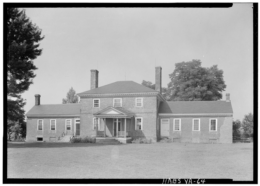
caption = 1930s photo of Belle Isle mansion by Thomas T. Waterman of Historic American Buildings Survey
locator_x =
locator_y =
location =
nearest_city =
lat_degrees =
lat_minutes =
lat_seconds =
lat_direction =
long_degrees =
long_minutes =
long_seconds =
long_direction =
area = 733 acres (2.97 km²)
established =
visitation_num =
visitation_year =
governing_body =Virginia Department of Conservation and Recreation Belle Isle State Park is located in
Lancaster County, Virginia on theRappahannock River . It sits in Lancaster County between Deep Creek and Morattico Creek and is currently under public ownership. The park has an area of convert|733|acre|km2 and has facilities for fishing, boating and picnics. While it is not an island, the park is surrounded byTidewater coastal marshes. Wildlife observed includes blue herons, osprey, hawks, bald eagles, white-tailed deer and various reptiles and amphibians. It is near the unincorporated towns of Litwalton, Morattico and Somers.The park and mansion were operated in the 19th century as a plantation. The property was acquired in 1692 by John Bertrand. Belle Isle mansion was built around 1760 by
Raleigh Downman and restored in the 1940s. The architect for the restoration wasThomas Tileston Waterman , the first director of theHistoric American Buildings Survey [http://links.jstor.org/sici?sici=0084-0416(198522%2F23)20%3A2%2F3%3C103%3ATTWSOA%3E2.0.CO%3B2-M] . Some of the interior rooms and paneling can be seen today at theWinterthur Museum inDelaware [http://www.findarticles.com/p/articles/mi_m1026/is_1_161/ai_81891357/pg_1] . The house, which is surrounded by the park but still privately owned, was placed on theNational Register of Historic Places in 1971. Bel Air, acolonial reproduction house on the grounds designed by Waterman, can be rented for overnight stays. In addition, there is a cottage that can also be rented.External links
* [http://www.dcr.virginia.gov/parks/bellisle.htm General Park Information]
* [http://recreation.gov/detail.cfm?ID=2293 More Park Info]
* [http://links.jstor.org/sici?sici=0084-0416(198522%2F23)20%3A2%2F3%3C103%3ATTWSOA%3E2.0.CO%3B2-M Bio of Thomas Waterman]
* [http://www.winterthur.org/visiting/tours_tickets.asp Winterthur iPod tour with Leigh and Leslie Keno]
* [http://memory.loc.gov/cgi-bin/ampage?collId=pphhsheet&action=browse&fileName=va/va0600/va0695/sheet/browse.db&recNum=0&itemLink=D?hh:1:./temp/~pp_Nh48::&title2=Belle%20Isle,%20State%20Route%20683,%20Somers%20vicinity,%20Lancaster%20County,%20VA&displayType=1&maxCols=2 Historic American Buildings Survey Info]
* [http://www.encyclopedia.com/doc/1G1-81891357.html History of house and removal of paneling to Winterthur]
Wikimedia Foundation. 2010.