- Assateague Island
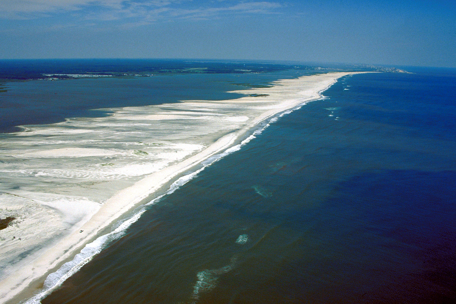
thumb|300px|Aerial view of Assateague Island. Ocean City Maryland is visible in the far distance at top. View is to the north.Assateague Island is a 37 mile long barrier island located off the eastern coast of
Maryland andVirginia . It is best known for its herds of wild horses, pristine beaches, and theAssateague Light house. Bridge access for cars is possible from both Maryland and Virginia, though no road runs the full length of the island.Assateague Island National Seashore, Assateague State Park & the Chincoteague National Wildlife Refuge
There are 3 agencies on the island,
Assateague Island National Seashore andAssateague State Park in Maryland, and theChincoteague National Wildlife Refuge in Virginia. The Refuge was established in 1943 to provide habitat for migratory birds, primarily snow geese. Assateague Island National Seashore was established in 1965 to preserve the barrier island, surrounding waters, and provide recreational opportunities. The United Nations has designated Assateague as a World Biosphere Reserve. The U.S. Department of the Interior has designated it a National Natural Landmark.Human Use of the Island
The National Park Service allows Off-road vehicles with permits in certain areas. Car camping sites are available in both the National Seashore and Assateague State Park by reservation. Backcountry sites are also available from the National Seashore. There is no camping available from the Chincoteague National Wildlife Refuge. Pets are prohibited in all areas except certain parts of the National Seashore. Check with each agency to find out the specifics. Kayak touring is a popular way to see the wildlife, especially on the calmer bay side. The best time to backcountry camp is in the spring and fall. Summer months are known for heavy mosquito populations, particularly on the bay side. Assateague State Park comprises almost 800 acres and lies in Maryland within the National Seashore. The state park is the most developed area on the island with 350 campsites. Most of the water around the island is within the boundaries of the national seashore. The island has a land area of 63.21 km² (24.4 sq mi) and has no resident population in either Maryland or Virginia, though a few retained rights properties existed until 2006. These were mainly hunting camps.
The Wild Horses of Assateague Island
Though commonly called "ponies" the animals are actually horses. The National Park Service provides information about these charismaticFact|date=August 2008 animals through brochures and internet. Made famous by
Marguerite Henry in her bookMisty of Chincoteague , generations of visitors make the pilgrimage each year to see these wonderful creatures. The Maryland horses are owned and managed by the National Park Service who have carefully followed the population over generations. In Virginia, the horses, known as the Chincoteague Ponies are owned by the Chincoteague Volunteer Fire Department. Once a year in July, Salt Water Cowboys round up the Chincoteague Ponies for auction on Pony Penning Day. The Maryland and Virginia horses are kept apart by fencing at the border between the two states.The National Park Service no longer refers to the island horses as feral. Experts in wild horses maintain that though the horses are descendants of domesticated animals, their behaviors are entirely consistent with their ancient ancestors.
To keep their numbers under control on the Maryland side, a federal contraceptive program has been in place since 1994. [ [http://www.nps.gov/archive/asis/horses.htm, Assateague Island National Seashore] ] In Virginia, the auction keeps the horse population at levels required by agreement with the Chincoteague National Wildlife Refuge.
Wildlife
Large populations of birds also inhabit the island, including
American Oystercatcher ,Great Blue Heron , andSnowy Egret . There are over 320 species that are known to inhabit the island during some portion of the year. These include gulls, terns, and other shorebirds along with raptors, waterbirds, and waterfowl.External links
* [http://www.nps.gov/asis/ Assateague Island National Seashore]
* [http://www.dnr.state.md.us/publiclands/eastern/assateague.html Assateague State Park]
* [http://www.chincoteague-island.net/ Chincoteague Travel Information]
* [http://www.assateaguecamping.com/ Assateague camping Information]
* [http://www.thehiddengalleon.com/ Assateague's most famous shipwreck]References
Photos
* [http://www.shutterglass.com/gallery/839364 Assateague]
Wikimedia Foundation. 2010.