Assateague State Park

Assateague State Park

Infobox_protected_area | name = Assateague State Park, Maryland, USA
iucn_category = V
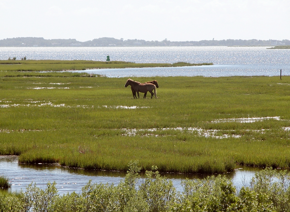


caption = Feral horses in Assateague State Park
locator_x =
locator_y =
location = Worcester County, Maryland, USA
nearest_city =
lat_degrees =
lat_minutes =
lat_seconds =
lat_direction =
long_degrees =
long_minutes =
long_seconds =
long_direction =
area = 859 acres (3.48 km²)
established =
visitation_num =
visitation_year =
governing_body = Maryland Department of Natural Resources

Assateague State Park is a public beach and state park of Maryland that lies at the northern end of Assateague Island. Reachable via Route 611, across Sinepuxent Bay via the Verrazano Bridge (not to be confused with the Verrazano Narrows Bridge), Assateague State Park offers beaches and campsites to the public for a fee. The park lies adjacent to Assateague Island National Seashore which is run by the National Park Service.

Assateague Island National Seashore offers a guarded beach, public bathrooms, showers and concessions. It also offers public campgrounds, available on a reservation basis.

ee also

Chincoteague National Wildlife Refuge

External links

* [http://www.dnr.state.md.us/publiclands/eastern/assateague.html Assateague State Park]
* [http://www.unep-wcmc.org/wdpa/sitedetails.cfm?siteid=21881 Assateague State Park in World Database on Protected Areas]
* [http://www.nps.gov/asis/home.htm Assateague Island National Seashore]


Wikimedia Foundation. 2010.

Игры ⚽ Нужно сделать НИР?

Look at other dictionaries:

  • Holts Landing State Park — Geobox Protected Area name = Holts Landing State Park native name = other name = other name1 = category local = Delaware State Park category iucn = image caption = etymology type = Named for etymology = The Holt Family country = United States… …   Wikipedia

  • Fenwick Island State Park — Geobox Protected Area name = Fenwick Island State Park native name = other name = other name1 = category local = Delaware State Park category iucn = image caption = Looking south at Fenwick Island State Park beach etymology type = Named for… …   Wikipedia

  • Delaware Seashore State Park — Delaware State Park Named for: The Delaware shoreline Country …   Wikipedia

  • Matapeake State Park — is a state park located in Matapeake, Kent Island, Maryland.[1] Its location is the site of a former ferry landing that served the state owned Chesapeake Bay Ferry System before the Chesapeake Bay Bridge opened. Today, the pier that once served… …   Wikipedia

  • Martinak State Park — is a state park in the state of Maryland.[1] The park is located on the Choptank River and Watts Creek in Caroline County, Maryland. It features fishing, campsites, boating access, hiking trails, playground, shelters and a nature center.… …   Wikipedia

  • Douthat State Park — IUCN Category V (Protected Landscape/Seascape) Douthat Lake …   Wikipedia

  • Occoneechee State Park — is a state park near Clarksville, Virginia, located along Buggs Island Lake. Occoneechee State Park is 2,698 acres in size. It is named for the Occaneechi Indians, who lived in the area. Bacon s Rebellion abruptly ended their prominence in 1676.… …   Wikipedia

  • State Parks in Maryland — Assateague State Park …   Deutsch Wikipedia

  • New Germany State Park — Coordinates: 39°38′00″N 79°07′17″W / 39.6333333°N 79.12139°W / 39.6333333; 79.12139 …   Wikipedia

  • Deep Creek Lake State Park — Garrett County, Maryland, USA IUCN Category V (Protected Landscape/Seascape) Location Garrett County, Maryland, USA Coordinates …   Wikipedia

Share the article and excerpts

Direct link
Do a right-click on the link above
and select “Copy Link”