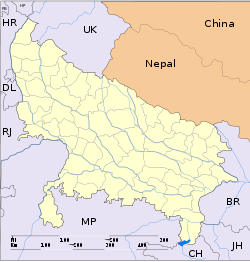
- Colonelganj
-
Colonelganj — city — Coordinates 27°08′N 81°42′E / 27.13°N 81.7°ECoordinates: 27°08′N 81°42′E / 27.13°N 81.7°E Country India State Uttar Pradesh District(s) Gonda Population 24,163 (2001[update]) Time zone IST (UTC+05:30) Area
• 119 metres (390 ft)
Colonelganj is a city and a municipal board in Gonda district in the state of Uttar Pradesh, India.
Geography
Colonelganj is located at 27°04′12″N 81°24′07″E / 27.07°N 81.402°E.[1] It has an average elevation of 119 metres (390 feet).hj It have best climate to product the pop-corn which most famous in all region. and in winter seasons here cabbage production in high rate.
This City is situated on the bank of Saryu river which is 2 KM away from Main city. In the range of Tahseel the area of sangam of two river as GHAGHARA AND SARJU are situated. Sarju is a small river in which the Ghaghara is tributory. This river sytem is again called as Sarju when it reaches Ayodhya in Faizabad district.
Demographics
As of 2001[update] India census,[2] Colonelganj had a population of 24,163. Males constitute 53% of the population and females 47%. Colonelganj has an average literacy rate of 48%, lower than the national average of 59.5%: male literacy is 53% and, female literacy is 42%. In Colonelganj, 17% of the population is under 6 years of age.
References
- ^ Falling Rain Genomics, Inc - Colonelganj
- ^ "Census of India 2001: Data from the 2001 Census, including cities, villages and towns (Provisional)". Census Commission of India. Archived from the original on 2004-06-16. http://web.archive.org/web/20040616075334/http://www.censusindia.net/results/town.php?stad=A&state5=999. Retrieved 2008-11-01.
Cities and towns in Gonda district Gonda Cities and towns
in other districtsAgra · Aligarh · Allahabad · Ambedkar Nagar · Auraiya · Azamgarh · Badaun · Bagpat · Bahraich · Ballia · Balrampur · Banda · Barabanki · Bareilly · Basti · Bhimnagar · Bijnor · Bulandshahr · Chandauli · Chitrakoot · Deoria · Etah · Etawah · Faizabad · Farrukhabad · Fatehpur · Firozabad · Gautam Buddha Nagar · Ghaziabad · Ghazipur · Gorakhpur · Hamirpur · Hardoi · Jalaun · Jaunpur · Jhansi · Jyotiba Phule Nagar · Kannauj · Kanpur Nagar · Kanshi Ram Nagar · Kaushambi · Kushinagar · Lakhimpur Kheri · Lalitpur · Lucknow · Mahamaya Nagar · Maharajganj · Mahoba · Mainpuri · Mathura · Mau · Meerut · Mirzapur · Moradabad · Muzaffarnagar · Panchsheel Nagar · Pilibhit · Prabuddhanagar · Pratapgarh · Raebareli · Ramabai Nagar · Rampur · Saharanpur · Sant Kabir Nagar · Sant Ravidas Nagar · Shahjahanpur · Shravasti · Siddharthnagar · Sitapur · Sonbhadra · Sultanpur · Unnao · Varanasi
Categories:- Cities and towns in Gonda district
- Uttar Pradesh geography stubs
Wikimedia Foundation. 2010.


