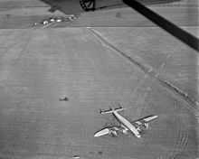
- Curles Neck Plantation
-
Curles Neck Farm
Location: 4705 Curles Neck Rd., Henrico, Virginia Coordinates: 37°24′1″N 77°16′43″W / 37.40028°N 77.27861°WCoordinates: 37°24′1″N 77°16′43″W / 37.40028°N 77.27861°W Area: 156 acres (63 ha)[2] Governing body: Private NRHP Reference#: 09001222[1] Added to NRHP: December 22, 2009[1] Curles Neck Plantation (also known as Curles Neck Farm) is located between State Route 5 and the north bank of the James River in the Varina district of Henrico County, Virginia. One of the great James River Plantations, Curles Neck has remained in active use for almost 400 years and remains a privately owned working farm which is not currently open to the public.
As "Curles Neck Farm", a 156-acre (0.63 km2) property was listed on the U.S. National Register of Historic Places in 2009.[1][2]
Contents
History
In November of 1635, a year after the formal designation of Henrico County as one of 8 shires (or counties) in the Virginia Colony, a land patent for 750 acres (3.0 km2) was granted to Captain Thomas Harris, who had apparently served under Sir Thomas Dale. The tobacco farm was referred to by early settlers as "Longfield", but soon thereafter became known as Curles Neck. Captain Harris served in the House of Burgesses at Jamestown as a Burgess for Curles Neck.
The source of the name Curles Neck in unknown. Many people thought that the name derived from the meandering sweeping curves of the tidal James River in the area, which can clearly be seen by map. However, the family name of Curle is recorded in various grants over a span of one hundred years in the books at the State Land Registry Office. A prominent representative of that family was the patriot Wilson Roscow Curle of the Revolutionary era.
Seat of Nathaniel Bacon
In the early 1670s, the property was owned by Nathaniel Bacon. The colonists in outlying locations such as those in Henrico and the Northern Neck came into conflict with the Colony's Royal Governor, Sir William Berkeley over taking reprisal action for alleged thefts by the Native Americans. In 1676, the tension erupted into a conflict between the colonists known as Bacon's Rebellion. Governor Berkeley was forced to retreat from Jamestown to the join loyalists on the Eastern Shore. Bacon fell ill and died in Gloucester, and the rebellion fell apart. In the aftermath, two dozen colonists were tried and hanged by Governor Berkeley. After Nathaniel Bacon was found guilty of treason post-mortem, his property was confiscated by the Crown, and later resold to William Randolph.
Revolutionary and Civil War periods
During the mid-18th century, John Pleasants donated the first Quaker meeting house at Curles Neck and was one of the trustees appointed to represent the newly formed Town of Richmond. In 1771, his slaves were granted their freedom under the terms of his will. Curles Neck was later acquired by William Randolph. A large Georgian plantation built by the Randolph family was probably destroyed during the American Civil War.
Dairy farming
By the twentieth century, the Curles Neck Farm was engaged in a large dairy farming operation. The company's plant in the Scott's Addition section of Richmond held processing and distribution facilities, and a small retail store. The operation lasted through the 1970s, and generations of school children toured the large dairy barns.
Archaeological digs
During excavation, archaeologists uncovered the foundation of Captain Harris's house, dating between 1635–1654, and portions of a later house probably occupied by Bacon. Landscape features include intricate terraces and traces of underground tunnels down to the James River which could be used as an escape route from potential invasions by Native Americans.
See also
- Richard Randolph of Curls Neck
References
- ^ a b c "Announcements and actions on properties for the National Register of Historic Places for January 15, 2010". Weekly Listings. National Park Service. January 15, 2010. http://www.nps.gov/history/nr/listings/20100115.htm. Retrieved 2010-05-06.
- ^ a b Nancy W. Kraus (August 26, 2009). "National Register of Historic Places Registration: Curles Neck Farm / DHR File No. 043-0035 / Curles Neck Plantation". Virginia Historic Landmarks Commission. http://www.dhr.virginia.gov/registers/Counties/Henrico/043-0035_Curles_Neck_Farm_2009_Nomination_FINAL.pdf. Retrieved 2010-05-06. and Accompanying six photos at Virginia Historic Landmarks Commission, undated
External links
U.S. National Register of Historic Places Topics Lists by states Alabama • Alaska • Arizona • Arkansas • California • Colorado • Connecticut • Delaware • Florida • Georgia • Hawaii • Idaho • Illinois • Indiana • Iowa • Kansas • Kentucky • Louisiana • Maine • Maryland • Massachusetts • Michigan • Minnesota • Mississippi • Missouri • Montana • Nebraska • Nevada • New Hampshire • New Jersey • New Mexico • New York • North Carolina • North Dakota • Ohio • Oklahoma • Oregon • Pennsylvania • Rhode Island • South Carolina • South Dakota • Tennessee • Texas • Utah • Vermont • Virginia • Washington • West Virginia • Wisconsin • WyomingLists by territories Lists by associated states Other Categories:- James River plantations
- Houses in Virginia
- Houses on the National Register of Historic Places in Virginia
- Houses in Henrico County, Virginia
- Farms in Virginia
Wikimedia Foundation. 2010.


